Mains Of Brims
Farmstead (Period Unassigned)
Site Name Mains Of Brims
Classification Farmstead (Period Unassigned)
Alternative Name(s) Brims Mains
Canmore ID 193039
Site Number ND07SW 22
NGR ND 04280 71010
NGR Description centred 04280 71010
Datum OSGB36 - NGR
Permalink http://canmore.org.uk/site/193039
- Council Highland
- Parish Thurso
- Former Region Highland
- Former District Caithness
- Former County Caithness
ND07SW 22 04280 71010.
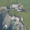
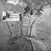
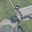
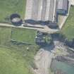
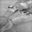
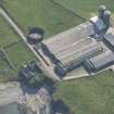
What survives of the original farmstead at Mains of Brims is masked by large modern sheds roofed with corrugated iron. The N range is the most intact and is T-shaped on plan incorporating a two-storey barn with threshing mill. This has roughly coursed rubble walls and a slate roof. The site was visited in 2000.
Information from RCAHMS (ARG) 11 July 2006


