
Pricing Change
New pricing for orders of material from this site will come into place shortly. Charges for supply of digital images, digitisation on demand, prints and licensing will be altered.
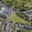
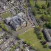
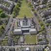
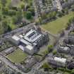
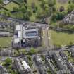
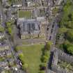
Dundee, Craigiebank Place, General


General View (Period Unassigned)
Site Name Dundee, Craigiebank Place, General
Classification General View (Period Unassigned)
Alternative Name(s) Pitkerro Road
Canmore ID 192291
Site Number NO43SW 644
NGR NO 41409 31824
NGR Description Centred NO 41409 31824
Datum OSGB36 - NGR
Permalink http://canmore.org.uk/site/192291


- Council Dundee, City Of
- Parish Dundee (Dundee, City Of)
- Former Region Tayside
- Former District City Of Dundee
- Former County Angus

