Balquhain
Cup Marked Stone (Prehistoric), Recumbent Stone Circle (Neolithic) - (Bronze Age)
Site Name Balquhain
Classification Cup Marked Stone (Prehistoric), Recumbent Stone Circle (Neolithic) - (Bronze Age)
Alternative Name(s) Mains Of Balquhain
Canmore ID 18989
Site Number NJ72SW 2
NGR NJ 7350 2408
Datum OSGB36 - NGR
Permalink http://canmore.org.uk/site/18989
- Council Aberdeenshire
- Parish Chapel Of Garioch
- Former Region Grampian
- Former District Gordon
- Former County Aberdeenshire
NJ72SW 2 7350 2408.
(NJ 7350 2408) Stone Circle (NR)
OS 6" map, (1959)
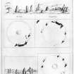
The remains of a recumbent stone circle probably originally consisting of 12 stones of which 7 are still set in a semi-circle which suggests a diameter of 64' (19.5m). Outside the circumference in the S is a 10'6" (3.2m) high monolith of white quartz (Q on plan).
An erect granite block stands 18' (5.49m) NW of this. The E pillar (P on plan), of whinstone, is prostrate. Three cup marks occur on its uppermost side. The recumbent stone (R on plan), of white-grained granite, is 12'7" (3.83m) long, 3'5" (1.04m) broad and 3'9" (1.14m) to 5'8" (1.72m) high. On the top is a curved holllow on which are a few possible cup-marks. A large squarish block is set under it and there are semi-fast stones near its inner side.
The W pillar, of reddish quartzite with a seam of white quartz, still stands to a height of 7'5" (2.26m).
Stone A stands 4'9" (1,45m) high. About half-way up its outer face is a group of six small cup-marks.
Stone B, of coarse grey granite, stands 4'6" (1.37m) igh.
Stone S is earthfast, 2' (0.61m) x 1' (0.3m) set at an angle. Coles (1901) located it by probing and cleared it by excavation which also exposed a rough paving of boulders at a depth of 6" (152mm) to 8" (203mm) in front of the stone. Below this and close to the stone lay large, rough stones and slabs, but no inner circle was located.
Stone T was the only other firmly set stone found.
The fallen stone on the E is a large block of similar material to A.
The stones removed from the N arc of the circle are set in the angle formed by two dykes to the N.
F R Coles 1901.
Three of the stones of this circle are cup-marked.
The recumbent stone bears a single hollow 1 1/4" (32mm) diameter and 1/2" (12.7mm) deep. Its sides being perpendicular and its bottom flat suggest that it may be the beginning of a bore-hole for blasting the stone.
On the upper surface of the fallen E pillar are 4 cup-marks, all on the lower half of the face and varying in size from 2" (51mm) to 2 1/2" (64mm) in diameter. Three are 1/2" (13mm) deep and the fourth, 1/4" (6mm). Near the middle of the stone a little above the cup-marks is a very shallow, ill-defined hollow which may possibly be a fifth cup.
On the standing stone next to the W pillar, there are 25 cup-marks about 2 1/2" (63.5mm) diameter and from 1/4" (6mm) to 1/2" (13mm) deep.
J Ritchie 1918.
Mainly as described and planned by Coles (1901), except that there is no trace of 'T'. Two small stones protrude through the turf in the vicinity of 'S', but which, if either, is the one surveyed by Coles (1901) is difficult to say. The recumbent stone 'R' bears only one small hollow which is a drill hole as suggested by Ritchie (1918) and not a cup mark. 'P', the fallen E flanking stone, has four cup-marks on its now horizontal upper surface. On the W face of 'A' there are 15 definite cup-marks. Several large stones in the nearby dykes bear drill marks and probably came from the circle.
Revised at 1/2500.
Visited by OS (ISS) 11 July 1973.
Listed as a recumbent stone circle by Burl (1973).
H A W Burl 1973.
This recumbent stone circle forms part of the Gordon Archaeological Trail and probably originally comprised twelve stones, of which six survive in rough grass. Beyond the circumference (on the S) there is a monolith of white quartz (Coles' stone Q) which measures 3.1m in height; an erect granite block stands 18 ft (5.5m) NW of this.
The E pillar (stone P) is of whinstone, lies prostrate and has four cup-marks on its now-horizntal upper surface. The recumbent (stone R) is of white-grained granite, and on the top there is a small hollow which may be identified as a drill-hole; a large squarish block is set beneath it and there are semi-fast stones near the inner side.
The following dimensions have been noted:
Stone B: 4ft 6ins (1.42m) high
Stone S: 2ft (0.6m) by 1 ft (0.3m)
Stone Q: 10ft 6ins (3.2m) high
W pillar: 7ft 5ins (2.26m) high
drill hole on recumbent: 1 1/4 ins (32mm) diameter by 1/2 ins (13mm) deep
cupmarks on E pillar: 2 ins (51mm) to 2 1/2 ins (64mm) diameter and 1/2 in (13mm) to 1/4 ins (6mm) deep
cupmarks on W pillar: 2 1/2 ins (64mm) diameter and 1/2 in (13mm) to 1/4 ins (6mm) deep
Information from Aberdeenshire Archaeological Service, June 1997 (visited August 1986 and 24 August 1990).
NMRS, MS/712/19.
Field Visit (26 August 1998 - 27 August 1998)
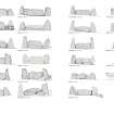
This recumbent stone circle stands on an island of uncultivated ground in the NE corner of a field on the lower slopes of Gallows Hill. Measuring roughly 21m in diameter, it may have comprised as many as fourteen stones, though only nine are currently present, and two of these (6 & 7) have only been unearthed quite recently (first noted Burl 2005c, 62). These last two aside, the rest are disposed around the SW half of the perimeter and five of them, including the recumbent and the W flanker, are still standing (1, 2, 4, 8, & 9). A tall, slender, monolith of solid quartz standing outside the circumference on the SE (A) is one of the most striking features of the ring, leading Coles to exclaim that it ‘gleams out with a rare distinction and effect’ (1901, 232).
The recumbent (2) is an irregular block on the SSW of the ring and measures 4.05m in length and 1.75m in height. A shot-hole in its uneven summit is testimony to an attempt to break up the block, which mainly appears to rest upon a bed of small boulders, with a support stone just visible beneath the field-cleared stones at its E end. The W flanker (1) measures 2.3m in height, as compared to 2.85m in length for its fallen pair on the E (3), so both would have stood a similar height above the recumbent, but whereas the western is leaf-shaped in profile, with a faceted outer face rising up into a point, the eastern is an altogether more rectangular block. At least four cupmarks are visible on the upturned inner face of the E flanker, and no less than eighteen can be counted on the outer face of orthostat 9 on the SW (below). At 1.5m in height, the latter and orthostat 8 on the WNW do not exhibit any evidence that this arc of the circle was consistently graded in height, while the disposition of the surviving stones around the southern half of the circumference suggests that the orthostats were evenly spaced elsewhere. Of the fallen stones, 5 has lain since the 1820s outside the ring on the ESE; 6 lies in the hollow from which it has been recently disinterred on the NNE; and 7, another recent addition, is lying in the NW quadrant. The disinterring of orthostat 6 and the plough scratches into its upper surface suggest that other missing stones may have been deliberately buried, though the majority were probably broken up for use elsewhere (below). Within the interior the ground is gently dished, as can be seen from the surveyed section, but when Coles opened a trench extending towards the centre from a point close to the S end of orthostat 6 he uncovered a layer of stones that probably formed the base of an internal cairn.
Visited by RCAHMS (ATW and KHJM) 26-7 August 1998


