
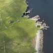
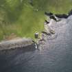
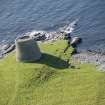
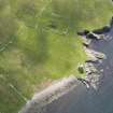
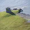
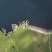
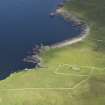
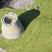
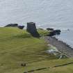
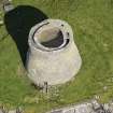
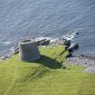
Mousa, Broch Of Mousa


Building (Period Unassigned)
Site Name Mousa, Broch Of Mousa
Classification Building (Period Unassigned)
Canmore ID 189287
Site Number HU42SE 11
NGR HU 4574 2369
Datum OSGB36 - NGR
Permalink http://canmore.org.uk/site/189287


- Council Shetland Islands
- Parish Dunrossness
- Former Region Shetland Islands Area
- Former District Shetland
- Former County Shetland
Note
A single unroofed building attached to a field wall is depicted on the 1st edition of the OS 6-inch map (Orkney and Shetland (Shetland) 1882, sheet lxiii), but it is not shown on the current edition of the OS 1:10000 map (1972).
Information from RCAHMS (AKK) 7 March 2001.

