
Clumlie


Head Dyke (Post Medieval), Township (Period Unassigned)
Site Name Clumlie
Classification Head Dyke (Post Medieval), Township (Period Unassigned)
Canmore ID 189285
Site Number HU41NW 39
NGR HU 402 182
NGR Description Centred on HU 402 182
Datum OSGB36 - NGR
Permalink http://canmore.org.uk/site/189285


- Council Shetland Islands
- Parish Dunrossness
- Former Region Shetland Islands Area
- Former District Shetland
- Former County Shetland
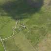
HU41NW 39 centred on 402 182
See also:
HU41NW 15 HU 4015 1855 Corn-Drying Kiln
A township comprising eleven unroofed buildings, two partially roofed buildings, twenty roofed buildings, one of which is annotated Mill (HU41NW 17), some enclosures, thirteen unroofed structures and a head-dyke is depicted on the 1st edition of the OS 6-inch map (Orkney and Shetland (Shetland) 1882, sheet lxv). Eighteen unroofed buildings, two partially roofed buildings, two roofed buildings, some enclosures, two unroofed structures and the head-dyke are shown on the current edition of the OS 1:10000 map (1973).
Information from RCAHMS (SAH) 19 June 2001

