
Islay, Machrie


Track (Period Unassigned)(Possible)
Site Name Islay, Machrie
Classification Track (Period Unassigned)(Possible)
Canmore ID 187909
Site Number NR26SW 101
NGR NR 21220 63988
Datum OSGB36 - NGR
Permalink http://canmore.org.uk/site/187909


- Council Argyll And Bute
- Parish Kilchoman
- Former Region Strathclyde
- Former District Argyll And Bute
- Former County Argyll
NR26SW 101 21220 63988
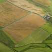
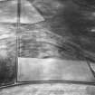
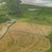
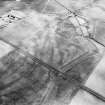
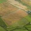
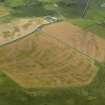
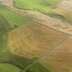
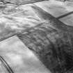
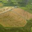
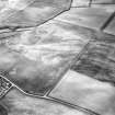
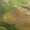
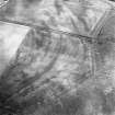
This trackway has been recorded as a cropmark on oblique aerial photographs (RCAHMSAP 20086). The adjacent area shows cropmarks of geological origin.
Information from RCAHMS (KHJM) 21st June 2011
Aerial Photographic Transcription (15 April 2011)

