Edinburgh Castle, Low Defence
Battery (16th Century)
Site Name Edinburgh Castle, Low Defence
Classification Battery (16th Century)
Canmore ID 187614
Site Number NT27SE 1.50
NGR NT 25136 73556
Datum OSGB36 - NGR
Permalink http://canmore.org.uk/site/187614
- Council Edinburgh, City Of
- Parish Edinburgh (Edinburgh, City Of)
- Former Region Lothian
- Former District City Of Edinburgh
- Former County Midlothian
Excavation (17 April 2000 - 21 April 2000)
NT27SE 1.50 25136 73556
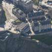
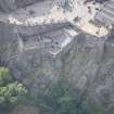
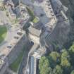
NT 2521 7356 The Lower Defence/Governor's Garden. All of the area of the angled artillery bastion immediately below the Argyll Battery, known as the Lower Defence or Governor's Garden, was systematically cleared of modern aggregate to reveal evidence of the gun platforms prior to their reinstatement. This was achieved progressively in discrete areas utilising a mini-excavator under archaeological supervision. The divisions of the sequence of trenches were ultimately absorbed within the single area covering the total surface of the bastion.
Period 1: c 1550-1708. There has been some form of angle-pointed artillery work on the site of the present Lower Defence since at least the mid-17th century. The Gordon of Rothiemay perspective of 1647 shows projecting bastions close to the site of the present configuration. It is likely, therefore, that part at least of the present earthwork is a development of the earlier work.
Period 2: 1708-1715. The twin embrasures and associated platforms were constructed to form part of the flanking defences for the 'grand secret', an elaborate, but never completed, hornwork for the E approaches to the castle.
Period 3: 1730-1737. The spur battery of the Queen Anne programme of work was altered by the creation of a parapet level and small arms firing platform on two sides of the earlier bastion. It is likely that the W wall was also rebuilt at this time - founded on apparently spare paving slabs from the parapet - and the new inner face of the N wall featured recycled stonework.
Period 4: 1737-1900. The gun platforms were robbed out and cleared away at some time prior to Period 5, and it may be that this is the time the area was initially converted to recreational use.
Period 5: 1900-1945. An arcaded, lean-to structure was built against the N face of the Argyll Battery wall base, along with a partially enclosed building to the E. These buildings are most likely evidence of the use of the Lower Defence as a coal store and smithy, both supplied by the large iron coal chute in the face of the Argyll Battery wall.
A Dunn 2000
Sponsor: Historic Scotland
Kirkdale Archaeology
Excavation (29 January 2001 - 12 February 2001)
In January and February 2001 Kirkdale Archaeology undertook a short excavation at the Low Defences of Edinburgh Castle as a follow up to the excavations done in April 2000.
G Ewart 2001
Sponsor: Historic Scotland
Kirkdale Archaeology


