
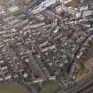
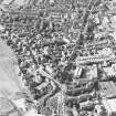
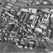
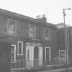
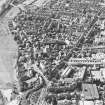
Dundee, Roseangle, General


General View (Period Unassigned)
Site Name Dundee, Roseangle, General
Classification General View (Period Unassigned)
Alternative Name(s) Magdalen Yard Road
Canmore ID 185609
Site Number NO32NE 132
NGR NO 3941 2959
NGR Description From NO 3959 2978 to NO 3923 2942
Datum OSGB36 - NGR
Permalink http://canmore.org.uk/site/185609


- Council Dundee, City Of
- Parish Dundee (Dundee, City Of)
- Former Region Tayside
- Former District City Of Dundee
- Former County Angus

