
Following the launch of trove.scot in February 2025 we are now planning the retiral of some of our webservices. Canmore will be switched off on 24th June 2025. Information about the closure can be found on the HES website: Retiral of HES web services | Historic Environment Scotland
Midmar


Motte (Medieval)
Site Name Midmar
Classification Motte (Medieval)
Alternative Name(s) Cunningar; Midmar Motte; Midmar Church
Canmore ID 18524
Site Number NJ70NW 10
NGR NJ 70083 05960
Datum OSGB36 - NGR
Permalink http://canmore.org.uk/site/18524


- Council Aberdeenshire
- Parish Midmar
- Former Region Grampian
- Former District Gordon
- Former County Aberdeenshire
NJ70NW 10 7007 0595
For adjacent church, see NJ70NW 11.
(NJ 7007 0595) Motte (NR)
OS 6" map, (1959)
During the Norman penetration in the 12th/13th century. Midmar was organised as a parish and a timbered motte was erected about 1/2 mile south of the stone circle (NJ 699 064) by the new Norman or Normanized Lord of the Manor. It was abandoned by the end of the 16th century or perhaps earlier.
This site known as variations of 'Cunningar' or 'rabbit-warren' is traditionally regarded as a dwelling house that had been covered over after being affected by the black plague.
W D Simpsom 1928; E R Lumsden 1929.
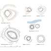
This motte, known as 'Cunningar', is a grass-covered mound about 47.0 metres in diameter and 10.0 metres high with a path in the NE section leading to a depression in the top measuring 22.0 metres in diameter.
Re-surveyed at 1/2500.
Visited by OS (RD) 13 January 1965.
Air photographs: AAS/97/02/G3/21-2 and AAS/97/02/CT.
NMRS, MS/712/29.
Air photographs: CUCAP BVI 045-6, flown 29 July 1975.
(GRC/AAS ground photographs listed).
NMRS, MS/712/64.
This motte is situated in the middle of a field about 150m NW of Midmar church (NJ70NW 11). Heavily quarried at its centre, it forms a subcircular sandy mound, measuring about 24m from NW to SE by 22m transversely and 7m in height. A ditch is also visible on the SE and NW. Little of the summit of the motte has survived quarrying.
Visited by RCAHMS (PJD), 18 May 2001.
Field Visit (15 July 1943)
This site was recorded as part of the RCAHMS Emergency Survey, undertaken by Angus Graham and Vere Gordon Childe during World War 2. The project archive has been catalogued during 2013-2014 and the material, which includes notebooks, manuscripts, typescripts, plans and photographs, is now available online.
Information from RCAHMS (GF Geddes) 4 December 2014.

