
Drumdevan


No Class (Event) (Period Unassigned)
Site Name Drumdevan
Classification No Class (Event) (Period Unassigned)
Alternative Name(s) Holm Mains Farm
Canmore ID 184924
Site Number NH64SE 247
NGR NH 655 414
NGR Description NH c.655 414
Datum OSGB36 - NGR
Permalink http://canmore.org.uk/site/184924


- Council Highland
- Parish Inverness And Bona
- Former Region Highland
- Former District Inverness
- Former County Inverness-shire
NH64SE 247 c.655 414
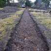
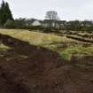
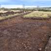
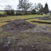
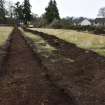
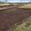
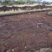
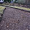
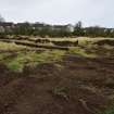
NH 655 414 In May 2000 an archaeological evaluation was carried out in advance of a proposed residential development. The evaluation involved a geophysical survey covering roughly 50% of the area, carried out by GeoQuest Associates, followed by trial trenching of a 2% sample of the site.
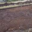
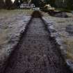
While the geophysical survey suggested the existence of various features of interest, including possible stone trackways or field banks to the N and widespread rectilinear cut features, excavation produced few signs of archaeological interest. Various possible drainage cuts and pits were located, concentrated to the N. There was also evidence of stone clearance, and of recent road construction. The marks of recent ploughing activity were also encountered.
Former field boundaries, running roughly E-W across the area, were marked by the remains of a hedge line and a drystone wall. In two areas significant features were identified. Several post-holes of indeterminate date were identified in a trench to the W, while to the N various ditches and pits were encountered. Further work was undertaken by Headland Archaeology (see below).
Sponsor: Tulloch Homes Ltd.
M Roy 2000
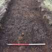
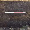
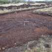
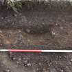
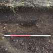
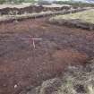
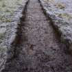
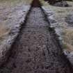
NH 655 414 An archaeological field evaluation was undertaken on the site of a proposed housing development. Trenches were machine-excavated over two areas where deposits of archaeological significance were identified during a previous evaluation (see above). Four isolated post-holes were identified in one trench but yielded no dateable material. Two large stone-filled pits in another trench were found to cut earlier linear features which may be the remains of a rectangular enclosure. The large pits are thought to be the result of stone burying associated with field clearance. A fragment of 19th-century glass was retrieved from one pit.
A full report has been lodged with the NMRS.
Sponsor: Tulloch Homes Ltd.
S Halliday 2000

