Pricing Change
New pricing for orders of material from this site will come into place shortly. Charges for supply of digital images, digitisation on demand, prints and licensing will be altered.
Lothianbridge, Lothian Bridge
Road Bridge (Period Unassigned)
Site Name Lothianbridge, Lothian Bridge
Classification Road Bridge (Period Unassigned)
Alternative Name(s) River South Esk; Newtongrange
Canmore ID 183833
Site Number NT36SW 65
NGR NT 32599 64935
Datum OSGB36 - NGR
Permalink http://canmore.org.uk/site/183833
- Council Midlothian
- Parish Newbattle
- Former Region Lothian
- Former District Midlothian
- Former County Midlothian
NT36SW 65 32599 64935
Lothian Bridge [NAT]
OS (GIS) AIB, April 2006.
Location formerly entered as Centred NT 3258 6494.
For corresponding railway viaduct (adjacent to SW), see NT36SW 41.
Plaque on NE side reveals the bridge to have been built originally in 1810.
(Undated) information in NMRS.
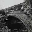
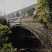
A single-span road bridge with a segmental arch, faced with dressed sandstone, carrying the A7 trunk road over the River South Esk. At the time of survey 2001, the parapet had been damaged (see bulge), and Midlothian Council were about to embark upon major repairs.
Information from RCAHMS (MKO), 2001.
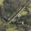
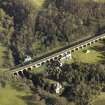
This bridge carries the A7(T) public road over the River South Esk immediately NE of the railway viaduct NT36SW 41. The river here forms the boundary between the parishes of Cockpen (to the NW) and Newbattle (to the SE).
The location assigned to this record defines the midpoint of the structure.
Information from RCAHMS (RJCM), 26 April 2006.
Project (April 2009 - February 2015)
The Borders Railway Project proposals are to reinstate the Newcraighall to Tweedbank section of the former Waverley Line. The reinstated railway line will be approximately 48km long and the majority of the route will use the existing railway embankment.
Several field surveys, archaeological evaluations and standing building surveys were undertaken by CFA Archaeology from April 2009 until February 2015.
CFA Archaeology


