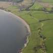
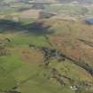
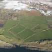
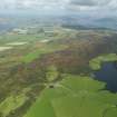
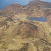
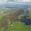
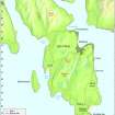
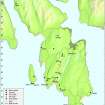
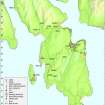
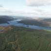
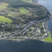
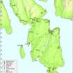
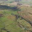
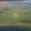
General View
Site Name Bute, General
Classification General View
Alternative Name(s) Island Of Bute
Canmore ID 183832
Site Number NS06NE 72
NGR NS 05 66
Datum OSGB36 - NGR
Permalink http://canmore.org.uk/site/183832
Ordnance Survey licence number AC0000807262. All rights reserved.
Canmore Disclaimer.
© Copyright and database right 2024.
- Correction
- Favourite
DP 057300
General oblique aerial view looking towards Glen More, taken from the S.
RCAHMS Aerial Photography Digital
31/10/2008
© Crown Copyright: HES
DP 062649
General oblique aerial view of the valley of the Ettrick Burn, taken from the SSE.
RCAHMS Aerial Photography Digital
6/2/2009
© Crown Copyright: HES
DP 062672
General oblique view looking towards Stravannan Bay looking along Bute airfield, taken from the E.
RCAHMS Aerial Photography Digital
6/2/2009
© Crown Copyright: HES
DP 062679
General oblique view looking towards Stravannan Bay, taken from the SE.
RCAHMS Aerial Photography Digital
6/2/2009
© Crown Copyright: HES
DP 066099
General oblique aerial view looking towards Glen Callum, taken from the SSE.
RCAHMS Aerial Photography Digital
9/9/2009
© Crown Copyright: HES
DP 097424
Map- Distribution of Pre-Improvement sites and activity.
Records of the Royal Commission on the Ancient and Historical Monuments of Scotland (RCAHMS), Edinbu
8/2010
© Crown Copyright: HES
DP 057280
General oblique aerial view centred on Kingarth and Kilchattan Bay, taken from the SW.
RCAHMS Aerial Photography Digital
31/10/2008
© Crown Copyright: HES
DP 057282
General oblique aerial view looking towards Suidhe Chatain, taken from the S.
RCAHMS Aerial Photography Digital
31/10/2008
© Crown Copyright: HES
DP 057287
General oblique view looking towards Kingarth, taken from the E.
RCAHMS Aerial Photography Digital
31/10/2008
© Crown Copyright: HES
DP 057330
General oblique aerial view of Ettrick Bay looking towards Ardmaleish Point, taken from the SW.
RCAHMS Aerial Photography Digital
31/10/2008
© Crown Copyright: HES
DP 062661
General oblique aerial view looking towards the church, taken from the SSW.
RCAHMS Aerial Photography Digital
6/2/2009
© Crown Copyright: HES
DP 062673
General oblique view looking towards Stravannan Bay along Bute airfield, taken from the E.
RCAHMS Aerial Photography Digital
6/2/2009
© Crown Copyright: HES
DP 066097
General oblique aerial view looking towards Glen Callum, taken from the SE.
RCAHMS Aerial Photography Digital
9/9/2009
© Crown Copyright: HES
DP 066199
General oblique aerial view looking towards Ettrick and St Ninian's Bay from Tarmore Hill, taken from the S.
RCAHMS Aerial Photography Digital
9/9/2009
© Crown Copyright: HES
DP 067119
Oblique aerial view looking towards the Lagganbeg burn, taken from the S.
RCAHMS Aerial Photography Digital
6/10/2009
© Crown Copyright: HES
DP 067122
Oblique aerial view looking from Badlia Hill towards the Kyles of Bute, taken from the SE.
RCAHMS Aerial Photography Digital
6/10/2009
© Crown Copyright: HES
DP 067125
Oblique aerial view looking from Badlia Hill towards the Kyles of Bute, taken from the S.
RCAHMS Aerial Photography Digital
6/10/2009
© Crown Copyright: HES
DP 067127
General oblique aerial view looking from Glenmore Hill to Colintraive, taken from the SSW.
RCAHMS Aerial Photography Digital
6/10/2009
© Crown Copyright: HES
DP 097421
Map - Distribution of Early Bronze Age sites and artefacts.
Records of the Royal Commission on the Ancient and Historical Monuments of Scotland (RCAHMS), Edinbu
8/2010
© Crown Copyright: HES
DP 062665
General oblique aerial view looking towards Suidhe Bhlain, taken from the E.
RCAHMS Aerial Photography Digital
6/2/2009
© Crown Copyright: HES
DP 067124
Oblique aerial view looking from Badlia Hill towards the Kyles of Bute, taken from the S.
RCAHMS Aerial Photography Digital
6/10/2009
© Crown Copyright: HES
DP 067126
Oblique aerial view looking from Badlia Hill towards the Kyles of Bute, taken from the SW.
RCAHMS Aerial Photography Digital
6/10/2009
© Crown Copyright: HES
DP 097422
Map - Distribution of sites and artefacts of the Late Bronze Age and Iron Age.
Records of the Royal Commission on the Ancient and Historical Monuments of Scotland (RCAHMS), Edinbu
8/2010
© Crown Copyright: HES
DP 097425
Map - Distribution of Improvement period sites and activilty.
Records of the Royal Commission on the Ancient and Historical Monuments of Scotland (RCAHMS), Edinbu
8/2010
© Crown Copyright: HES
DP 057279
General oblique aerial view of Glen Callum, taken from the NW.
RCAHMS Aerial Photography Digital
31/10/2008
© Crown Copyright: HES
DP 057283
General oblique aerial view looking towards Langalchorad, taken from the S.
RCAHMS Aerial Photography Digital
31/10/2008
© Crown Copyright: HES
DP 066098
General oblique aerial view looking towards Glen Callum, taken from the SE.
RCAHMS Aerial Photography Digital
9/9/2009
© Crown Copyright: HES
DP 066200
General oblique aerial view looking towards Loch Dhu and Barone Hill in the distance from Scalpsie Bay, taken from the SSW. Loch Quien is at the bottom right, with Loch Fad beyond it.
RCAHMS Aerial Photography Digital
9/9/2009
© Crown Copyright: HES
DP 066201
General oblique aerial view looking towards Rothesay from Scalpsie Bay, taken from the SSW.
RCAHMS Aerial Photography Digital
9/9/2009
© Crown Copyright: HES
DP 097419
Map - The Isle of Bute, showing Rothesay, other settlements and geographical features.
Records of the Royal Commission on the Ancient and Historical Monuments of Scotland (RCAHMS), Edinbu
8/2010
© Crown Copyright: HES
DP 097423
Map - Distribution of Early Historic and Medieval sites and artefacts.
Records of the Royal Commission on the Ancient and Historical Monuments of Scotland (RCAHMS), Edinbu
8/2010
© Crown Copyright: HES
SC 1437947
Kyles of Bute North Bute, Bute, Scotland. Oblique aerial photograph taken facing North/East. This image was marked by AeroPictorial Ltd for photo editing.
Aero Pictorial
8/6/1952
© Courtesy of HES (Aero Pictorial Collection)
DP 057299
General oblique aerial view looking towards Rothesay Bay, taken from the W.
RCAHMS Aerial Photography Digital
31/10/2008
© Crown Copyright: HES
DP 062664
General oblique aerial view looking towards Suidhe Bhlain, taken from the E.
RCAHMS Aerial Photography Digital
6/2/2009
© Crown Copyright: HES
DP 062678
General oblique view looking towards Stravannan Bay, taken from the SE.
RCAHMS Aerial Photography Digital
6/2/2009
© Crown Copyright: HES
DP 066198
General oblique aerial view from Quien Hill looking towards North Bute, taken from the S.
RCAHMS Aerial Photography Digital
9/9/2009
© Crown Copyright: HES
DP 067005
Oblique aerial view looking towards Craw Hill, taken from the WSW.
RCAHMS Aerial Photography Digital
6/10/2009
© Crown Copyright: HES
DP 067046
General oblique aerial view looking over Ettrick Bay towards Glen More, taken from the S.
RCAHMS Aerial Photography Digital
6/10/2009
© Crown Copyright: HES
DP 067121
Oblique aerial view looking towards the Kyles of Bute, taken from the S.
RCAHMS Aerial Photography Digital
6/10/2009
© Crown Copyright: HES
DP 097420
Map - Distribution of Mesolithic and Neolithic sites and artefacts.
Records of the Royal Commission on the Ancient and Historical Monuments of Scotland (RCAHMS), Edinbu
8/2010
© Crown Copyright: HES
SC 1437948
Kyles of Bute North Bute, Bute, Scotland. Oblique aerial photograph taken facing East. This image was marked by AeroPictorial Ltd for photo editing.
Aero Pictorial
8/6/1952
© Courtesy of HES (Aero Pictorial Collection)
DP 057278
General oblique aerial view of Glen Callum, taken from the NW.
RCAHMS Aerial Photography Digital
31/10/2008
© Crown Copyright: HES
DP 062663
General oblique aerial view centred on the remains of the field banks and rig and furrow, taken from the SE.
RCAHMS Aerial Photography Digital
6/2/2009
© Crown Copyright: HES
DP 067047
General oblique view looking towards Kames Bay, taken from the SW.
RCAHMS Aerial Photography Digital
6/10/2009
© Crown Copyright: HES
DP 067193
General oblique aerial view looking towards Ardbeg, taken from the ESE.
RCAHMS Aerial Photography Digital
6/10/2009
© Crown Copyright: HES
DP 062670
General oblique of the remains of the rig and furrow and drainage, taken from the NE.
RCAHMS Aerial Photography Digital
6/2/2009
© Crown Copyright: HES
DP 067123
Oblique aerial view looking from Badlia Hill towards the Kyles of Bute, taken from the SSE.
RCAHMS Aerial Photography Digital
6/10/2009
© Crown Copyright: HES
DP 091379
General oblique aerial view over the Kelspoke reservoir and St Blane's Hill to Arran beyond, taken from the E.
RCAHMS Aerial Photography Digital
21/6/2010
© Crown Copyright: HES
DP 056903
General oblique aerial view centred on the low land between Stravanan Bay and Kilchattan Bay, taken from the S.
RCAHMS Aerial Photography Digital
31/10/2008
© Crown Copyright: HES
DP 062662
General oblique aerial view centred on the remains of the field banks and rig and furrow, taken from the SE.
RCAHMS Aerial Photography Digital
6/2/2009
© Crown Copyright: HES
DP 062666
Oblique aerial view centred on the remains of the enclosure and the rig and furrow, taken from the NE.
RCAHMS Aerial Photography Digital
6/2/2009
© Crown Copyright: HES
DP 066202
General oblique aerial view looking towards North Bute from Scalpsie Bay, taken from the S.
RCAHMS Aerial Photography Digital
9/9/2009
© Crown Copyright: HES
DP 067120
Oblique aerial view looking towards the Kyles of Bute, taken from the S.
RCAHMS Aerial Photography Digital
6/10/2009
© Crown Copyright: HES
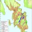
- Council Argyll And Bute
- Parish North Bute
- Former Region Strathclyde
- Former District Argyll And Bute
- Former County Buteshire