Following the launch of trove.scot in February 2025 we are now planning the retiral of some of our webservices. Canmore will be switched off on 24th June 2025. Information about the closure can be found on the HES website: Retiral of HES web services | Historic Environment Scotland
Birsay, Earl's Palace
Palace (16th Century)
Site Name Birsay, Earl's Palace
Classification Palace (16th Century)
Canmore ID 1836
Site Number HY22NW 6
NGR HY 24803 27775
Datum OSGB36 - NGR
Permalink http://canmore.org.uk/site/1836
First 100 images shown. See the Collections panel (below) for a link to all digital images.
- Council Orkney Islands
- Parish Birsay And Harray
- Former Region Orkney Islands Area
- Former District Orkney
- Former County Orkney
HY22NW 6 24803 27775
(HY 2480 2775) Earl's Palace (NR) (In Ruins)
OS 6" map, Orkney, 2nd ed., (1900).
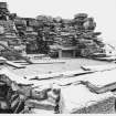
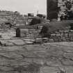
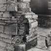
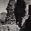
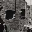
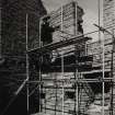
The remains of the 'palace' of the Earls of Orkney, built between 1574 and the end of the 16th century. The masonry throughout is of rubble, with pinnings, set in clay or lime-mortar. The building was occupied until the mid-17th century and thereafter was allowed to fall into ruin.
RCAHMS 1946.
Earl's Palace, as described.
Visited by OS (RL) 25 May 1967.
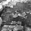
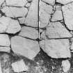
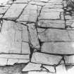
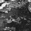
Excavation has taken place in all the rooms of the palace, excluding the N range, to remove topsoil and turf in order to redisplay the monument. Turf from the wall tops has also been removed. Few 17th century finds or contexts have been encountered. In some rooms destruction debris and fragmentary roof slates survived recent clearance and levelling. The original stone floors of the W and S wings have survived in various states of preservation but the floors of the E wing are now mainly earth, clay and mortar. Floors, doorways, fireplaces and windows reflect the status of rooms and or ranges and complement the contemporary documentation.
Sponsor: SDD HBM.
B Smith 1989a; 1989b.
HY 248 277 Archaeological monitoring was undertaken of a service trench. The monument (NMRS HY22NW 6) takes the form of a rectangular block, orientated N-S, with a central courtyard surrounded by ranges, now roofless shells, with towers projecting from all but the NW corner.
The hand-dug trench was to carry electricity between the two towers projecting S from the S facade of the palace, both of which are still roofed. The only archaeological feature noted in the trench was an 800mm wide stretch of drystone walling, not excavated, but apparently reduced to a single course. Although the trench was very narrow, the wall could be seen to be built of sandstone blocks, and had a good E face, but a poorly preserved W one. It lay 200mm below modern ground level. This wall ran N-S: the same orientation as the E wall of the SW tower, although set slightly back (to the W of its line). This was not removed, and the electricity cable was to run over it. The monument was used as farm outbuildings in the recent past, and a drystone dyke might fit with such a use.
There was a lack of dateable finds from the excavation, but the wall seems likely to post-date the construction of the SW tower. The layer overlying this wall contained sandstone fragments and some mortar, which may represent material fallen from the decaying palace.
Sponsor: Historic Scotland
P Sharman 2000
'The Orcadian' in 1903 described that the grave of St Magnus was in the floor of the church, after the body had been removed from Gairsay to the Earl's Palace.
M Howe 2006.
Excavation (1989)
Excavation has taken place in all the rooms of the palace, excluding the N range, to remove topsoil and turf in order to redisplay the monument. Turf from the wall tops has also been removed. Few 17th century finds or contexts have been encountered. In some rooms destruction debris and fragmentary roof slates survived recent clearance and levelling. The original stone floors of the W and S wings have survived in various states of preservation but the floors of the E wing are now mainly earth, clay and mortar. Floors, doorways, fireplaces and windows reflect the status of rooms and or ranges and complement the contemporary documentation.
Sponsor: SDD HBM.
B Smith 1989a; 1989b.
Publication Account (1996)
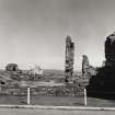
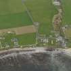
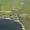
The striking but gaunt shell of the Earl's Palace still dominates the village and the broad bay of Birsay, and the walls convey a strong sense of its original massive grandeur, but it takes a little imagination to restore an impression of its once magnificent elegance: it was described in 1633 as 'a sumptuous and stately dwelling'. The rooms on the upper floor were attractively decorated with painted ceilings, including biblical scenes with appropriate texts, and they would undoubtedly have been furnished with brightly coloured wall-hangings. The exterior of the building seems always to have been fairly austere, befitting its status as a fortified residence of the Earl of Orkney, but the upper windows of the north and east wings were embellished with carved and pinnacled pediments.
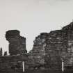
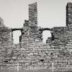
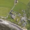
It was built by Robert Stewart, Earl of Orkney, in the latter half of the 16th century as a courtyard house in fashionable Renaissance style, consisting of four wings round a rectangular courtyard with square towers at each corner except that on the north-west. It seems that a decision to modify the original plan was made during the course of a long building programme, because the north wing is awkwardly placed, masking the gable-end of the west wing and very close to the west side of the tower at the north-east corner, as if there was originally to have been only a screen-wall a long the north side of the courtyard (and presumably a tower at the north-west corner to match the other three). The fact that the upper-floor windows on the north and east wings match suggest that this change of design took place not long after the completion of the latter wing. In the centre of the courtyard is a circular well. The external walls of the Palace are lined with gun-loops, as were the internal walls lining the courtyard, including one surviving on the west wing which is angled to cover the main entrance into the courtyard from outside. The ground-floor was lit by small horizontal windows as an addition defensive precaution. The entire building was two-storeyed except for the north-east tower which rose an extra storey, but only the towers, the north wing and part of the west wing survive to any height, for it has been uninhabited since the late 17th century.
There exists a beautifully detailed plan of the Palace, drawn in the 17th century, which shows not only the missing upper storeys but the main entrance with the initials R E O for Robert Earl of Orkney and the date 1574 above what may be either a window or, more probably, an armorial panel. It also shows the immediate setting of the Palace: the pathway leading out to Skipi Geo to the north where boats were landed, huge peat-stacks on the west between the Palace and the shore of the bay and a range of walled enclosures down the east side of the build ing, includ ing a ' Floure Yard' or flower garden and a 'Herbe Yard '. The 'Bow Butts' ran the length of these two gardens, so that the ladies could admire the achers at their targets practice, and there was a bowling green in front of the Palace.
The drawing also shows the church and churchyard (no. 38) close to the south-west corner of the Palace, and a courtyard range south of the churchyard. It is possible that this represents the old episcopal palace, by now converted into barns and stables for the Earl.
The bridge over the Barony burn to the south of the Earl 's Palace has a longer history than is immediately apparent. It is a stone-bui lt bridge with two arches and, although the upper part was reconstructed in 1872, the lower part may well be medieval. A two-span bridge is certainl y shown on an 18th-century drawing and a bridge on the same spot on the 17th-century drawing already mentioned. A bridge over the burn was vital to access from Kirkwall and elsewhere on mainland, unlike the modern approach from the north-east of the Palace.
Information from ‘Exploring Scotland’s Heritage: Orkney’, (1996).
Watching Brief (10 January 2000 - 14 January 2000)
HY 248 277 Archaeological monitoring was undertaken of a service trench. The monument (NMRS HY22NW 6) takes the form of a rectangular block, orientated N-S, with a central courtyard surrounded by ranges, now roofless shells, with towers projecting from all but the NW corner.
The hand-dug trench was to carry electricity between the two towers projecting S from the S facade of the palace, both of which are still roofed. The only archaeological feature noted in the trench was an 800mm wide stretch of drystone walling, not excavated, but apparently reduced to a single course. Although the trench was very narrow, the wall could be seen to be built of sandstone blocks, and had a good E face, but a poorly preserved W one. It lay 200mm below modern ground level. This wall ran N-S: the same orientation as the E wall of the SW tower, although set slightly back (to the W of its line). This was not removed, and the electricity cable was to run over it. The monument was used as farm outbuildings in the recent past, and a drystone dyke might fit with such a use.
There was a lack of dateable finds from the excavation, but the wall seems likely to post-date the construction of the SW tower. The layer overlying this wall contained sandstone fragments and some mortar, which may represent material fallen from the decaying palace.
Sponsor: Historic Scotland
P Sharman 2000
Kirkdale Archaeology
Field Visit (3 March 2008)
Orkney Research Centre for Archaeology (ORCA) was commissioned to conduct an archaeological desk-based assessment and walkover survey of an area at Earl's Palace, Birsay, Orkney prior to proposed development for new housing and a car-park.
The area proposed for housing development did not display any signs of the presence of ancient remains but due to the presence of a high density of significant remains nearby, areas likely to be affected by the development should be examined further using geophysical techniques in the first instance.
Information from Orkney Research Centre for Archaeology (ORCA).
Watching Brief (22 January 2009)
Excavations at a proposed new house plot on 22 January 2009. Archaeological deposits were associated with a stone layer beneath deep sand in the W of the site. These deposits were unlikely to be disturbed by the development and no other archaeological remains were recorded.
Report: Orkney SMR and RCAHMS
Funder: Mr B Cox
Dave Lawrence – ORCA
Watching Brief (23 June 2011)
HY 248 277 (Earl’s Palace), HY 239 285 (Brough of Birsay) and HY 2829 1172 (Unstan) A watching brief was maintained on 23 June 2011 during the excavation of shallow holes in advance of the installation of survey markers at three sites around Orkney. Two of the holes at the Earl’s Palace required the removal of whin dust or gravel, revealing in situ flagstone floors. The stones were not disturbed, as the survey points were marked by metal studs installed between the stones. All the other holes disturbed only turf and topsoil and revealed no features or deposits of archaeological significance.
Archive: RCAHMS (intended)
Funder: Historic Scotland
Kirkdale Archaeology, 2011
Information also reported in Oasis (kirkdale1-171087)
Project (26 July 2017 - 18 November 2017)
HY 24791 27691 A staged research training and community project was undertaken, 26 July – 18 November 2017, around the story of St Magnus during the 900 commemorative year of his death. Activities including archive research, excavation (25 September – 6 October 2017), walkover survey, geophysical survey, measured survey and coastal survey were primarily focused in and around Palace Village, Birsay. Other key places in the Magnus story were included, such as the site of Magnus’ martyrdom on Egilsay and the Mansie Stane sites where his body was rested during transit. Activities in the village focused on the area within the present house gardens around the site of the medieval Bishop’s Palace (HY22NW 7). Geophysical survey was undertaken in and around Palace Village with three small areas of earth resistance undertaken within residents’ gardens (centred on HY 24749 27607, HY 24730 27617 and HY 24761 27653) and four areas of magnetometry undertaken in surrounding fields (centred on HY 24743 27744, HY 24752 27779, HY 24846 27700 and HY 24863 27755). Little of note was revealed in the results of the resistance surveys relating to the Bishop’s Palace site. Data from the magnetometry surveys has yet to be fully processed, but initial plots show clear linear anomalies (walls?) and other features within the former garden area immediately to the E of the Earl’s Palace (HY22NW 6).
Coastal survey was undertaken around the Point of Buckquoy with the aim of reassessing the sites recorded during the Birsay Bay Project and the numerous NRHE entries (HY 24340 28382 around the point and south to HY 24706 27650). In total, 26 sites were recorded including midden, rubble, stones, structures, nousts, and cut features. These correspond with the numerous prehistoric, medieval and post-medieval features recorded in the Birsay Bay Project coastal survey along the same sections, and will be reported in full in the final report.
Measured plane table survey was undertaken at the boat nousts at Skipi Geo (12 nousts and stone hut, HY 25062 28316) and Point of Buckquoy (13 nousts – HY22NW 45). Scaled plans were drawn.
Walkover survey focused on Palace Village and the area to the E of the Barony Mill. Four sites were recorded including a stone structure in the village (HY 24758 27644), a bridge abutment along the Burn of Boardhouse (HY 25110 27556), the Mans Well (HY22NE 9) and nearby earthwork with stone revetment (HY 25578 27408). The latter is said to be the site of a click mill, although this is unclear from the remains. Previously unrecorded Manse Stane sites, where the body of Magnus was rested when moved, were visited and recorded at Strathyre and along Northside.
A total of eight trenches were excavated within Palace Village, Birsay, and within the gardens of domestic properties in an area which was likely to be that of the earlier and later medieval Bishop’s Palace building (HY22NW 7). Excavation was undertaken by volunteers and undergraduate students under professional supervision.
Trench 1 measured 10 x 2m and was aligned WNW/ESE (HY 24757 27651). A probable flagstone floor and wall was exposed in the base of the trench. Quantities of animal and fish bone and shell were recovered from the stony and midden-type deposit associated with this floor, along with a sherd of Norse/medieval pottery.
Trench 2 measured 3 x 1.5m (HY 24759 27641). Two phases of structural remains were identified. The later structures probably dated to the 19th or early 20th century. The earlier structures appeared to be related to those exposed in Trench A, probably dating to the medieval period. Midden-type deposits were also identified in Trench 2.
Trench 3 measured 2 x 2m, and contained topsoil and windblown sand (HY 24745 27660).
Trench 4 measured 2 x 1.5m (HY 24751 27666). A midden type deposit and a possible robbed out stone-built structural deposit were identified.
Trench 5 measured 2 x 2m, and contained topsoil and windblown sand (HY 24739 27609).
Trench 6 measured 2 x 1m (HY 24742 27619). A midden type deposit, a possible floor surface and wall foundation were exposed in this trench.
Trench A measured 2.9 x 2.7m and was located below the path to the rear of Heimdall (HY 24766 27636). The foundation courses of a substantial stone-built wall, 0.9m wide, with dressed stone faces were exposed. Another, less well preserved wall, 0.75m wide, butted against this on the N side. Midden-type deposits similar to those found in Trench 1, but also containing lime mortar, abutted the base of the walls. The alignment of these structures indicated an earlier phase of construction than the surrounding standing stone-built walls and house, and so could date to the Norse/medieval period, but more likely relates to the 16th-century stables and barns for the Earl’s Palace. Animal and fish bone were recovered from the deposits butting against the main wall.
Trench B measured 1 x 1m, and contained stony topsoil (HY 24772 27633). The main wall exposed in Trench A did not apparently continue to this side of the present house. A layer of windblown sand encountered in all the trenches except Trench B, and was seen to seal the medieval deposits where these were present. In Trench A, the sand was found below the wall and midden. This layer of sand was significantly thicker in those trenches located W of the current boundary wall W of Trench 1. This suggests that the western edge of the medieval settlement was further to the E than in later periods, and that there may have been a short period of abandonment in this area of the settlement in the later medieval period. Excavations confirmed the presence of medieval activity, which may have related to the medieval ecclesiastical complex around the Bishop’s Palace, clustered in the eastern part of the present-day village. Full post-excavation work, finds analysis and radiocarbon dating are pending.
Archive: UHI (currently) and NRHE and Orkney Museum (intended)
Client: Orkney Islands Council. Funding: Heritage Lottery Fund
Daniel Lee, Sarah Jane Gibbon and Sean Bell – Archaeology Institute, UHI
(Source: DES, Volume 18)
Magnetometry (26 July 2017 - 18 November 2017)
HY 24791 27691 Four areas of magnetometry were undertaken in surrounding fields (centred on HY 24743 27744, HY 24752 27779, HY 24846 27700 and HY 24863 27755). Data from the magnetometry surveys has yet to be fully processed, but initial plots show clear linear anomalies (walls?) and other features within the former garden area immediately to the E of the Earl’s Palace (HY22NW 6).
Archive: UHI (currently) and NRHE and Orkney Museum (intended)
Client: Orkney Islands Council. Funding: Heritage Lottery Fund
Daniel Lee, Sarah Jane Gibbon and Sean Bell – Archaeology Institute, UHI
(Source: DES, Volume 18)
Earth Resistance Survey (26 July 2017 - 18 November 2017)
HY 24791 27691 Three small areas of earth resistance were undertaken within residents’ gardens (centred on HY 24749 27607, HY 24730 27617 and HY 24761 27653). Little of note was revealed in the results of the resistance surveys relating to the Bishop’s Palace site.
Archive: UHI (currently) and NRHE and Orkney Museum (intended)
Client: Orkney Islands Council. Funding: Heritage Lottery Fund
Daniel Lee, Sarah Jane Gibbon and Sean Bell – Archaeology Institute, UHI
(Source: DES, Volume 18)
Orkney Smr Note
The palace stands at the N end of the village near the shore at Birsay Bay. It has been a large building but large proportions have disappeared. A drawing of 17th century date is presented in the General Register House. Edinburgh. Above the main entrance on the S are the initials REO for Robert Earl of Orkney with the date 1574 on a window over the gateway. Reputed treasonable by King James 6th ROBERTUS STEUARTUS FILIUS JACOBI Sti REX SCOTORUM HOC AEDIFICIUM INSTRUXITTwo periods can be distinguished the second probablytwenty-thirty years later. It was built about the year 1574, was two stories high. Recovered from a well in the middle of the courtyard in 1929 were five finials, one bearing the initial G. For more information refer to RCAMS.[R1,R2]
Detailed historical treatment with passim descriptive notes (Anderson, PD 1982 "Robert Stewart Earl of Orkney, Lord of
Shetland", Edinburgh, 1985.)
Information from Orkney SMR [n.d.]


