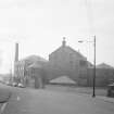
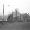
Glasgow, 200 Old Dumbarton Road, Warehouse
Warehouse (Period Unassigned)
Site Name Glasgow, 200 Old Dumbarton Road, Warehouse
Classification Warehouse (Period Unassigned)
Canmore ID 183348
Site Number NS56NE 2645
NGR NS 5630 6628
Datum OSGB36 - NGR
Permalink http://canmore.org.uk/site/183348
- Council Glasgow, City Of
- Parish Govan (City Of Glasgow)
- Former Region Strathclyde
- Former District City Of Glasgow
- Former County Lanarkshire
Archaeological Evaluation (7 June 2010 - 10 September 2011)
Headland Archaeology Ltd undertook an evaluation on the site of a proposed student accommodation development at 200 Dumbarton Road, Glasgow, in order to test the archaeological potential of the area. The work was commissioned by Watkin Jones Construction and a specification for the work was agreed with West of Scotland Archaeology Service (WoSAS). The site is adjacent to the River Kelvin and both mill buildings and lades are shown in the vicinity on Roy's mid-18th century survey. Four test pits were excavated across the development area. The test pits revealed a former ground surface (topsoil) at a depth of between 8.15 and 7.76m AOD across the site. This contained fragments of late 18th century clay pipe, and a concentration of pantile roof tiles, which most likely represented demolition debris from a nearby building. This layer was sealed by up to 2.5m of modern overburden which made investigating a representative sample of the former ground surface impractical. Therefore further work, a watching brief, was required during main contract bulk excavations. The watching brief was undertaken during groundworks below 8.4m AOD to enable further archaeological examination of the former ground surface uncovered during test pitting. The foundations of a building built at some point between 1858 and 1894 were uncovered during this phase. There was no evidence for any unmapped structures or earlier activity.
Information from Oasis (headland1-104921) 23 October 2012


![Watching brief, Wall [101] and [102], 200 Old Dumbarton Road, Glasgow](http://i.rcahms.gov.uk/canmore/l/DP00350715.jpg)
![Watching brief, Wall [101] Section, 200 Old Dumbarton Road, Glasgow](http://i.rcahms.gov.uk/canmore/l/DP00350720.jpg)


![Watching brief, Walls [100], [101], [102], 200 Old Dumbarton Road, Glasgow](http://i.rcahms.gov.uk/canmore/l/DP00350718.jpg)
![Watching brief, Shot of [120], 200 Old Dumbarton Road, Glasgow](http://i.rcahms.gov.uk/canmore/l/DP00350722.jpg)

![Watching brief, Wall [100], 200 Old Dumbarton Road, Glasgow](http://i.rcahms.gov.uk/canmore/l/DP00350719.jpg)
![Watching brief, Wall [100] Section, 200 Old Dumbarton Road, Glasgow](http://i.rcahms.gov.uk/canmore/l/DP00350721.jpg)


![Watching brief, Layer [054], 200 Old Dumbarton Road, Glasgow](http://i.rcahms.gov.uk/canmore/l/DP00350704.jpg)
![Watching brief, Wall [102] and Buttress [103], 200 Old Dumbarton Road, Glasgow](http://i.rcahms.gov.uk/canmore/l/DP00350713.jpg)


![Watching brief, Wall [101] and [102], 200 Old Dumbarton Road, Glasgow](http://i.rcahms.gov.uk/canmore/s/DP00350715.jpg)
![Watching brief, Wall [101] Section, 200 Old Dumbarton Road, Glasgow](http://i.rcahms.gov.uk/canmore/s/DP00350720.jpg)


![Watching brief, Walls [100], [101], [102], 200 Old Dumbarton Road, Glasgow](http://i.rcahms.gov.uk/canmore/s/DP00350718.jpg)
![Watching brief, Shot of [120], 200 Old Dumbarton Road, Glasgow](http://i.rcahms.gov.uk/canmore/s/DP00350722.jpg)

![Watching brief, Wall [100], 200 Old Dumbarton Road, Glasgow](http://i.rcahms.gov.uk/canmore/s/DP00350719.jpg)
![Watching brief, Wall [100] Section, 200 Old Dumbarton Road, Glasgow](http://i.rcahms.gov.uk/canmore/s/DP00350721.jpg)


![Watching brief, Layer [054], 200 Old Dumbarton Road, Glasgow](http://i.rcahms.gov.uk/canmore/s/DP00350704.jpg)
![Watching brief, Wall [102] and Buttress [103], 200 Old Dumbarton Road, Glasgow](http://i.rcahms.gov.uk/canmore/s/DP00350713.jpg)


