
Pricing Change
New pricing for orders of material from this site will come into place shortly. Charges for supply of digital images, digitisation on demand, prints and licensing will be altered.
Upcoming Maintenance
Please be advised that this website will undergo scheduled maintenance on the following dates:
Thursday, 9 January: 11:00 AM - 3:00 PM
Thursday, 23 January: 11:00 AM - 3:00 PM
Thursday, 30 January: 11:00 AM - 3:00 PM
During these times, some functionality such as image purchasing may be temporarily unavailable. We apologise for any inconvenience this may cause.
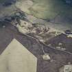
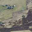
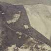
Stoneyhall


Farmstead (Period Unassigned)(Possible)
Site Name Stoneyhall
Classification Farmstead (Period Unassigned)(Possible)
Canmore ID 182858
Site Number HY31SE 50
NGR HY 3651 1265
Datum OSGB36 - NGR
Permalink http://canmore.org.uk/site/182858


- Council Orkney Islands
- Parish Firth
- Former Region Orkney Islands Area
- Former District Orkney
- Former County Orkney
HY31SE 50 3651 1265
What may be a farmstead, comprising two roofed buildings, one unroofed building and one enclosure is depicted on the 1st edition of the OS 6-inch map (Orkney and Shetland (Orkney) 1882, sheet ci). One roofed building and one enclosure are shown on the current edition of the OS 1:10000 map (1972).
Information from RCAHMS (AKK) 19 December 2000.

