
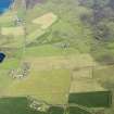
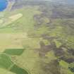
Rousay, Feolquoy


Farmstead (Period Unassigned)
Site Name Rousay, Feolquoy
Classification Farmstead (Period Unassigned)
Alternative Name(s) Setterquoy
Canmore ID 182055
Site Number HY33SE 68
NGR HY 3990 3231
Datum OSGB36 - NGR
Permalink http://canmore.org.uk/site/182055


- Council Orkney Islands
- Parish Rousay And Egilsay
- Former Region Orkney Islands Area
- Former District Orkney
- Former County Orkney
HY33SE 68 3990 3231
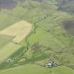
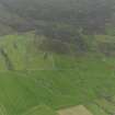
A farmstead comprising one unroofed long building of three compartments and one enclosure is depicted on the 1st edition of the OS 6-inch map (Orkney and Shetland (Orkney) 1882, sheet lxxxv), but it is not shown on the current edition of the OS 1:10000 map (1977).
Information from RCAHMS (SAH) 11 December 2000

