
Beachview


Settlement (Period Unassigned)
Site Name Beachview
Classification Settlement (Period Unassigned)
Canmore ID 1807
Site Number HY22NW 19
NGR HY 247 275
Datum OSGB36 - NGR
Permalink http://canmore.org.uk/site/1807
Ordnance Survey licence number AC0000807262. All rights reserved.
Canmore Disclaimer.
© Bluesky International Limited 2025. Public Sector Viewing Terms
- Correction
- Favourite

SC 1862343
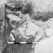
Copy of polaroid of site during excavation.
Viking and Early Settlement Archaeology Research Project
1980
© Courtesy of HES (Viking and Early Settlement Archaeology Research Project)

SC 1862367
Beachview, Burnside. Illus 29a p39 Cutting 2 general photo after cleaning from N.
Viking and Early Settlement Archaeology Research Project
1980
© Courtesy of HES (Viking and Early Settlement Archaeology Research Project)

SC 1862372
Beachview, Burnside. Illus 33 p44 Area 3: during excavation (phase X) from E. 2 prints.
Viking and Early Settlement Archaeology Research Project
1979
© Courtesy of HES (Viking and Early Settlement Archaeology Research Project)

SC 1862378
Beachview, Studio Site. Illus 59 p79 Area 1, sub-areas D/E Phase R wall from S. 2 prints.
Viking and Early Settlement Archaeology Research Project
1980
© Courtesy of HES (Viking and Early Settlement Archaeology Research Project)

SC 1862386
Beachview, Studio Site. IIllus 70b p87 Area 1, sub-areas D/E from above phase Y walling from SW.
Viking and Early Settlement Archaeology Research Project
1980
© Courtesy of HES (Viking and Early Settlement Archaeology Research Project)

SC 1862394
Beachview, Studio Site. IIllus 85a p109 Area 1, sub-areas D/E phase M walling DN inside collapsed walling of phase K from W. 2 prints.
Viking and Early Settlement Archaeology Research Project
1980
© Courtesy of HES (Viking and Early Settlement Archaeology Research Project)

SC 1862398
Beachview, Studio Site. IIllus 89 p113 Area 1, sub-areas D/E Hearth HI with deposits ID/IH around from S.
Viking and Early Settlement Archaeology Research Project
1980
© Courtesy of HES (Viking and Early Settlement Archaeology Research Project)

SC 1862399
Beachview, Studio Site. IIllus 99 p123 Area 1, sub-areas D/E Detail of drains LC & LD of phase W with infilling stone of phase Y from E. 2 prints
Viking and Early Settlement Archaeology Research Project
1980
© Courtesy of HES (Viking and Early Settlement Archaeology Research Project)

SC 1862403
Beachview, Studio Site. IIllus 92 p116 Area 1, pit IQ in phase R, from N. 2 prints
Viking and Early Settlement Archaeology Research Project
1979
© Courtesy of HES (Viking and Early Settlement Archaeology Research Project)

SC 1862407
Bisay Bay Project Vol.2: Beachview Studio Site, area 1, whetstone RF230 Illus.108 p134. Photographic copy of drawing.
Viking and Early Settlement Archaeology Research Project
1996
© Courtesy of HES (Viking and Early Settlement Archaeology Research Project)

SC 1862411
Bisay Bay Project Vol.2: Beachview Burnside, area 2, bone and antler artefacts (all 2:1 except RF665 & 682 1:1). Illus.45 p62. Photographic copy of drawing.
Viking and Early Settlement Archaeology Research Project
1996
© Courtesy of HES (Viking and Early Settlement Archaeology Research Project)

SC 2008440
Buckquoy Orkney various finds
Historic Scotland Photographic Library
22/11/1971
© Crown Copyright: HES

SC 1862339
Preliminary clearance at Beachview?
Viking and Early Settlement Archaeology Research Project
1976
© Courtesy of HES (Viking and Early Settlement Archaeology Research Project)

SC 1862353
Copy of polaroid of site during excavation.
Viking and Early Settlement Archaeology Research Project
1980
© Courtesy of HES (Viking and Early Settlement Archaeology Research Project)

SC 1862359
Copy of polaroid of site during excavation.
Viking and Early Settlement Archaeology Research Project
1980
© Courtesy of HES (Viking and Early Settlement Archaeology Research Project)

SC 1862364
Beachview, Studio Site. Area 1 Overall photo of site at final stage of excavation from E. 2 prints.
Viking and Early Settlement Archaeology Research Project
1980
© Courtesy of HES (Viking and Early Settlement Archaeology Research Project)

SC 1862369
Beachview, Burnside. Illus 32a p42 Cutting 3 general photo from N.
Viking and Early Settlement Archaeology Research Project
1980
© Courtesy of HES (Viking and Early Settlement Archaeology Research Project)

SC 1862377
Beachview, Studio Site. Illus 59 p79 Area 1, sub-areas D/E Phase R wall from S. 2 prints.
Viking and Early Settlement Archaeology Research Project
1980
© Courtesy of HES (Viking and Early Settlement Archaeology Research Project)

SC 1862380
Beachview, Studio Site. Illus 63 p81 Area 1, sub-areas D/E Midden dump KD in phase U from NE. 2 prints.
Viking and Early Settlement Archaeology Research Project
1980
© Courtesy of HES (Viking and Early Settlement Archaeology Research Project)

SC 1862390
Beachview, Studio Site. IIllus 81a p105 Area 1, sub-areas D/E phase K walling: IM (with sand KW of phase W over) from NE. 2 prints.
Viking and Early Settlement Archaeology Research Project
1980
© Courtesy of HES (Viking and Early Settlement Archaeology Research Project)

SC 1862395
Beachview, Studio Site. IIllus 85b p109 Area 1, sub-areas D/E DN in relation to wall AU pf phase K from N.
Viking and Early Settlement Archaeology Research Project
1980
© Courtesy of HES (Viking and Early Settlement Archaeology Research Project)

SC 1862406
Bisay Bay Project Vol.2: Beachview Studio Site, area 1 (inc. sub-areas D/E) burnt clay artefacts. Illus.110 p137. Photographic copy of a drawing.
Viking and Early Settlement Archaeology Research Project
1996
© Courtesy of HES (Viking and Early Settlement Archaeology Research Project)

SC 2008448
Buckquoy Orkney various finds
Historic Scotland Photographic Library
22/11/1971
© Crown Copyright: HES

SC 2008453
Buckquoy Orkney various finds
Historic Scotland Photographic Library
22/11/1971
© Crown Copyright: HES

SC 2340009
Beachview, HY22NW 19, Ordnance Survey index card, page number 1, Recto
Records of the Ordnance Survey, Southampton, Hampshire, England
c. 1958
© Crown Copyright: HES (Ordnance Survey Archaeology Division)

SC 1862340
Clearance at Beachview.
Viking and Early Settlement Archaeology Research Project
1976
© Courtesy of HES (Viking and Early Settlement Archaeology Research Project)

SC 1862348
Copy of polaroid of site during excavation.
Viking and Early Settlement Archaeology Research Project
1980
© Courtesy of HES (Viking and Early Settlement Archaeology Research Project)

SC 1862370
Beachview, Burnside. Illus 32b p42 Detail of stonework exposed.
Viking and Early Settlement Archaeology Research Project
1980
© Courtesy of HES (Viking and Early Settlement Archaeology Research Project)

SC 1862412
Bisay Bay Project Vol.2: Beachview Burnside, area 2, iron snaffle bit RF663 after conservation. Illus.43b p58. Photographic copy of drawing.
Viking and Early Settlement Archaeology Research Project
1996
© Courtesy of HES (Viking and Early Settlement Archaeology Research Project)

SC 2008436
Buckquoy Orkney various finds
Historic Scotland Photographic Library
22/11/1971
© Crown Copyright: HES

SC 2008441
Buckquoy Orkney various finds
Historic Scotland Photographic Library
22/11/1971
© Crown Copyright: HES

SC 2008443
Buckquoy Orkney various finds
Historic Scotland Photographic Library
22/11/1971
© Crown Copyright: HES

SC 2008454
Buckquoy Orkney various finds
Historic Scotland Photographic Library
22/11/1971
© Crown Copyright: HES

SC 2340011
Beachview, HY22NW 19, Ordnance Survey index card, page number 1, Recto
Records of the Ordnance Survey, Southampton, Hampshire, England
c. 1958
© Crown Copyright: HES (Ordnance Survey Archaeology Division)

SC 1862341
Clearance at Beachview.
Viking and Early Settlement Archaeology Research Project
1976
© Courtesy of HES (Viking and Early Settlement Archaeology Research Project)

SC 1862352
Copy of polaroid of site during excavation.
Viking and Early Settlement Archaeology Research Project
1980
© Courtesy of HES (Viking and Early Settlement Archaeology Research Project)

SC 1862355
Copy of polaroid of site during excavation.
Viking and Early Settlement Archaeology Research Project
1980
© Courtesy of HES (Viking and Early Settlement Archaeology Research Project)

SC 1862357
Copy of polaroid of site during excavation.
Viking and Early Settlement Archaeology Research Project
1980
© Courtesy of HES (Viking and Early Settlement Archaeology Research Project)

SC 1862375
Beachview, Burnside. Illus 43a p58 Area 2: iron snaffle bit (RF 663) in situ. 2 prints.
Viking and Early Settlement Archaeology Research Project
1979
© Courtesy of HES (Viking and Early Settlement Archaeology Research Project)

SC 1862376
Beachview, Burnside. Illus 43a p58 Area 2: iron snaffle bit (RF 663) in situ. 2 prints.
Viking and Early Settlement Archaeology Research Project
1979
© Courtesy of HES (Viking and Early Settlement Archaeology Research Project)

SC 1862379
Beachview, Studio Site. Illus 63 p81 Area 1, sub-areas D/E Midden dump KD in phase U from NE. 2 prints.
Viking and Early Settlement Archaeology Research Project
1980
© Courtesy of HES (Viking and Early Settlement Archaeology Research Project)

SC 1862382
Beachview, Studio Site. Illus 65 p83 Area 1, sub-areas D/E from E the walls of phases R & V. 2 prints.
Viking and Early Settlement Archaeology Research Project
1980
© Courtesy of HES (Viking and Early Settlement Archaeology Research Project)

SC 1862391
Beachview, Studio Site. IIllus 81b p105 Area 1, sub-areas D/E phase K walling: detail of blocking in IM from N. 2 prints.
Viking and Early Settlement Archaeology Research Project
1980
© Courtesy of HES (Viking and Early Settlement Archaeology Research Project)

SC 1862393
Beachview, Studio Site. IIllus 85a p109 Area 1, sub-areas D/E phase M walling DN inside collapsed walling of phase K from W. 2 prints.
Viking and Early Settlement Archaeology Research Project
1980
© Courtesy of HES (Viking and Early Settlement Archaeology Research Project)

SC 1862413
View of excavation - possibly Beachview? Copy print & neg and original colour polaroid.
Viking and Early Settlement Archaeology Research Project
1980
© Courtesy of HES (Viking and Early Settlement Archaeology Research Project)

SC 2008435
Buckquoy Orkney various finds
Historic Scotland Photographic Library
22/11/1971
© Crown Copyright: HES

SC 2008442
Buckquoy Orkney various finds
Historic Scotland Photographic Library
22/11/1971
© Crown Copyright: HES

SC 2008451
Buckquoy Orkney various finds
Historic Scotland Photographic Library
22/11/1971
© Crown Copyright: HES

SC 2008455
Buckquoy Orkney various finds
Historic Scotland Photographic Library
22/11/1971
© Crown Copyright: HES

SC 2008456
Buckquoy Orkney various finds
Historic Scotland Photographic Library
22/11/1971
© Crown Copyright: HES

SC 2340010
Beachview, HY22NW 19, Ordnance Survey index card, page number 2, Recto
Records of the Ordnance Survey, Southampton, Hampshire, England
c. 1958
© Crown Copyright: HES (Ordnance Survey Archaeology Division)

SC 1862342
Copy of polaroid of site during excavation.
Viking and Early Settlement Archaeology Research Project
1980
© Courtesy of HES (Viking and Early Settlement Archaeology Research Project)

SC 1862344
Copy of polaroid of site during excavation.
Viking and Early Settlement Archaeology Research Project
1980
© Courtesy of HES (Viking and Early Settlement Archaeology Research Project)

SC 1862361
Copy of polaroid of site during excavation.
Viking and Early Settlement Archaeology Research Project
1980
© Courtesy of HES (Viking and Early Settlement Archaeology Research Project)

SC 1862365
Beachview, Burnside. Illus 24 p34 General view of house platforms, Birsay Links. 2 prints.
Viking and Early Settlement Archaeology Research Project
1980
© Courtesy of HES (Viking and Early Settlement Archaeology Research Project)

SC 1862366
Beachview, Burnside. Illus 24 p34 General view of house platforms, Birsay Links. 2 prints.
Viking and Early Settlement Archaeology Research Project
1980
© Courtesy of HES (Viking and Early Settlement Archaeology Research Project)

SC 1862381
Beachview, Studio Site. Illus 65 p83 Area 1, sub-areas D/E from E the walls of phases R & V. 2 prints.
Viking and Early Settlement Archaeology Research Project
1980
© Courtesy of HES (Viking and Early Settlement Archaeology Research Project)

SC 1862396
Beachview, Studio Site. IIllus 87 p111 Area 1, sub-areas D/E Phase N structure: walling AE slabs JA from above. 2 prints.
Viking and Early Settlement Archaeology Research Project
1979
© Courtesy of HES (Viking and Early Settlement Archaeology Research Project)

SC 1862401
Beachview, Studio Site. IIllus 102 p126 Area 1, sub-areas D/E building phase X with rubble infill LB at W end of site (phase Y) from E. 2 prints
Viking and Early Settlement Archaeology Research Project
1980
© Courtesy of HES (Viking and Early Settlement Archaeology Research Project)

SC 1862409
Bisay Bay Project Vol.2: Beachview Studio Site, area 1, sub-areas D/E, silver wire RF488. Illus.74 p91. Photographic copy of drawing.
Viking and Early Settlement Archaeology Research Project
1996
© Courtesy of HES (Viking and Early Settlement Archaeology Research Project)

SC 1862410
Bisay Bay Project Vol.2: Beachview Studio Site, area 1, sub-areas D/E, portable whetstone RF498. Illus.72 p89. Photographic copy of drawing.
Viking and Early Settlement Archaeology Research Project
1996
© Courtesy of HES (Viking and Early Settlement Archaeology Research Project)

SC 2008439
Buckquoy Orkney various finds
Historic Scotland Photographic Library
22/11/1971
© Crown Copyright: HES

SC 2008446
Buckquoy Orkney various finds
Historic Scotland Photographic Library
22/11/1971
© Crown Copyright: HES

SC 2008449
Buckquoy Orkney various finds
Historic Scotland Photographic Library
22/11/1971
© Crown Copyright: HES

SC 2008450
Buckquoy Orkney various finds
Historic Scotland Photographic Library
22/11/1971
© Crown Copyright: HES

SC 2340012
Beachview, HY22NW 19, Ordnance Survey index card, page number 2, Recto
Records of the Ordnance Survey, Southampton, Hampshire, England
c. 1958
© Crown Copyright: HES (Ordnance Survey Archaeology Division)

SC 2340013
Beachview, HY22NW 19, Ordnance Survey index card, page number 3, Recto
Records of the Ordnance Survey, Southampton, Hampshire, England
c. 1958
© Crown Copyright: HES (Ordnance Survey Archaeology Division)

SC 1862346
Copy of polaroid of site during excavation.
Viking and Early Settlement Archaeology Research Project
1980
© Courtesy of HES (Viking and Early Settlement Archaeology Research Project)

SC 1862358
Copy of polaroid of site during excavation.
Viking and Early Settlement Archaeology Research Project
1980
© Courtesy of HES (Viking and Early Settlement Archaeology Research Project)

SC 1862374
Beachview, Burnside. Illus 40 p52 Area 2: photo from W phase V. 2 prints.
Viking and Early Settlement Archaeology Research Project
1979
© Courtesy of HES (Viking and Early Settlement Archaeology Research Project)

SC 1862383
Beachview, Studio Site. Illus 68 p84 Area 1, sub-areas D/E from N phase K walling & D-shaped 'shed'.
Viking and Early Settlement Archaeology Research Project
1980
© Courtesy of HES (Viking and Early Settlement Archaeology Research Project)

SC 1862384
Beachview, Studio Site. Illus 70a p86 Area 1, sub-areas D/E from above phase Y walling from W.
Viking and Early Settlement Archaeology Research Project
1980
© Courtesy of HES (Viking and Early Settlement Archaeology Research Project)

SC 1862392
Beachview, Studio Site. IIllus 81b p105 Area 1, sub-areas D/E phase K walling: detail of blocking in IM from N. 2 prints.
Viking and Early Settlement Archaeology Research Project
1980
© Courtesy of HES (Viking and Early Settlement Archaeology Research Project)

SC 1862400
Beachview, Studio Site. IIllus 99 p123 Area 1, sub-areas D/E Detail of drains LC & LD of phase W with infilling stone of phase Y from E. 2 prints
Viking and Early Settlement Archaeology Research Project
1980
© Courtesy of HES (Viking and Early Settlement Archaeology Research Project)

SC 1862402
Beachview, Studio Site. IIllus 102 p126 Area 1, sub-areas D/E building phase X with rubble infill LB at W end of site (phase Y) from E. 2 prints
Viking and Early Settlement Archaeology Research Project
1980
© Courtesy of HES (Viking and Early Settlement Archaeology Research Project)

SC 1862405
Bisay Bay Project Vol.2: Beachview Studio Site, area 1, pottery. Illus.111 p138. Photographic copy of a drawing.
Viking and Early Settlement Archaeology Research Project
1996
© Courtesy of HES (Viking and Early Settlement Archaeology Research Project)

SC 1866124
Bisay Bay Project Vol.2: Beachview Burnside, area 3, metal artefacts RF700 & RF702. Illus.37 p48
Viking and Early Settlement Archaeology Research Project
1996
© Courtesy of HES (Viking and Early Settlement Archaeology Research Project)

SC 2008437
Buckquoy Orkney various finds
Historic Scotland Photographic Library
22/11/1971
© Crown Copyright: HES

SC 2507506
Beachview, HY22NW 40, Ordnance Survey index card, Recto
Records of the Ordnance Survey, Southampton, Hampshire, England
c. 1958
© Crown Copyright: HES (Ordnance Survey Archaeology Division)

SC 2576621
View of excavation - possibly Beachview? Copy print & neg and original colour polaroid.
Viking and Early Settlement Archaeology Research Project
1980
© Courtesy of HES (Viking and Early Settlement Archaeology Research Project)

SC 1862345
Copy of polaroid of site during excavation.
Viking and Early Settlement Archaeology Research Project
1980
© Courtesy of HES (Viking and Early Settlement Archaeology Research Project)

SC 1862349
Copy of polaroid of site during excavation.
Viking and Early Settlement Archaeology Research Project
1980
© Courtesy of HES (Viking and Early Settlement Archaeology Research Project)

SC 1862350
Copy of polaroid of site during excavation.
Viking and Early Settlement Archaeology Research Project
1980
© Courtesy of HES (Viking and Early Settlement Archaeology Research Project)

SC 1862354
Copy of polaroid of site during excavation.
Viking and Early Settlement Archaeology Research Project
1980
© Courtesy of HES (Viking and Early Settlement Archaeology Research Project)

SC 1862362
Copy of polaroid of site during excavation.
Viking and Early Settlement Archaeology Research Project
1980
© Courtesy of HES (Viking and Early Settlement Archaeology Research Project)

SC 1862371
Beachview, Burnside. Illus 33 p44 Area 3: during excavation (phase X) from E. 2 prints.
Viking and Early Settlement Archaeology Research Project
1979
© Courtesy of HES (Viking and Early Settlement Archaeology Research Project)

SC 1862373
Beachview, Burnside. Illus 40 p52 Area 2: photo from W phase V. 2 prints.
Viking and Early Settlement Archaeology Research Project
1979
© Courtesy of HES (Viking and Early Settlement Archaeology Research Project)

SC 1862387
Beachview, Studio Site. IIllus 80 p104 Area 1, sub-areas D/E phase K walling: AU/AV & hearth JB from E. 2 prints.
Viking and Early Settlement Archaeology Research Project
1980
© Courtesy of HES (Viking and Early Settlement Archaeology Research Project)

SC 1862388
Beachview, Studio Site. IIllus 80 p104 Area 1, sub-areas D/E phase K walling: AU/AV & hearth JB from E. 2 prints.
Viking and Early Settlement Archaeology Research Project
1980
© Courtesy of HES (Viking and Early Settlement Archaeology Research Project)

SC 2340008
Beachview, HY22NW 19, Ordnance Survey index card, Recto
Records of the Ordnance Survey, Southampton, Hampshire, England
c. 1958
© Crown Copyright: HES (Ordnance Survey Archaeology Division)

SC 1862347
Copy of polaroid of site during excavation.
Viking and Early Settlement Archaeology Research Project
1980
© Courtesy of HES (Viking and Early Settlement Archaeology Research Project)

SC 1862351
Copy of polaroid of site during excavation.
Viking and Early Settlement Archaeology Research Project
1980
© Courtesy of HES (Viking and Early Settlement Archaeology Research Project)

SC 1862356
Copy of polaroid of site during excavation. High rubble in sand Area 5 6/8/80.
Viking and Early Settlement Archaeology Research Project
1980
© Courtesy of HES (Viking and Early Settlement Archaeology Research Project)

SC 1862360
Copy of polaroid of site during excavation.
Viking and Early Settlement Archaeology Research Project
1980
© Courtesy of HES (Viking and Early Settlement Archaeology Research Project)

SC 1862363
Beachview, Studio Site. Area 1 Overall photo of site at final stage of excavation from E. 2 prints.
Viking and Early Settlement Archaeology Research Project
1980
© Courtesy of HES (Viking and Early Settlement Archaeology Research Project)

SC 1862368
Beachview, Burnside. Illus 29b p39 Detail of Cutting 2 from N.
Viking and Early Settlement Archaeology Research Project
1980
© Courtesy of HES (Viking and Early Settlement Archaeology Research Project)

SC 1862385
Beachview, Studio Site. Area 1, sub-areas D/E from above phase Y walling from W.
Viking and Early Settlement Archaeology Research Project
1980
© Courtesy of HES (Viking and Early Settlement Archaeology Research Project)

SC 1862389
Beachview, Studio Site. IIllus 81a p105 Area 1, sub-areas D/E phase K walling: IM (with sand KW of phase W over) from NE. 2 prints.
Viking and Early Settlement Archaeology Research Project
1980
© Courtesy of HES (Viking and Early Settlement Archaeology Research Project)

SC 1862397
Beachview, Studio Site. IIllus 87 p111 Area 1, sub-areas D/E Phase N structure: walling AE slabs JA from above. 2 prints.
Viking and Early Settlement Archaeology Research Project
1979
© Courtesy of HES (Viking and Early Settlement Archaeology Research Project)

SC 1862404
Beachview, Studio Site. IIllus 92 p116 Area 1, pit IQ in phase R, from N. 2 prints
Viking and Early Settlement Archaeology Research Project
1979
© Courtesy of HES (Viking and Early Settlement Archaeology Research Project)


First 100 images shown. See the Collections panel (below) for a link to all digital images.
- Council Orkney Islands
- Parish Birsay And Harray
- Former Region Orkney Islands Area
- Former District Orkney
- Former County Orkney
HY22NW 19 247 275
The vicinity of Beachview exhibits both structural and residual evidence of extensive occupation. Excavations at HY 2474 2757 and HY 2477 2759 have yielded evidence of major Viking/Late Norse settlement as have the upper levels of a mound site at HY 2470 2754. Its lower levels may date back to prehistory.
C D Morris 1983; C D Morris and N Emery 1979, 1980
Archive from the excavations at Beachview has been catalogued.
Historic Scotland Archive Project
Excavation (1979 - 1980)
The vicinity of Beachview exhibits both structural and residual evidence of extensive occupation. Excavations at HY 2474 2757 and HY 2477 2759 have yielded evidence of major Viking/Late Norse settlement as have the upper levels of a mound site at HY 2470 2754. Its lower levels may date back to prehistory.
C D Morris 1983; C D Morris and N Emery 1979, 1980

