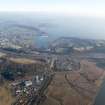
Accessibility

Font Size

100% 150% 200%

Background Colour

Default Contrast
Close Reset

St Margaret's Hope

Breakwater (Period Unassigned)

Site Name St Margaret's Hope

Classification Breakwater (Period Unassigned)

Alternative Name(s) Cults Ness; Rosyth; Inner Forth Estuary

Canmore ID 180085

Site Number NT18SW 255

NGR NT 1235 8133

Datum OSGB36 - NGR

Permalink http://canmore.org.uk/site/180085

Ordnance Survey licence number AC0000807262. All rights reserved.
Canmore Disclaimer. © Bluesky International Limited 2025. Public Sector Viewing Terms

Toggle Aerial | View on large map

Digital Images

Oblique aerial view.
Oblique aerial view.General oblique aerial of the new Forth crossing works site, taken from the WNW.General oblique aerial view of the new Forth crossing works site, taken from the SW.General oblique aerial view of the new Forth crossing works site, taken from the NW.Oblique aerial view during construction of the New Forth Bridge Crossing, looking to the E.Oblique aerial view.Oblique aerial view.Oblique aerial view.General oblique aerial of the new Forth crossing works site, taken from the SSE.General oblique aerial view of the new Forth crossing works site, taken from the N.Oblique aerial view during construction of the New Forth Bridge Crossing, looking to the SSE.Oblique aerial view.Oblique aerial view during construction of the New Forth Bridge Crossing, looking to the NNE.Oblique aerial view during construction of the New Forth Bridge Crossing, looking to the SSW.Oblique aerial view.Oblique aerial view.General oblique aerial of the new Forth crossing works site, taken from the WNW.General oblique aerial view of the new Forth crossing works site, taken from the SSW.General oblique aerial view of the Forth bridges and the new crossing works site, taken from the WNW.General oblique aerial of the new Forth crossing works site, taken from the S.Oblique aerial view of the approach road to the new Forth Bridge Crossing under construction, looking to the SE.Oblique aerial view during construction of the New Forth Bridge Crossing, looking to the NE.General oblique aerial of the new Forth crossing works site, taken from the SSE.Oblique aerial view of the approach road to the new Forth Bridge Crossing under construction, looking to the ESE.Oblique aerial view.Oblique aerial view.General oblique aerial of the new Forth crossing works site, taken from the NW.General oblique aerial view of the new Forth crossing works site, taken from the W.General oblique aerial view of the new Forth crossing works site, taken from the SSE.Oblique aerial view of the approach road to the new Forth Bridge Crossingunder construction, looking to the E.Oblique aerial view during construction of the New Forth Bridge Crossing, looking to the W.

Administrative Areas

  • Council Fife
  • Parish Inverkeithing
  • Former Region Fife
  • Former District Dunfermline
  • Former County Fife

Archaeology Notes

NT18SW 255 1235 8133

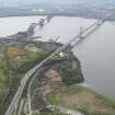
The 1st edition of the OS 6-inch map (Fife, 1855, sheet 39) depicts a breakwater at this location.

Information from RCAHMS (GJW) 20 February 2001.

An archaeological watching brief was maintained on the excavation for a pipeline in an area of ground formerly a natural bay with access to the Firth of Forth. Before land reclamation the area was used for the maritime movement of stone from nearby quarries.

NT 1235 8133 Pier.

Excavations revealed features relating to the area being used for the movement of stone in the form of trackways of gravel and concrete. The area has seen extensive tipping of waste, both industrial and domestic, from the 1920s to the 1970s.

A full report has been lodged with Fife SMR and the NMRS.

Sponsors: Amec Ltd, Paterson Candy Ltd for East of Scotland Water.

S Farrell 2000.

References

MyCanmore Image Contributions


Contribute an Image

MyCanmore Text Contributions