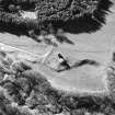
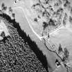
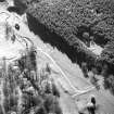
Accessibility

Font Size

100% 150% 200%

Background Colour

Default Contrast
Close Reset

Abbotrule

Building (Period Unassigned)

Site Name Abbotrule

Classification Building (Period Unassigned)

Canmore ID 179604

Site Number NT61SW 32

NGR NT 6100 1271

Datum OSGB36 - NGR

Permalink http://canmore.org.uk/site/179604

Ordnance Survey licence number AC0000807262. All rights reserved.
Canmore Disclaimer. © Bluesky International Limited 2025. Public Sector Viewing Terms

Toggle Aerial | View on large map

Digital Images

Aerial view of the gable end of a building at Abbotrule, taken from the SSW.
Aerial view of the gable end of a building at Abbotrule, taken from the SSW.Aerial view of Abbotrule church and building, taken from the ESE.Aerial view of buildings and rig at Abbotrule, taken from the WSW.Aerial view of the gable end of a building at Abbotrule, taken from the N.Aerial view of Abbotrule church, buildings and rig taken from the E.Aerial view of the gable end of a building at Abbotrule, taken from the SW.Aerial view of the gable end of a building at Abbotrule, taken from the NE.

Administrative Areas

  • Council Scottish Borders, The
  • Parish Southdean
  • Former Region Borders
  • Former District Roxburgh
  • Former County Roxburghshire

References

MyCanmore Image Contributions


Contribute an Image

MyCanmore Text Contributions