Pricing Change
New pricing for orders of material from this site will come into place shortly. Charges for supply of digital images, digitisation on demand, prints and licensing will be altered.
Cairnton
Recumbent Stone Circle (Neolithic) - (Bronze Age)
Site Name Cairnton
Classification Recumbent Stone Circle (Neolithic) - (Bronze Age)
Alternative Name(s) Westertown
Canmore ID 17855
Site Number NJ54SE 1
NGR NJ 5859 4467
Datum OSGB36 - NGR
Permalink http://canmore.org.uk/site/17855
- Council Aberdeenshire
- Parish Forgue
- Former Region Grampian
- Former District Gordon
- Former County Aberdeenshire
NJ54SE 1 5859 4467.
(NJ 5859 4467) Stone Circle (NR) (Remains of)
OS 6" map, Aberdeenshire, 2nd ed., (1902)
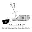
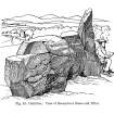
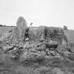
Two blocks of whinstone, the remains of a stone circle, stand on ground sloping to the east, about 1 1/4 miles south-south-west of Yonder Bognie.
One of the stones has lost about a third of its original mass. One stone measures 9 feet 10 inches long by 3 feet broad and 6 feet 3 inches in height.
The other a 'pillar' is 8 feet 3 inches in height.
F R Coles 1903.
The remains of the stone circle are, generally as described above. The pillar stone is 2.2m in height and the second stone 1.7m in height. A mound of stones surrounds the two large stones but this is a result of field clearance.
Visited by OS (EGC) 2 October 1961.
Listed as stone circle: 'Destroyed or unrecognisable'. 'Recumbent stone circle'.
H A W Burl 1976.
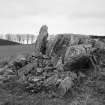
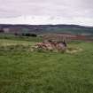
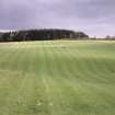
This recumbent stone circle is situated on sloping ground about 510m WNW of Westertown farmhouse. Only two stones of the circle survive, the W flanker and the recumbent; the former measures 2.3m in height and the other is 2.9m long and 1.6m high. Field gathered stones have been piled in the interior of the circle. Although known as the Cairnton recumbent stone circle the site lies on Westertown ground.
Visited by RCAHMS (JBS) 9 November 1983.
Field Visit (6 April 2005)
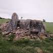
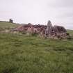
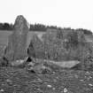
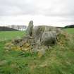
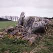
The site of this recumbent stone circle falls on a slight terrace on a SE-facing slope, but only the recumbent and its W flanker remain in place, and these are subsumed into a large pile of field-gathered stones. The recumbent (2), which is a metamorphosed block of quartzite, faces S and measures 2.85m in length by 1.55m in height. The W flanker, a pillar some 2.25m high, stands slightly forward of the recumbent’s leading face and the overall outlook of the setting may have been closer to SSE than S. Whether the recumbent is in its original position, however, is difficult to judge, for the rear of the stone has evidently been blasted, also destroying the W end of its relatively level summit. A possible cupmark can be seen close to the upper eastern corner of its leading face.
The site of this recumbent stone circle falls on a slight terrace on a SE-facing slope, but only the recumbent and its W flanker remain in place, and these are subsumed into a large pile of field-gathered stones. The recumbent (2), which is a metamorphosed block of quartzite, faces S and measures 2.85m in length by 1.55m in height. The W flanker, a pillar some 2.25m high, stands slightly forward of the recumbent’s leading face and the overall outlook of the setting may have been closer to SSE than S. Whether the recumbent is in its original position, however, is difficult to judge, for the rear of the stone has evidently been blasted, also destroying the W end of its relatively level summit. A possible cupmark can be seen close to the upper eastern corner of its leading face.
Visited by RCAHMS (ATW and KHJM) 6 April 2005
Measured Survey (6 April 2005)
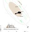
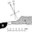
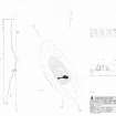
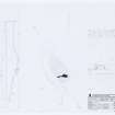
RCAHMS surveyed the remains of Cairnton recumbent stone circle on 6 April 2005 with plane table and alidade producing a plan and section of the site and an elevation of the recumbent stone and flanker at a scale of 1:100. The plan, section and elevation were redrawn in ink and used as the basis for an illustration produced in vector graphics software and published at a scale of 1:250 (Welfare 2011, 321).


