Avochie
Cup And Ring Marked Stone (Neolithic) - (Bronze Age)
Site Name Avochie
Classification Cup And Ring Marked Stone (Neolithic) - (Bronze Age)
Canmore ID 17852
Site Number NJ54NW 7
NGR NJ 53980 46840
Datum OSGB36 - NGR
Permalink http://canmore.org.uk/site/17852
- Council Aberdeenshire
- Parish Huntly
- Former Region Grampian
- Former District Gordon
- Former County Aberdeenshire
NJ54NW 7 5398 4684.
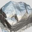
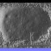
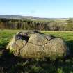
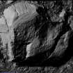
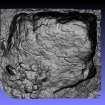
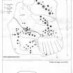
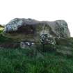
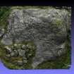
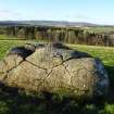
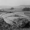
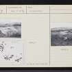
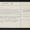
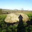
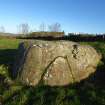
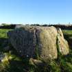
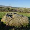
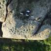
There is a cup and ring marked whinstone boulder, measuring 11 by 9ft and just over 2 feet high on the north slope of the Hill of Avochie, at a point 586 yards SW of the site of the stone circle (NJ54NW 6).
F R Coles 1906.
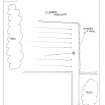
NJ 5398 4684. The boulder is generally as described and illustrated above; it measures 4.3 x 3.0m and has a maximum height of 1.0m.
Surveyed at 1:2500.
Visited by OS (EGC) 7 February 1964.
Publication Account (2011)
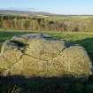
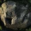
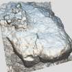
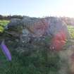
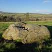
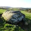
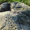
This massive cup-and-ring marked slab, which is situated on the crest of a west-north-west-facing slope 220m west-south-west of Hillhead of Avochie, was tentatively suggested as the recumbent of a destroyed circle by Burl (2005a, 119), though he has never listed it as a recumbent stone circle in his gazetteer. The slab, which measures 4m from north-north-east to south-southwest by 3.5m transversely and rises up to 1.2m above the surrounding ground level, bears no less than 80 cupmarks, many of them ringed. Although it bears some resemblance to a collapsed recumbent, there can be little doubt that this is no more than an earthfast erratic that has become progressively more exposed by cultivation over the century since Coles first published his description (Coles 1906b, 318–20, fig 20; Ritchie 1918, 115). It is perhaps telling that Coles, who had visited several erratic blocks in pursuit of recumbent stone circles, never entertained that possibility here.
Note (2 December 2020)
Date Fieldwork Started: 02/12/2020
Compiled by: NOSAS
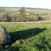
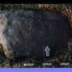
Location Notes: The panel is located on a moderate W facing slope with views over the Deveron valley, in rough pasture approximately 200m from the track leading to Avochie Quarry and Hillhead of Avochie Farm. The ruin of Avochie Castle/House can be seen to the SW, Knock Hill to the N, and a stone wall runs N-S 10m to the E. A small wooded copse is to the SE and a cleared wooded area to the N. The rough pasture is enclosed in a drystone wall and fenced area with a gap of approximately 15m wide which provides access from the Hillhead of Avochie Farm track. Approximately 120m down the slope at NJ53890 46893 a rock with 2 cups was located, and Hill of Avochie 1 (Canmore 294037), 2 and 3 are situated approximately 340m to the SW on the slopes of the Hill of Avochie.
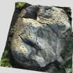
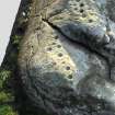
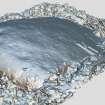
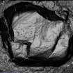
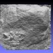
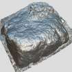
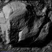
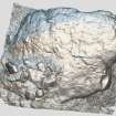
Panel Notes: This is a large, roughly rectangular whinstone boulder, measuring 4.3 x 3.5m with the longer axis orientated W-E. At its maximum height it rises to 1.3m and slopes to 0.8m at its lowest. Grey/white lichen covers most of the top surface, with grass also growing in a large hollow to the S, where water collects. A natural channel runs from this hollow to the W side of the rock. A natural crack runs parallel to this, to the N. To the NE of the surface there is another shallow hollow. A total of 72 cupmarks were identified. These are mainly situated on the three principle raised areas of the rock. A group of 10 motifs are located on the NE area and include 7 cups and 2 cups with single rings, and 1 cup with single ring and radial. The ringed cups were found to be the largest, with approximate diameters of 8cm and a maximum depth of 2.5cm. Another smaller cup may have a tail, but it may be a natural crack. A larger group of motifs to the N of the deep hollow includes 2 cups with possible rings.


