Pricing Change
New pricing for orders of material from this site will come into place shortly. Charges for supply of digital images, digitisation on demand, prints and licensing will be altered.
The Candy Stone
Stone Circle (Neolithic) - (Bronze Age)
Site Name The Candy Stone
Classification Stone Circle (Neolithic) - (Bronze Age)
Alternative Name(s) Woodside; Jeldah
Canmore ID 17781
Site Number NJ53SW 11
NGR NJ 5336 3036
Datum OSGB36 - NGR
Permalink http://canmore.org.uk/site/17781
- Council Aberdeenshire
- Parish Kennethmont
- Former Region Grampian
- Former District Gordon
- Former County Aberdeenshire
NJ53SW 11 5336 3036.
(NJ 5336 3036) Stone (NAT)
OS 6" map, Aberdeenshire, 2nd ed., (1902)
There is a standing stone, the sole remains of a stone circle, less than a hundred feet west of the cart-road to Crossburn of Cults, to the north of the main road between Gartly and Kirkhill. The stone is of syenite: it is 4ft 9ins high with a basal girth of over 11ft.
On the east of the cart-road, which may have cut through the circle, a row of sixty or seventy huge fragments of both syenite and whinstone rolled into the line of the fence above the road, many of them 3 and 4 ft broad, may be the remains of other stones of the circle.
F R Coles 1902.
The stone is as described by Coles (1902). There is no trace of the remainder of the circle of which the stone formed part.
The row of stones mentioned lie loose along the side of a dyke but their appearance suggests that they are merely the result of normal field clearance.
Visited by OS (JLD) 14 September 1961.
(Name cited as Woodside).
NMRS, MS/712/54.
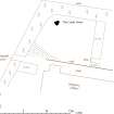
All that remains of this stone circle is a single standing stone situated in the rear garden of a modern house called Jeldah. Irregular in profile and roughly triangular on plan, it measures 1.4m in height.
Visited by RCAHMS (JRS, IF), 24 April 1996.


