Pricing Change
New pricing for orders of material from this site will come into place shortly. Charges for supply of digital images, digitisation on demand, prints and licensing will be altered.
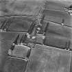
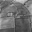
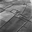
Auchenhove Castle, Eastermains
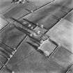
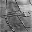
Castle (Medieval), Farmstead (Period Unassigned), Rig And Furrow (Medieval) - (Post Medieval)
Site Name Auchenhove Castle, Eastermains
Classification Castle (Medieval), Farmstead (Period Unassigned), Rig And Furrow (Medieval) - (Post Medieval)
Alternative Name(s) Easter Mains; Auchinhove
Canmore ID 17486
Site Number NJ50SE 1
NGR NJ 55438 02455
Datum OSGB36 - NGR
Permalink http://canmore.org.uk/site/17486
- Council Aberdeenshire
- Parish Lumphanan
- Former Region Grampian
- Former District Kincardine And Deeside
- Former County Aberdeenshire
NJ50SE 1 55438 02455
(NJ 5547 0245) Auchenhove Castle (NR)
OS 6" map, (1959)
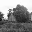
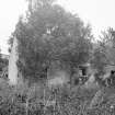
What remains of the walls of Auchenhove Castle is now incorporated with the steading of Easter Mains.
Name Book 1867.
The estate of Auchenhove belonged to the Duguid family from about 1434. The castle, which may have been built in the late 16th century, was burnt in 1745, and only its foundations may be traced amid the remains of derelict farm buildings. It appears to have been a late courtyard house, with a causeway approach.
A I McConnochie 1898; W D Simpson 1929.
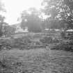
There is no definite trace of Auchenhove Castle beneath the ruins of later farm buildings. The walls of the later buildings, 0.8m thick, contain large facing stones, probably from the castle.
Visited by OS (NKB), 25 October 1968.


