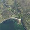
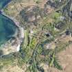
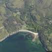
Roshven House, The Square
Cart Shed (Period Unassigned), Cottage (Period Unassigned), Farmstead (Period Unassigned), Granary (Period Unassigned), Stable (Period Unassigned)
Site Name Roshven House, The Square
Classification Cart Shed (Period Unassigned), Cottage (Period Unassigned), Farmstead (Period Unassigned), Granary (Period Unassigned), Stable (Period Unassigned)
Alternative Name(s) Formerly Roshven House Home Farm; The Square Cottage; The Smithy; The Mill; Roshven House Policies; Roshven Estate
Canmore ID 174554
Site Number NM77NW 9.03
NGR NM 70947 78640
NGR Description Centred NM 70947 78640
Datum OSGB36 - NGR
Permalink http://canmore.org.uk/site/174554
- Council Highland
- Parish Arisaig And Moidart
- Former Region Highland
- Former District Lochaber
- Former County Inverness-shire
The Square, post 1856 Fine group comprising: mill, round-ended by 1890, with lade and part of machinery for overshot wheel still in situ (being converted to a house); slit-vented barn at right angles. Cartshed/granary with architectural detail of the same vintage as the later work at the big house, designed by Jemima Blackburn with references to Philip Webb's work at nearby Arisaig House. Square Cottage, c.1890, mill-manager's house built of shuttered concrete to replace a thatched hovel. West Lodge, 1890s to Jemima Blackburn's design, with eyebrow dormers and curving jerkin-head roof continuing the Arts & Crafts theme of The Square.
Taken from "Western Seaboard: An Illustrated Architectural Guide", by Mary Miers, 2008. Published by the Rutland Press http://www.rias.org.uk


