
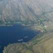
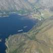
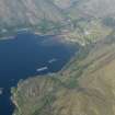
Lochailort, Railway Tunnel


Railway Tunnel (19th Century) - (20th Century)
Site Name Lochailort, Railway Tunnel
Classification Railway Tunnel (19th Century) - (20th Century)
Alternative Name(s) Druim Ban
Canmore ID 174542
Site Number NM78SE 11
NGR NM 7660 8239
NGR Description NM 7660 8239 to NM 7673 8542
Datum OSGB36 - NGR
Permalink http://canmore.org.uk/site/174542


- Council Highland
- Parish Arisaig And Moidart
- Former Region Highland
- Former District Lochaber
- Former County Inverness-shire
NM78SE 11 7660 8239 to 7673 8242
See also NM78SE 9 and NM78SE 10.
Tunnel [NAT]
OS 1:10,000 map, 1974.

