Following the launch of trove.scot in February 2025 we are now planning the retiral of some of our webservices. Canmore will be switched off on 24th June 2025. Information about the closure can be found on the HES website: Retiral of HES web services | Historic Environment Scotland
Fort George
Coastal Battery (Second World War)
Site Name Fort George
Classification Coastal Battery (Second World War)
Canmore ID 173653
Site Number NH75NE 30
NGR NH 7720 5748
NGR Description Centred NH 7720 5748
Datum OSGB36 - NGR
Permalink http://canmore.org.uk/site/173653
- Council Highland
- Parish Ardersier
- Former Region Highland
- Former District Inverness
- Former County Inverness-shire
NH75NE 30 centred 7720 5748
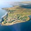
This World War II coast battery is situated on the coast adjacent to a NW-SE running group of rifle ranges to the E of Fort George (NH75NE 3).
Very little remains of this battery, one pile of broken concrete may possibly be No.2 gun emplacement, which has the appearance of being been blown up. In addition, one UP (unrotating projectile) mounting survives on the site.
The battery was armed with 2 x 4-inch Naval guns in August 1940 which were replaced by 2 x 5.5-inch Mk.I/PI guns in February 1943. The battery was placed on a care and maintainance basis in April 1945 and the guns removed in October 1945.
J Guy 2000; NMRS MS 810/10, Vol.2, 126, Vol.3, 40
This coast battery is visible on wartime oblique aerial photographs (RAF S463.H53, 70, 72, flown 31st August 1941). The two gun-emplacements with camouflage netting along with the hutted accommodation camp to the SE are clearly seen. Most of the huts are of the 'Nissen' type supplemented by a few wooden buildings. It is difficult to ascertain from the photographs whether an observation tower existed at this site as none is visible in or around the site. Also visible on the photographs in a field to the S of the gun battery are a series of anti-landing posts and trenches.
Information from RCAHMS (DE), February 2004
Note (1 April 2022)
(NH 7724 5744) The Pillbox Study Group report that a possible searchlight building and two gun-houses are depicted on the OS 1:2500 map (1965).
Information from Pillbox Study Group to HES 1 April 2022


