Pricing Change
New pricing for orders of material from this site will come into place shortly. Charges for supply of digital images, digitisation on demand, prints and licensing will be altered.
Margnaha
Farmstead (Period Unassigned)
Site Name Margnaha
Classification Farmstead (Period Unassigned)
Alternative Name(s) Wester Carwhin; Carie; Marragnaha
Canmore ID 173377
Site Number NN63NW 85
NGR NN 63822 36657
Datum OSGB36 - NGR
Permalink http://canmore.org.uk/site/173377
- Council Perth And Kinross
- Parish Kenmore (Perth And Kinross)
- Former Region Tayside
- Former District Perth And Kinross
- Former County Perthshire
NN63NW 85 63822 36657
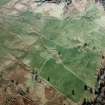
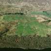
This farmstead stands in improved pasture on the SSE-facing slopes above the shore of Loch Tay. It comprises at least four buildings disposed around a yard, and two additional enclosures. The principal building (BL00 111) stands on the NW side of the yard. It originally measured internally 10.4m from NE to SW by 4.4m transversely, but it has been extended at each end to form a range measuring 27.6m in overall length. Its rubble walls stand up to 2.8m high at the gable ends and 1.7m high at the sides, and there are cruck-slots visible in the original structure and in the SW extension. The original portion has an entrance on the SE, with a window to each side of it, and there is a fireplace in the NE gable. An internal doorway leads to the SW extension, which measures 6.1m in length. The extension to the NE, 6.7m long, has been divided into three compartments. All three parts to this range open onto a raised terrace running along the front of the building, below which there is a possible midden, and on the rising ground behind the building there is a stone-walled enclosure measuring about 32m by 24m, with a small pen in its W corner. The second building (BL00 112) lies parallel to the first, and immediately to the S of it. It measures 11.6m in length by 3.3m in breadth within walls up to 1.5m high, there is an entrance in each side and a later pen has been constructed in the NE end. The third building, to the SE of the second, stands along the SW side of the yard (BL00 113). It measures 12.4m from NNW to SSE by 4.7m transversely within walls 1.6m high at the sides and 4.4m high at the SSE gable, which is complete. It has been divided into two equal compartments; that to the S has an entrance on the ENE, and that to the N has an entrance on the WSW. The ENE wall of the latter compartment has been robbed away. An outshot extends 2m to the SSE, and there is a rectangular stone-walled enclosure to the WSW, measuring about 22m in length by 13m in breadth. This building overlies the NNW end of an earlier range, now reduced to a platform measuring about 22m in length by 6m in breadth. The final building is a small outhouse, possibly a storage clamp, at the SE side of the yard (BL00 114). It measures 2.7m from NW to SE by 2m internally, and it has been dug into sloping ground to provide a level interior. The entrance is in the SE end.
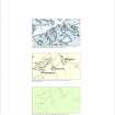
A farmstead named Marragnaha is depicted at this location on John Farquharson's 1769 Survey of the North Side of Loch Tay (National Archives of Scotland, RHP 973/1, Plan 7), one of five settlements depicted on the farm of Wester Carwhin. Farquharson shows six buildings, the positions of three of them closely matching that of the first three buildings described above (BL00 111-3). The 1st edition of the OS 6-inch map (Perthshire 1867, sheet lxix) depicts those three buildings as roofed, and two of them (BL00 111 and 113) are again shown roofed on the second edition map (Perthshire 1900, sheet lxix SW). On both OS maps the farmstead is named Margnaha. The site now lies on Carie farm.
(BL00 111-4, 2608)
Visited by RCAHMS (MFTR, ATW), 5 April 2000.


