
Following the launch of trove.scot in February 2025 we are now planning the retiral of some of our webservices. Canmore will be switched off on 24th June 2025. Information about the closure can be found on the HES website: Retiral of HES web services | Historic Environment Scotland
North Uist, Newton House Hotel


Hotel (19th Century), Souterrain (Prehistoric)
Site Name North Uist, Newton House Hotel
Classification Hotel (19th Century), Souterrain (Prehistoric)
Alternative Name(s) Newton House
Canmore ID 171876
Site Number NF87NE 39
NGR NF 89072 77359
Datum OSGB36 - NGR
Permalink http://canmore.org.uk/site/171876


- Council Western Isles
- Parish North Uist
- Former Region Western Isles Islands Area
- Former District Western Isles
- Former County Inverness-shire
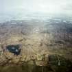
Newton House, early to mid-19th century A good example of the few solid stone and slated two-storey, three-bay farmhouses built down the west side of the Uists when the fertile machair lands were turned into big farms. Inside, the atmosphere is that of an unpretentious shooting lodge, with lots of comfortably furnished rooms and plenty of tongue and groove panelling. Later extensions to the east (rear) give the house a pleasant rambling feel. Accompanying walled garden (once reputed to be the best on the island), and quadrangle of steadings.
Taken from "Western Seaboard: An Illustrated Architectural Guide", by Mary Miers, 2008. Published by the Rutland Press http://www.rias.org.uk

Project (8 May 2007 - 16 May 2007)
NF 8907 7735 (Newton House), NF 8627 7532 (Cnoc a’ Chaisteal), NF 8646 7545 (Druim na h-Uamha) A souterrain at Newton House was discovered when a tractor partially collapsed the roof. This sparked community interest in the monument type and local residents were interested in two further possible
souterrains at Vallaquie. Orkney College Geophysics Unit was subsequently commissioned to survey this group of monuments by the North Uist Access Archaeology Group, in order to better understand the context within which the monuments were situated and define any associated settlement. A combination of gradiometry, resistance survey and ground-penetrating radar (GPR) survey was undertaken from 8–16 May 2007.
The gradiometer data from Newton House has defined an area of settlement activity covering approximately 0.25ha, which appears to be associated with the souterrain discovered in 2006. Within this area a possible roundhouse has been identified as well as a number of possible rectilinear structures that are presumably also broadly Iron Age in date. Although the results of the resistance survey were generally disappointing they did support the probable location of the roundhouse and also gave a broad idea of the depth at which some of these deposits were buried. The survey has also suggested that although a considerable depth and area of archaeological deposits are present, these are concentrated on the N side of a natural landform, rather than
constituting an entire settlement mound similar to those found the Northern Isles and the Outer Hebrides.
Archive deposited with Geophysics Unit, Orkney College.
Funder: Access Archaeology.
Ground Penetrating Radar (8 May 2007 - 16 May 2007)
NF 8907 7735 (Newton House), NF 8627 7532 (Cnoc a’ Chaisteal), NF 8646 7545 (Druim na h-Uamha) Ground penetrating radar survey.
Archive deposited with Geophysics Unit, Orkney College.
Funder: Access Archaeology.
Earth Resistance Survey (8 May 2007 - 16 May 2007)
NF 8907 7735 (Newton House), NF 8627 7532 (Cnoc a’ Chaisteal), NF 8646 7545 (Druim na h-Uamha) Resistance survey.
Archive deposited with Geophysics Unit, Orkney College.
Funder: Access Archaeology.
Magnetometry (8 May 2007 - 16 May 2007)
NF 8907 7735 (Newton House), NF 8627 7532 (Cnoc a’ Chaisteal), NF 8646 7545 (Druim na h-Uamha) Magnetometry survey.
Archive deposited with Geophysics Unit, Orkney College.
Funder: Access Archaeology.

