
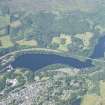
Loch Faskally, Coronation Bridge


Road Bridge (Period Unassigned)
Site Name Loch Faskally, Coronation Bridge
Classification Road Bridge (Period Unassigned)
Alternative Name(s) River Garry; River Tummel
Canmore ID 171487
Site Number NN95NW 106
NGR NN 92805 58572
NGR Description NN 92795 58625 to NN 92816 58500
Datum OSGB36 - NGR
Permalink http://canmore.org.uk/site/171487

- Council Perth And Kinross
- Parish Moulin
- Former Region Tayside
- Former District Perth And Kinross
- Former County Perthshire
NN95NW 106 92795 58625 to 92816 58500
Coronation Bridge [NAT]
OS 1:10,000 map, 1989.
For adjacent Clunie (Cluny) Bridge, see NN95NW 71.
Not to be confused with Coronation Bridge, Tor an Eas (NN 90319 60167), for which see NN96SW 38.
This bridge carries the present line of the A9(T) public road over Loch Faskally above the Pitlochry Power Station and Dam (NN95NW 62).
Information from RCAHMS (RJCM), 20 February 2006.

