
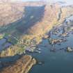
Harris, Leverburgh, Pier


Pier (Period Unassigned)
Site Name Harris, Leverburgh, Pier
Classification Pier (Period Unassigned)
Canmore ID 171107
Site Number NG08NW 10
NGR NG 0118 8632
Datum OSGB36 - NGR
Permalink http://canmore.org.uk/site/171107


- Council Western Isles
- Parish Harris
- Former Region Western Isles Islands Area
- Former District Western Isles
- Former County Inverness-shire

