Jenny Lind
Farmstead (Period Unassigned)
Site Name Jenny Lind
Classification Farmstead (Period Unassigned)
Alternative Name(s) Clogholes; The Clogholes; Pollok Estate
Canmore ID 171017
Site Number NS55NW 79
NGR NS 53580 58610
Datum OSGB36 - NGR
Permalink http://canmore.org.uk/site/171017
- Council Glasgow, City Of
- Parish Eastwood (City Of Glasgow)
- Former Region Strathclyde
- Former District City Of Glasgow
- Former County Lanarkshire
NS55NW 79 53580 58610
'An old farm steading now in ruins.'
Name Book 1864
A farmstead annotated Clogholes (Ruin) and comprising one unroofed building is depicted on the 1st edition of the OS 6-inch map (Renfrewshire 1864, sheet xii), but it is not shown on the current edition of the OS 1:10000 map (1990).
Information from RCAHMS (SAH), 4 May 2000.
Archaeological Evaluation (26 June 2013 - 27 June 2013)
NS 53566 58609 A trial trenching evaluation was undertaken, 26–27 June 2013, prior to development. A total of 13 trenches, covering 458m, were excavated with the goal of locating evidence of Clogholes Farmstead, which is marked on the 1st Edition OS map. No evidence of the farmstead was located; however, the foundations of a stone boundary wall thought to be contemporary with the farmstead were recorded. Two linear ditches were also identified, although the modern finds recovered from the fills indicated they were 20th-century in date. The finds included a number of bullet cartridges associated with the area’s use as a rifle range in the early 20th century. A number of tile field drains were also noted.
Archive: RCAHMS
Funder: Meridian Developments Ltd
Donald Wilson, Headland Archaeology Ltd, 2013
(Source: DES)
OASIS ID: headland1-154103


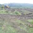
![Archaeological evaluation, View of trench 3 showing ditch cut [007] from N, Darnley Mains](http://i.rcahms.gov.uk/canmore/l/DP00302124.jpg)


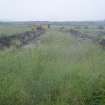
![Archaeological evaluation, View of trench 4 showing ditch cut [005] from W, Darnley Mains](http://i.rcahms.gov.uk/canmore/l/DP00302128.jpg)
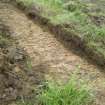
![Archaeological evaluation, View of trench 7 showing wall foundation [002] from N, Darnley Mains](http://i.rcahms.gov.uk/canmore/l/DP00302130.jpg)
![Archaeological evaluation, Section through wall foundation [002] in trench
5 from N, Darnley Mains](http://i.rcahms.gov.uk/canmore/l/DP00302137.jpg)


![Archaeological evaluation, View of trench 3 showing ditch cut [007] from N, Darnley Mains](http://i.rcahms.gov.uk/canmore/s/DP00302124.jpg)


![Archaeological evaluation, View of trench 4 showing ditch cut [005] from W, Darnley Mains](http://i.rcahms.gov.uk/canmore/s/DP00302128.jpg)
![Archaeological evaluation, View of trench 7 showing wall foundation [002] from N, Darnley Mains](http://i.rcahms.gov.uk/canmore/s/DP00302130.jpg)
![Archaeological evaluation, Section through wall foundation [002] in trench
5 from N, Darnley Mains](http://i.rcahms.gov.uk/canmore/s/DP00302137.jpg)


