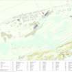
North Sutor, Coast Battery
Pillbox (Second World War)
Site Name North Sutor, Coast Battery
Classification Pillbox (Second World War)
Alternative Name(s) Cromarty Defences; Fort North Sutor, Site No. 1
Canmore ID 170756
Site Number NH86NW 9.10
NGR NH 81865 68976
Datum OSGB36 - NGR
Permalink http://canmore.org.uk/site/170756
- Council Highland
- Parish Nigg (Ross And Cromarty)
- Former Region Highland
- Former District Ross And Cromarty
- Former County Ross And Cromarty
NH86NW 9.10 8188 6898
A half- pillbox is situated on the fence-line about 45m NE from the stand-by set house. Only the 'front half' is extant, the rear portion is open. Examination of a RAF vertical air photograph (106G/UK751, 6039, flown 31 August 1945) would suggest that the pillbox was built in this fashion.
Visited by RCAHMS (DE, SW), August 2000
Note (29 July 2013)
Identified as a pillbox, it is positioned on the N boundary of the military camp. It may be that this may be a First World War blockhouse (pillbox) with its unusual construction and thin walls.
Information from RCAHMS (AKK) 29 July 2013.
Project (March 2013 - September 2013)
A project to characterise the quantity and quality of the Scottish resource of known surviving remains of the First World War. Carried out in partnership between Historic Scotland and RCAHMS.
Field Visit (15 March 2019)
This pillbox, which formed part of the defences introduced by the Army during WWII, is situated in a gap between two of the barrack blocks in the shelterbelt, where it is incorporated into the line of the security fence from which it projects NNW (NH86NW 9.51). It is a half-hexagon on plan and measures up to 3.46m from ENE to WSW by 1.51m transversely within reinforced cast concrete walls 0.25m thick and 1.98m high. Its flat roof incorporates the sawn-off stumps of the fence’s railings, although the lower section of three still penetrate through the concrete to the ground on the WSW of the pill box’s interior, which otherwise has no back wall on the SSE. The inside has been whitewashed and a wooden framed, rectangular gun port measuring 0.17m by 0.4m externally distinguishes each wall.
A grass-grown, flat-topped, stony apron projects immediately N of the pillbox. It measures 4.8m from ENE to WSW by 3m transversely and up to 0.6m in height.
The pillbox is similar to that which was originally located on the W side of the N gateway (NH86NW 9.14). It is depicted on two RAF aerial photographs (106G/RAF/0751/6039-40) flown on 31 August 1945.
Visited by HES, Survey and Recording (ATW, AKK), 15 March 2019.


