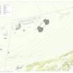
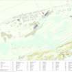
North Sutor, Coast Battery
Command Post (First World War), Officers Quarters (Second World War)
Site Name North Sutor, Coast Battery
Classification Command Post (First World War), Officers Quarters (Second World War)
Alternative Name(s) Cromarty Defences; Fort North Sutor, Site No. 1
Canmore ID 170742
Site Number NH86NW 9.03
NGR NH 82146 68966
Datum OSGB36 - NGR
Permalink http://canmore.org.uk/site/170742
- Council Highland
- Parish Nigg (Ross And Cromarty)
- Former Region Highland
- Former District Ross And Cromarty
- Former County Ross And Cromarty
NH86NW 9.03 82146 68966
World War I battery observation post.
Information from RCAHMS (DE), August 2000
This World War I Battery Observation post is situated downslope and about 154m E from the gun-emplacements (NH86NW 9.02).
The structure, built on three levels with three observation platforms in reinforced concrete and steel. Some additional brickwork has been added to support the central platform canopy. The upper canopy has collapsed but still lies in situ whilst the lower has broken off completely. Some camouflage paint can be seen in the area immediately in front of the central observation platform.
The observation post reflects the divisions between the Royal Navy and Army who were both responsible for the 9.2-inch calibre gun battery during the First World War.
Visited by RCAHMS (DE, SW, GS, JG), August 2000 and May 2002
Note (29 July 2013)
The Battery Observation Post lies to 150m E of No. 2 gun emplacement. It lies to the W of the Second World War BOP and is as described by a previous field visit.
During the Second World War it was used as officers quarters for the BOP.
Information from RCAHMS (AKK) 29 July 2013.
Field Visit (13 March 2019)
This building, which is partly buried on a steep SE-facing slope less than 3m W of the later Battery Observation Post (NH86NW 9.7), is a unique design introduced to the infrastructure of the battery by the Admiralty in World War 1. Its layout reflects four crucial activities in order of ascent: range-finding, operation of the searchlights, telecommunications and the directing of the fire of the battery. The post is a three-tiered building of reinforced cast concrete, measuring 11.2m from NW to SE by 3.6m transversely over walls up to 0.5m thick and at least 6.25m high. Each of the roofs covering the three separate compartments was originally masked with a layer of turf, which has now completely disappeared; but those parts of the external walls that are exposed have been camouflaged with blotches of whitewash, blackwash and colourwashes of blue, red, brown yellow and green. Some of the gorse- and grass-grown spoil from the excavation is situated to its SE.
The flat roof of the lowest tier is moss-grown and slopes gently SE before levelling-off, at which point it has collapsed on top of the wrap-around observation window due to the robbing of the supporting steel struts. It preserves traces of the bitumen by which it was weather-proofed and two of the three small drain pipes provided at the upturned, overhanging front edge of the canopy, which are common to each tier. A doorway on the SW is distinctive in being surrounded by a cast concrete architrave. This provides access to a compartment, in which the walls and ceiling are partly whitewashed, containing three position finding pillars set on low plinths in a triangular formation, each measuring 0.5m square and 0.53m high. A rectangular cubby-hole runs almost the full length of the SW wall, while a much smaller one opposite the doorway occupies the lower part of a cupboard that otherwise may have contained electrical equipment attached to a board above. Both cubbyholes have been blackwashed on at least one occasion.
The roof of the central tier is similar to that protecting the lower compartment except it remains intact. However, the wrap-around observation window has been blocked on the NE by secondary brickwork pierced by a circular aperture permitting a restricted outlook to be maintained. The doorway on the SW, incorporates a flight of three rising steps, while the compartment, itself, measures 3.2m from NW to SE by 2.74m transversely and 2.07m high. The walls and ceiling have been whitewashed and also colour-washed cream. It contains few fittings other than two metal straps below the window and three horizontal lines of wooden plugs running around the walls.
The upper tier is two storied, but its roof has also collapsed due to the removal of the steel struts that supported its canopy. Two large fragments from it now rest upon each other on the roof of the central tier below. The lower story, which was possibly the telephone room, is distinguished by a doorway on the SW at the same level as that providing access to the central compartment. Its original plank-built door remains in place, while a wooden-framed window immediately to its NW is also intact except for its glass. This compartment measures 2.75m from NW to SE by 2.04m transversely and 2.15m high. There is a short wall jutting out to the NW behind the door, which creates a tall recess from floor to ceiling in the compartment’s E corner. A plinth for a stove is situated in the N corner. Its chimney pipe penetrated through the ceiling into the upper compartment, where what is left of it exits through the NE wall a little above the level of the floor. In addition, two thick electrical cables entering just below ceiling level also run up through the floor. The upper compartment appears to have been reached originally by a metal ladder attached to the outside of the building, but there are only traces of the fixing points below the door’s threshold which is offset NW of the window below. This compartment measures 3.07m from NW to SE by 2.8m transversely, within walls 0.47m thick and 2.06m high. The walls and ceiling have been whitewashed and there is a platform 0.15m high and 1.38m broad immediately below the lower wall of the wrap-around observation window.
The building is annotated ‘Fire Commander’ on a plan held at the National Archives at Kew (WO78/5192), ‘Main Exchange’ on a sketch map entitled ‘Telephone Circuits’, dated 7 May 1919, also at Kew (ADM 7/942), and ‘Officer’s Quarters BOP’ on a Second World War sketch map entitled ‘Layout of Fort North Sutor’, which is bound into the Fort Record Book held at Kew (WO192/248). Its proximity to the Battery Observation Post (NH86NW 9.7) forming part of the infrastructure introduced by the Army in World War 2 may well have encouraged this re-use, but there is nothing visible to confirm this.
Visited by HES, Survey and Recording (ATW, AKK), 13 March 2019.


