
Knock Hill


Cairn (Period Unassigned)
Site Name Knock Hill
Classification Cairn (Period Unassigned)
Alternative Name(s) Ferny Howe; Upper Ruthven; Knockargety
Canmore ID 17044
Site Number NJ40SE 44
NGR NJ 45104 03077
Datum OSGB36 - NGR
Permalink http://canmore.org.uk/site/17044


- Council Aberdeenshire
- Parish Logie-coldstone
- Former Region Grampian
- Former District Kincardine And Deeside
- Former County Aberdeenshire
NJ40SE 44 45104 03077
(NJ 4512 0306) Cairn or Redoubt
Information from A C O'Dell to OS, 1953.
570ft to the W of the 'camp' (NJ40SE 3) is a circular heap of stones, which has the appearance of having been a ring-shaped redoubt, or less probably a large cairn. It is 35 or 40ft diameter.
A Ogston 1931.
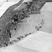
Conspicuously situated in a pasture field on a fairly level shoulder of Knockargety Hill, a flat topped, turf-covered mound of stone, c.16.0m diameter c.0.8m high. The margin is obscured by field clearance and a plough line and no kerb stones can be seen to enable positive classification, but it is probably a cairn.
Surveyed at 1/2500.
Visited by OS (R L) 29 October 1968.
Scheduled as cairn.
Information from Historic Scotland, scheduling document dated 8 November 1999.

