Blue Cairn Of Ladieswell
Recumbent Stone Circle (Neolithic) - (Bronze Age)
Site Name Blue Cairn Of Ladieswell
Classification Recumbent Stone Circle (Neolithic) - (Bronze Age)
Alternative Name(s) Burn Of Kinalchie
Canmore ID 17000
Site Number NJ40NW 4
NGR NJ 4113 0633
Datum OSGB36 - NGR
Permalink http://canmore.org.uk/site/17000
- Council Aberdeenshire
- Parish Logie-coldstone
- Former Region Grampian
- Former District Kincardine And Deeside
- Former County Aberdeenshire
NJ40NW 4 4113 0633.
(NJ 4113 0633) Blue Cairn (NR) Remains of: Supposed Stone Circle.
OS 6" map, Aberdeenshire, 2nd ed., (1902)
A mutilated stone circle, defined by a large cairn of stones, 90ft in diameter. 6ft inside the edge of the cairn in the SW is a huge recumbent stone, 11ft long by 5ft broad. The only upright stone remaining is in the N (A on plan) and is 2ft high, two others of the same height are leaning, and 27 other stones up to 5 or 6ft long which have once formed the customary ring of erect stones, are fallen and displaced. An excavation in 1875 revealed only animal bones and fragments of a clay urn (A Ogston 1931) All the upright stones had been removed by 1866 except the recumbent stone (Name Book 1866).
Name Book 1866; A Ogston 1931.
Blue Cairn, a mutilated recumbent stone circle mainly as described above. The upright block in the NE ('A' on Ogston's plan) seems to have been erected later. To the E of the recumbent stone is a large stone leaning outwards which may be the only one of the ring of standing stones left, most of those described by Ogston being merely large stones.
Resurveyed at 1/2500.
Visited by OS (N K B) 4 September 1968.
The monument is situated on a moderate SE-facing slope at an altitude of about 285m OD.
NMRS, MS/712/44.
Field Visit (4 June 1998)
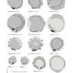
The dominant feature of this recumbent stone circle is the large mound of stones within the ring. This stands within a post and rail fence in a clearing amongst the conifers of Balronald Wood and straddles the leading edge of a natural terrace on the steep SE flank of Bonlee Hill. Unusually, the orthostats of the ring are interdigitated with the kerb of the cairn, which measures about 23m in overall diameter by up to 1.5m in height. This has led some to question whether it should be included in the class (Ruggles 1984, 60; Barnatt 1989, 483), but there is no doubting the character of the recumbent block (2) on the SSW, albeit missing its flankers. This measures about 3.6m in length by 0.9m in height and its even summit is set roughly horizontal. Of the orthostats, four remain on the SE, one leaning steeply (4) and the other three fallen (5–7). They were probably set out at intervals of about 3m and may have graded into the run of large kerbstones that demarcates the E side of the cairn. Elsewhere, a stumpy upright pillar (8) stands within the margin of the cairn on the NNE, while two slabs lying fallen on NW (9) and WSW (10) respectively may be small orthostats rather than kerbstones. The surface of the cairn is disfigured with crude excavation trenches dug in 1875 by Rev John Michie, but it preserves an asymmetric profile on the slope and is evidently built up on the E to create a level top; this may account for the presence of the larger kerbstones on the E, designed to retain the greater height of cairn material on the downslope side. Nothing can now be seen of a court that Michie describes at the centre of the cairn; measuring 3.65m in diameter within a kerb of upright stones and drystone masonry, it contained some sherds of pottery and a few sheep and deer bones.
Visited by RCAHMS (ATW and KHJM) 4 May 2006


