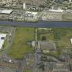
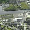
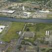
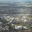
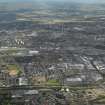
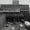
Glasgow, Lower Harbour, Clyde Tunnel
Road Tunnel (20th Century)
Site Name Glasgow, Lower Harbour, Clyde Tunnel
Classification Road Tunnel (20th Century)
Alternative Name(s) River Clyde; Whiteinch; Linthouse
Canmore ID 167373
Site Number NS56NW 200
NGR NS 5422 6641
NGR Description NS 5431 6676 to NS 5530 6590
Datum OSGB36 - NGR
Permalink http://canmore.org.uk/site/167373
- Council Glasgow, City Of
- Parish Govan (City Of Glasgow)
- Former Region Strathclyde
- Former District City Of Glasgow
- Former County Lanarkshire
NS56NW 200.00 5431 6676 to 5530 6590
NS56NW 200.01 NS 54316 66748 North Portal (Ferryden St)
NS56NW 200.02 NS 54316 66748 South Portal (Holmfauld Rd)
Clyde Tunnel [NAT] (at NS 5421 6625)
OS 1:1250 map, 1965 [map sheet NS5466SW].
Clyde Tunnel [NAT] (at NS 5426 6662)
OS 1:1250 map, 1973 [map sheet NS5466SW].
Not to be confused with (disused pedestrian) Harbour Tunnel (NS 5718 6516 to NS 57072 64951), for which see NS56NE 79.00.
Clyde Tunnel. From Whiteinch on the N bank to Linthouse on the S. Built 1957-64, but first planned just after the Second World War, when bridges over the navigable approach to the city could not be contemplated. Engineer Sir Wm Halcrow & Partners of London, whose associate architect E J D Mansfield designed the ventilation buldings and the landscaping of the approaches; contractor Charles Brand & Son Ltd. The planning consultant fot the Tunnel and Clydeside Expressway junction was William Holford & Associates.
A short tunnel of two seperate tubes, each containing two lanes of road traffic, and, under the road, a cycle track and pedestrian passage; one tube for northbound traffic, one for southbound.
The tunnel is approached down ramps through cuttings and underpasses, all of grey concrete which is generally dirty, and entered under the ventialtion buildings, fronted by the wide glazing of the tunnel control rooms. A steep descent (1 in 16) and immediate change to ascent reflect the narrowness of the river. Despite the tunnel's shortness, widely varying geological strata made the construction difficult.
At each end, a swirl of approach roads. The best hard landscaping is under the flyover of the Clyde Expressway (A814) at Broomhill Drive, a little to the E, where pleasant pedestrian routes run through the junction in several directions.
E Williamson, A Riches and M Higgs 1990.
This tunnel carries the A739 public road between Whiteinch (to the N) and Linthouse (to the S) beneath the River Clyde (Glasgow Lower Harbour). The river here forms the boundary between the parishes of Glasgow (to the N) and Govan (to the S). The route of the tunnel is indicated by pecked lines on the appropriate sheets of the OS 1:1250 map.
Information from RCAHMS (RJCM), 6 January 2006.
Construction (1957 - 1964)
Design by Sir A M Muir Wood. MAin contractor, Charles Brand and Son Ltd.Ventilation buildings E J D Mansfield.
Project (2007)
This project was undertaken to input site information listed in 'Civil engineering heritage: Scotland - Lowlands and Borders' by R Paxton and J Shipway, 2007.
Publication Account (2007)
Clyde Tunnel ia a 1/2 -mile long dual carriageway tunnel, the longest and most advanced of its kind in Scotland, was shield driven under the Clyde from 1957–64, joining Linthouse and Whiteinch. Each tunnel has a heavy cast-iron lining of about 32 ft diameter containing a dual carriageway with a maximum design capacity of 5200 veh/hr and with a cycle track and walkway beneath (see figures). The approach gradients are 1 in 16 with a short level length at the tunnel centre. The portals and approaches are constructed in heavy reinforced concrete and, as most of each approach was below the water table, flotation had to be resisted, including by means of wide holdingdown piles. Generous ventilation provision was made with a building over each portal, carriageway road heating was built into the approaches, and special provision made for lighting, and pumping from four pump rooms with nine pumps each capable of delivering more than 400 gallons/min
The approximate cost of the civil engineering works was £10.5m. The consulting engineers to Glasgow Corporation were Sir Wm. Halcrow & Partners, with design and planning by Sir A. M. Muir Wood. The main contractor was Charles Brand & Son Ltd. The architect for the ventilation buildings and landscaping the approaches was E. J. D. Mansfield.
R Paxton and J Shipway 2007
Reproduced from 'Civil Engineering heritage: Scotland - Lowlands and Borders' with kind permission of Thomas Telford Publishers.


