
Pricing Change
New pricing for orders of material from this site will come into place shortly. Charges for supply of digital images, digitisation on demand, prints and licensing will be altered.
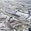
Corsbie, Steading


Farmstead (Period Unassigned)
Site Name Corsbie, Steading
Classification Farmstead (Period Unassigned)
Alternative Name(s) Corsbie Farm
Canmore ID 167082
Site Number NT64SW 55
NGR NT 6060 4434
Datum OSGB36 - NGR
Permalink http://canmore.org.uk/site/167082


- Council Scottish Borders, The
- Parish Legerwood
- Former Region Borders
- Former District Ettrick And Lauderdale
- Former County Berwickshire
The farmstead of Corsbie stands about 400m north of the ruins of Corsbie tower near the Dowdiedean Burn and comprises several outbuildings, cottages and a farm house. Corsbie is recorded on maps as early as the Armstrong's Map of the County of Berwick, dating to 1771. Reference to the 1st edition of the Ordnance Survey 6-inch map of Berwickshire (1862) shows Corsbie as a large steading, with the farmhouse standing in wooded grounds, and a large mill pond and sluice on the nearby Dowiedean Burn.
Text prepared by RCAHMS as part of the Accessing Scotland's Past project
NT64SW 55.00 6060 4434
NT64SW 55.01 60790 44168 Farmhouse
NT64SW 55.02 60658 44116 Dovecot
NT64SW 55.03 6038 4428 and 6042 4427 Cottages

