
Pricing Change
New pricing for orders of material from this site will come into place shortly. Charges for supply of digital images, digitisation on demand, prints and licensing will be altered.
Glasgow, Maryhill Barracks


Barracks (19th Century) - (20th Century), Barracks (First World War), Barracks (Second World War), Hospital (First World War)
Site Name Glasgow, Maryhill Barracks
Classification Barracks (19th Century) - (20th Century), Barracks (First World War), Barracks (Second World War), Hospital (First World War)
Alternative Name(s) Wyndford Road; Maryhill Road; Garrioch Barracks; Maryhill Militar Hospital
Canmore ID 166210
Site Number NS56NE 1603
NGR NS 5680 6833
NGR Description NS c. 5680 6833
Datum OSGB36 - NGR
Permalink http://canmore.org.uk/site/166210


- Council Glasgow, City Of
- Parish Glasgow (City Of Glasgow)
- Former Region Strathclyde
- Former District City Of Glasgow
- Former County Lanarkshire
Maryhill Barracks is marked on the 2nd epoch 1:2500 map (surveyed 1893-4) as comprising over 30 buildings around a central square, with a hospital building at the SW corner. The 3rd epoch labels more of the buildings, and the depot church and a 'miniature rifle range' are shown. A large area between the built-up area of the barracks and the River Kelvin to the south is marked 'Exercise Area' and is shown as War Office land, by the location of boundary stones.
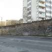
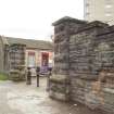
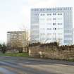
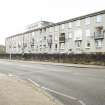
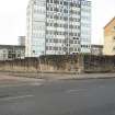
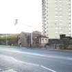
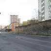
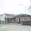
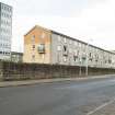
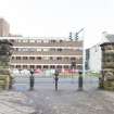
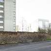
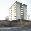
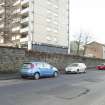
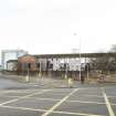
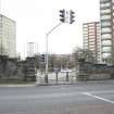
The barracks was the regimental depot of the Highland Light Infantry. The complex has largely been demolished but the guardroom and lengths of the boundary wall survive.
Information from HS/RCAHMS World War One Audit Project (GJB) 12 September 2013.
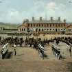
Maryhill Barracks, 1876
Garrioch Barracks, as they were originally called, were built on 12 hectares (30 acres) of the Ruchill estate, to house an infantry regiment, a squadron of cavalry and a battery of field artillery. The City Council had been petitioning the government since the early 1800s for more military protection from their fear of 'riot and tumult' in the growing industrial areas. Higher quality than normal, the barracks seem to have reduced vandalism and engendered a sense of community.
Taken from "Greater Glasgow: An Illustrated Architectural Guide", by Sam Small, 2008. Published by the Rutland Press http://www.rias.org.uk

NS56NE 1603 c. 5680 6833
Maryhill Barracks entrance was formerly on Maryhill Road.
Project (March 2013 - September 2013)
A project to characterise the quantity and quality of the Scottish resource of known surviving remains of the First World War. Carried out in partnership between Historic Scotland and RCAHMS.
Archaeological Evaluation (21 June 2018 - 28 September 2018)
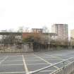
NS 5680 6833 A programme of archaeological work was undertaken, 21 June – 28 September 2018, on the site of the former barracks. The work formed part of Scottish Archaeology Month 2018, and the results will contribute to a wider Heritage Lottery-funded community project run by the mangers of the Wyndford Estate, Cube Housing Association. This project seeks to engage the local residents in the heritage of the barracks, and investigate the History of the site from the 1890s until the 1960s when the barracks were demolished.
The work included a desk-based assessment, geophysical survey (undertaken by Rose Geophysical Consultants) and a small trench excavation across the recorded locations of the former late 19th-century Barrack’s Church an adjacent building, and a series of U-shaped buildings dating to the mid-20th century. These buildings are located within accessible public green spaces. Additional excavation work was undertaken on 28th September 2018 with local volunteers from the Cube Housing Association and the Dunbartonshire Canal College 2 programme.
The work revealed the presence of a possible surface relating to the exterior of the U-shaped buildings, an interior surface and internal fixtures and fittings associated with the building near to the church. Excavation in these areas suggests that structural features were demolished, and then the ground infilled and levelled with imported material. Numerous modern finds from the topsoil indicate the post-barracks use of the site and the public green spaces.
Whilst no structural remains of the church were identified, the geophysical survey and excavation suggest that a raised platform or mound at the location of the former church, is man-made, constructed from demolition and imported infilling material, and that upstanding structural remains of the church survive within the mound.
Archive: NRHE
Funder: Heritage Lottery Fund
Helena Gray – Archaeology Scotland
(Source: DES Vol 19)

