Cruachan, Power Station, Turbine Hall
Hydroelectric Power Station (20th Century)
Site Name Cruachan, Power Station, Turbine Hall
Classification Hydroelectric Power Station (20th Century)
Alternative Name(s) Ben Cruachan Pumped Storage Scheme; Loch Awe/ben Cruachan Hydroelectric Scheme
Canmore ID 164452
Site Number NN02NE 12.04
NGR NN 08009 27748
NGR Description NN c. 0800 2775
Datum OSGB36 - NGR
Permalink http://canmore.org.uk/site/164452
- Council Argyll And Bute
- Parish Ardchattan And Muckairn (Argyll And Bute)
- Former Region Strathclyde
- Former District Argyll And Bute
- Former County Argyll
NN02NE 12.04 c. 0800 2775
Cruachan Power Station [NAT] (at NN 0773 2675)
OS 1:10,000 map, 1974.
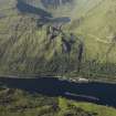
This underground turbine hall cannot be accurately located from the available map evidence but the 1974 edition of the OS 1:10,000 map indicates a feature at NN 0800 2775 which is probably the top of a vertical shaft carrying power lines from the turbines. Access to the turbine hall is gained by a tunnel running from an entrance adjacent to the visitor centre NN02NE 12.05.
Information from RCAHMS (RJCM), 29 June 2000.
Note (25 October 2023)
Loch Awe Scheme was built between 1959 and 1967 and comprised three power stations Inverawe, Nant and Cruachan, the latter two being underground. Inverawe is supplied by a tunnel from Loch Awe and discharges into Loch Etive, whereas Nant is fed from Loch Nant by a tunnel supplemented by an aqueduct collecting from local streams and discharges into Loch Awe. These stations have installed capacity of 25MW and 15MW respectively.
By far the largest Power station in the scheme is Cruachan at 400MW and is a pumped storage system, making use of Cruachan Reservoir at an altitude of 1316 feet to give a head of 1198 feet. During off-peak periods at night and at week-ends, water is pumped up to the reservoir from Loch Awe using available excess power. The water is used to generate during daytime demand, discharging into Loch Awe.
The project involved the design and development of special turbines that could be utilized as pumps against a high head of water, and alternators that could be driven as motors. A buttress dam was built at the exit end of Cruachan Reservoir, and several tunnels to collect water from the surrounding area. Problems at the lower level were largely caused by congestion at the Pass of Brander, leading to the decision to build the power station in the heart of Ben Cruachan. This involved an enormous amount of excavation , made difficult by geological problems. Later on problems arose due to the necessity to assemble large machinery in confined space under controlled conditions. Also difficulties were encountered with the outfall into Loch Awe. However, in spite of the difficulties the project was successfully completed to specification in 1967.
Information from NRHE catalogue item number WP007424 compiled by George Walker in 2005.


