
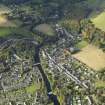
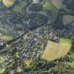
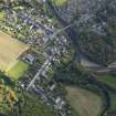
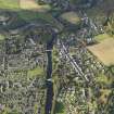
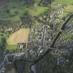
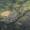
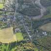
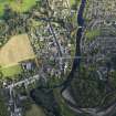
Comrie, Drummond Street, Genereal


General View (Period Unassigned), Road (Period Unassigned)
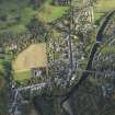
Site Name Comrie, Drummond Street, Genereal
Classification General View (Period Unassigned), Road (Period Unassigned)
Canmore ID 163420
Site Number NN72SE 85
NGR NN 7746 2208
NGR Description From NN 7733 2199 to NN 7760 2218
Datum OSGB36 - NGR
Permalink http://canmore.org.uk/site/163420


- Council Perth And Kinross
- Parish Comrie (Perth And Kinross)
- Former Region Tayside
- Former District Perth And Kinross
- Former County Perthshire
NN72SE 85 From NN 7733 2199 to NN 7760 2218

