Scheduled Maintenance
Please be advised that this website will undergo scheduled maintenance on the following dates: •
Tuesday 3rd December 11:00-15:00
During these times, some services may be temporarily unavailable. We apologise for any inconvenience this may cause.
Ettleton Sike
Boundary Bank(S) (Medieval) - (Post Medieval), Farmstead (Medieval) - (Post Medieval), Field System (Medieval) - (Post Medieval), Rig And Furrow (Medieval) - (Post Medieval)
Site Name Ettleton Sike
Classification Boundary Bank(S) (Medieval) - (Post Medieval), Farmstead (Medieval) - (Post Medieval), Field System (Medieval) - (Post Medieval), Rig And Furrow (Medieval) - (Post Medieval)
Alternative Name(s) Kirk Hill; Side
Canmore ID 162925
Site Number NY48NE 145
NGR NY 4668 8647
NGR Description centred on NY 4668 8647
Datum OSGB36 - NGR
Permalink http://canmore.org.uk/site/162925
- Council Scottish Borders, The
- Parish Castleton
- Former Region Borders
- Former District Roxburgh
- Former County Roxburghshire
Field Visit (29 March 1996 - 5 August 1996)
NY48NE 145 centred on 4668 8647
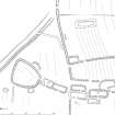
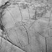
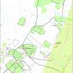
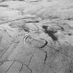
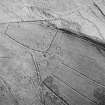
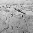
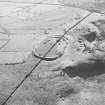
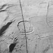
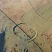
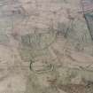
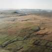
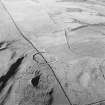
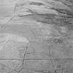
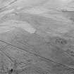
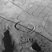
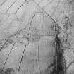
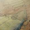
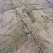
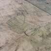
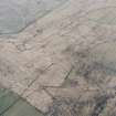
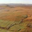
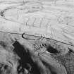
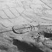
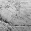
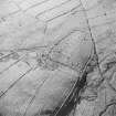
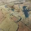
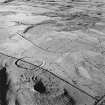
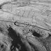
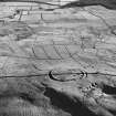
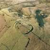
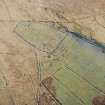
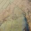
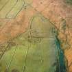
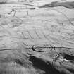
On a broad terrace on the the E flank of Kirk Hill there are a farmstead, an earthen-banked field-system, some rig and a boundary-dyke displaying two phases of construction. The farmstead stands at the centre of the field-system, which extends from the hill-fort on the hilltop to the W (NY48NE 1) to the front of the terrace on the E, a distance of about 600m, and from the Ettleton Sike in the N to the field-system of the next farmstead to the S (NY48NE 6), about 400m.
The farmstead which comprises eight buildings, four pens and two enclosures, displays at least three main phases of development. Phase 1 comprises an outlying building (LID96 191) to the W, which respects the boundary dyke that predates the earthen-banked field-system, lying parallel and immediately inside its line. The other two phases respect the earthen-banked field-system, being centrally placed within it. Phase 2 comprises three buildings (LID96 183, 185 and the predecessor of 187), which pre-date the buildings in phase 3 (LID96 181, 182, 186 and 187), including an additional building (LID96 181) inserted in the enclosure on the W of the northernmost building, possibly belonging to a fourth phase on its own.
The five largest buildings (LID96 182, 185, 186, 187, 191), all of which are aligned N and S, range from 9m to 12m in length by between 2.6m and 3.2m in breadth within earthen banks up to 1.2m in thickness and 0.5m in height. One of the buildings (LID96 187) overlies the end of a smaller two compartment building, measuring about 7m by 3.5m, and two other smaller buildings (LID96 181 and 183) are both about 4.5m in length by 2.5m in breadth internally. All the buildings have entrances on the E, and in addition to the two compartment building noted above, one other has traces of a partition (LID96 182). The stone footings of three of the buildings have been extensively robbed, of which the outlying building to the W is the most dramatic, leaving a well-defined trench between two earthen banks for most of its perimeter (LID96 191). There are two patches of lazy-beds to the W of the farmstead, of which one is dug right up to the entrance of the phase 1 building (LID96 191). The enclosure to the S has a build-up of soil within it and may have been used as a garden.
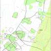
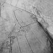
The field-system comprises three blocks of subrectangular earthen-banked fields lying to the E (NY 4678 8643), SW (NY 4648 8631) and NW respectively of the farmstead (NY 4659 8650), each of which encloses rig. However, recent cultivation has smoothed much of the ground below the farmstead. The fields measure as much as 175m in length but are generally less than half that in breadth. In places elements of the field-systems evidently post-date areas of rig, for example, in the block of fields to the SW of the steading. There the E-W field-boundaries display a reverse-S curve, which suggests that they have been built to follow the line of earlier rig, but inside the fields the rig is tailored to the space enclosed. There are also traces of rig outside the earthen-banked fields, one instance being to the W of the fields on the NW of the farmstead (NY 4652 8647) and another immediately S of the farmstead (NY 4666 8645 and see plan). The field-banks themselves are multi-period and the system has been extended in two phases towards the SW to overlie the ramparts of the hillfort on Kirkhill (NY48NE 1); a late phase of field-bank also overlies the field-system to the E of the farmstead, enclosing about 12ha of pasture immediately W of Ettleton churchyard (NY48NE 4).
The two successive phases of boundary-dyke, both of which take the form of a bank with a ditch on the uphill side, external to the area enclosed. They enclosed the farmland on the lower slopes of the hill; in the primary phase extending from the southern branch of the Ettleton Sike (NY 4729 8620) through to Short Sike in the N (NY 4696 8722). In the second phase the boundary bank continues S to join a boundary enclosing another farm to the S (NY48NE 6). To the S of this junction the boundary continues across the Ettleton Sike and then turns uphill, from the angle onwards representing the secondary phase (NY 4663 8659). However, the primary boundary may be traced continuing to the S across a tributary of the Ettleton Sike, where it is overlain by the earthen-banked field-systems to the NW of the farmstead (NY 4662 8655). The part of the boundary dyke to the N of a junction with a later field-bank to the N of Ettleton Sike is described elsewhere (NY 4676 8680 and see NY48NE 189.01). It emerges on the S (NY 4663 8644) to turn downhill to the SE as a well-defined bank and ditch, until it is overridden by the easterly of the earthen-banked field-systems (NY 4671 8635). The boundary continues as a ditch from this field-system as far as the public road to Ettleton Churchyard (NY 4718 8620) and issues beyond. into the head of a small tributary of the Ettleton Sike (NY 4729 8621). The secondary dyke runs from the point where it diverged from the primary dyke (NY 4663 8659) in a curve to the SW, until it is overlain by the earthen-banked field-system to the SW of the farmstead (NY 4645 8643), which reuses its line as one of its boundaries. Its ditch is still traceable until it reaches another earthen-banked field-system (NY 4646 8620). From this point the ditch of another boundary runs off to the SSW (see NY48NE 6).
Roy's map depicts a farmstead called Side at about this location (Roy 1747-55), and Blaeu a settlement called Syid (Blaeu 1654). There is an entry in the 1376 rental for 'Locus Willelmi del Syde' (RHM I, App. 17). The 1718 estate survey shows Side as part of Reidmoss, Over Whisgills, Tunnies, Bankhead and Shipshelden, alias Side farm (SRO RHP 9629). However, the bounds given are not explicit enough to be sure if this farmstead is the one depicted on the plan. The OS have applied the name Side to a farmstead to the SSW (NY48NE 6), but the name could equally well be applied to this site.
(LID96 180-183, 185-191)
Visited by RCAHMS (DCC and PJD) 29 March 1996 and 5 August 1998
J Blaeu 1654, W Roy 1747-55
Measured Survey (5 August 1998)
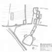
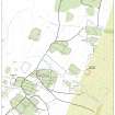
RCAHMS surveyed the township at Ettleton Sike with plane-table and self-reducing alidade on 5 August 1998 at a scale of 1:250. The resultant plan was redrawn in ink and published at a scale of 1:500.
Note (2 August 2000)
A field-system marked by pecked lines is depicted on the 1st edition of the OS 6-inch map (Roxburghshire 1862-3, sheet xlv) and on the current edition of the OS 1:10000 map (1982), where an additional enclosure is shown.
Information from RCAHMS (SAH) 2 August 2000


