
Following the launch of trove.scot in February 2025 we are now planning the retiral of some of our webservices. Canmore will be switched off on 24th June 2025. Information about the closure can be found on the HES website: Retiral of HES web services | Historic Environment Scotland
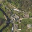
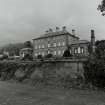
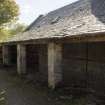
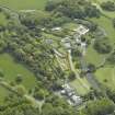
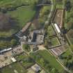
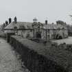
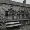
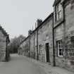
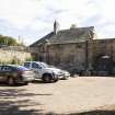
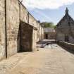
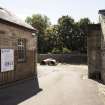
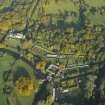
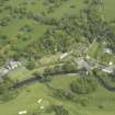
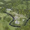
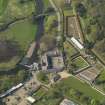
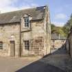
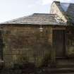
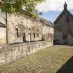
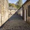
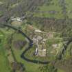
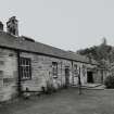
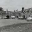
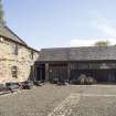
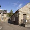
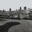
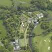
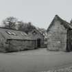
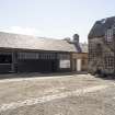
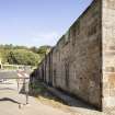
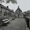
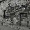
Glasgow, Pollokshaws Road, Pollok Park, Pollok House, Stables


Stable (17th Century) - (19th Century)
Site Name Glasgow, Pollokshaws Road, Pollok Park, Pollok House, Stables
Classification Stable (17th Century) - (19th Century)
Canmore ID 162548
Site Number NS56SW 31.03
NGR NS 54994 61662
Datum OSGB36 - NGR
Permalink http://canmore.org.uk/site/162548


First 100 images shown. See the Collections panel (below) for a link to all digital images.
- Council Glasgow, City Of
- Parish Eastwood (City Of Glasgow)
- Former Region Strathclyde
- Former District City Of Glasgow
- Former County Lanarkshire
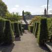
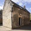
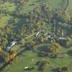
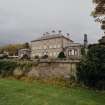
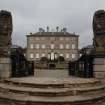
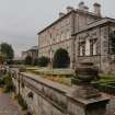
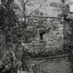
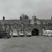
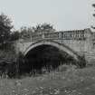
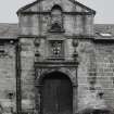
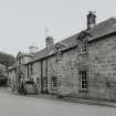
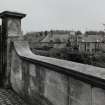
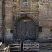
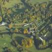
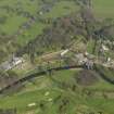
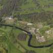
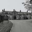
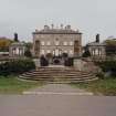
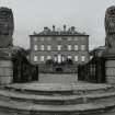
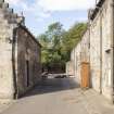
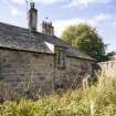
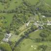
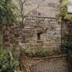
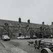
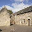
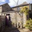
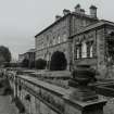
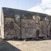
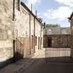
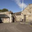
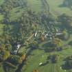
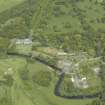
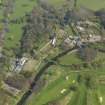
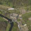
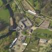
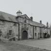
Lodge, Pollok House, 97 Haggs Road, 1892, R Rowand Anderson. Scottish classical with shallow conical slate roof over a broad semicircular bay window. Shawmuir Lodge, Pollok Avenue, 2060 Pollokshaws Road, 1891, Robert Rowand Anderson. Scots Classical Lodge with bell-cast slate hipped roof. Tall square gatepiers with urns and decorative wrought-iron gates. Estate Bridge over River Cart, 1757. Single wide segmental arch, balustraded parapet, roadway widens at abutments. Stables Range, 17th to 19th century. Courtyard Range on site of previous house, the Laigh Castle, includes handsome Renaissance gateway (north-west side) and more 17th-century work incorporated into later buildings. Weir, Sawmill and Power Station, c.1860 for Sir John Stirling-Maxwell. Weir may be 18th century. Single-storey brick sawmill with early machinery, although a turbine replaces the low-breast water wheel. Late 19th-century Power Station, with Waverley turbine by Carrick & Ritchie of Edinburgh.
Taken from "Greater Glasgow: An Illustrated Architectural Guide", by Sam Small, 2008. Published by the Rutland Press http://www.rias.org.uk

NS56SW 31.03 54994 61662
EXTERNAL REF:
Strathclyde Regional Archives, Pollok Maxwell Collection
Pollok Stables, 1867. 3 plans for stables at Pollok. " ground plans and an elevation. Tinted. By Wilson And Tomson 29 St Vincent Pl. 1867.
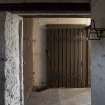
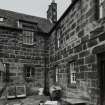
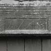
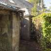
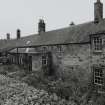
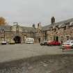
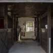
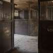
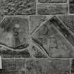
Ranges of different dates, mainly 17th-19th century; formerly stables to Pollok house, but at site of previous house (the Laighe Castle) and containing much re-used 17th century work; fragments at E corner said to be of c. 1536 tower. Mostly rubble, ashlar dressings, 2- storey elevations, small-paned sashes, tall stacks, slate roofs. RANGE TO NW incorporates handsome 17th century renaissance gateway, pend, margined openings, big roof ventilator; RANGE TO NE built in 3 stages, the centre probably a later 19th century rebuild, incorporating carved fragments, now with uniform eaves level and roof, further range to E; SW range also built in stages. (Historic Scotland)
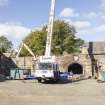
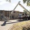
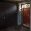
Standing Building Recording (20 March 2024 - 21 March 2024)
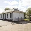
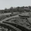
NS 54996 61624 A Level 2 historic building survey was undertaken by AOC Archaeology Group on the Stables, the Saw Mill and the Hen House, located between the two. A Level 2 survey includes a photographic, written and drawn record.
Information from D. Sproat – AOC Archaeology Group, 2024.
OASIS ID: aocarcha1-522803

