
Following the launch of trove.scot in February 2025 we are now planning the retiral of some of our webservices. Canmore will be switched off on 24th June 2025. Information about the closure can be found on the HES website: Retiral of HES web services | Historic Environment Scotland
West Cambusdrennie


Farmhouse (Period Unassigned), Farmstead (Period Unassigned)
Site Name West Cambusdrennie
Classification Farmhouse (Period Unassigned), Farmstead (Period Unassigned)
Canmore ID 162465
Site Number NS79SE 220
NGR NS 7519 9435
NGR Description Centred on NS 7529 9432
Datum OSGB36 - NGR
Permalink http://canmore.org.uk/site/162465
Ordnance Survey licence number AC0000807262. All rights reserved.
Canmore Disclaimer.
© Bluesky International Limited 2025. Public Sector Viewing Terms
- Correction
- Favourite

SC 2151885
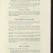
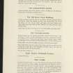
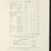
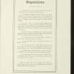
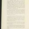
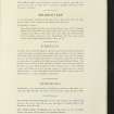
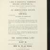
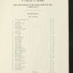
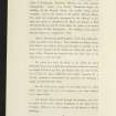
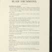
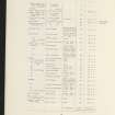
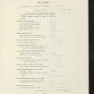
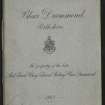
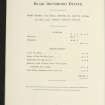
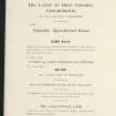
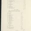
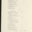
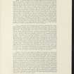
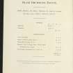
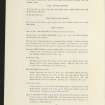
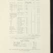
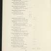
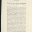
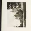
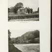
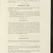
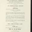
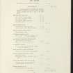
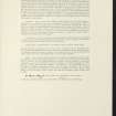
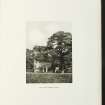
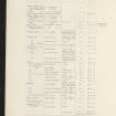
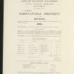
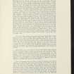
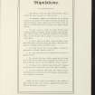
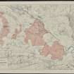
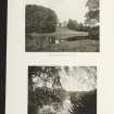
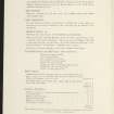
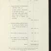
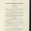
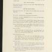
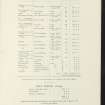
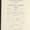
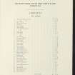
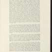
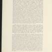
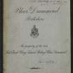
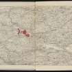
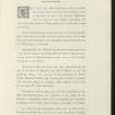
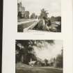
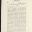
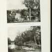
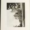
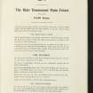
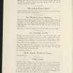
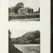
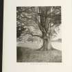
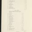
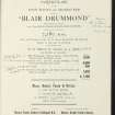
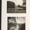
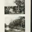
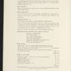
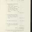
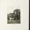
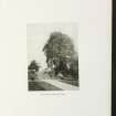
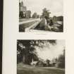
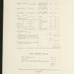
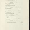
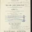
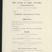
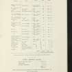
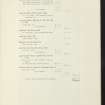
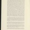
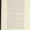
Estate Exchange. Blair Drummond Estate. No. 1515 Sale Brochure 1912. Includes details of Lot I: Blair Drummond Mansion House. Lot II: Fourteen Farms and five cottage holdings. Lot III: Five farms (inc. Ballingrew, Ballinton Farms). Lot IV: Ten farms and Eighty-eight tenancies and fues at Thornhill.
Collection of sale catalogues relating to Scottish estates
21/6/1912
© Courtesy of HES (Estates Exchange Collection)

SC 2151886
Estate Exchange. Blair Drummond Estate. No. 1515 Sale Brochure 1912. Includes details of Lot I: Blair Drummond Mansion House. Lot II: Fourteen Farms and five cottage holdings. Lot III: Five farms (inc. Ballingrew, Ballinton Farms). Lot IV: Ten farms and Eighty-eight tenancies and fues at Thornhill.
Collection of sale catalogues relating to Scottish estates
21/6/1912
© Courtesy of HES (Estates Exchange Collection)

SC 2151891
Estate Exchange. Blair Drummond Estate. No. 1515 Sale Brochure 1912. Includes details of Lot I: Blair Drummond Mansion House. Lot II: Fourteen Farms and five cottage holdings. Lot III: Five farms (inc. Ballingrew, Ballinton Farms). Lot IV: Ten farms and Eighty-eight tenancies and fues at Thornhill.
Collection of sale catalogues relating to Scottish estates
21/6/1912
© Courtesy of HES (Estates Exchange Collection)

SC 2151913
Estate Exchange. Blair Drummond Estate. No. 1515 Sale Brochure 1912. Includes details of Lot I: Blair Drummond Mansion House. Lot II: Fourteen Farms and five cottage holdings. Lot III: Five farms (inc. Ballingrew, Ballinton Farms). Lot IV: Ten farms and Eighty-eight tenancies and fues at Thornhill.
Collection of sale catalogues relating to Scottish estates
21/6/1912
© Courtesy of HES (Estates Exchange Collection)

SC 2160910
Estate Exchange. Blair Drummond Estate. No. 1516 Sale Brochure 1913. Includes details of Lot I: Blair Drummond Mansion House. Lot II: Fourteen Farms and five cottage holdings. Lot III: Five farms (inc. Ballingrew, Ballinton Farms). Lot IV: Ten farms and Eighty-eight tenancies and fues at Thornhill.
Collection of sale catalogues relating to Scottish estates
15/1/1913
© Courtesy of HES (Estates Exchange Collection)

SC 2160913
Estate Exchange. Blair Drummond Estate. No. 1516 Sale Brochure 1913. Includes details of Lot I: Blair Drummond Mansion House. Lot II: Fourteen Farms and five cottage holdings. Lot III: Five farms (inc. Ballingrew, Ballinton Farms). Lot IV: Ten farms and Eighty-eight tenancies and fues at Thornhill.
Collection of sale catalogues relating to Scottish estates
15/1/1913
© Courtesy of HES (Estates Exchange Collection)

SC 2160930
Estate Exchange. Blair Drummond Estate. No. 1516 Sale Brochure 1913. Includes details of Lot I: Blair Drummond Mansion House. Lot II: Fourteen Farms and five cottage holdings. Lot III: Five farms (inc. Ballingrew, Ballinton Farms). Lot IV: Ten farms and Eighty-eight tenancies and fues at Thornhill.
Collection of sale catalogues relating to Scottish estates
15/1/1913
© Courtesy of HES (Estates Exchange Collection)

SC 2160936
Estate Exchange. Blair Drummond Estate. No. 1516 Sale Brochure 1913. Includes details of Lot I: Blair Drummond Mansion House. Lot II: Fourteen Farms and five cottage holdings. Lot III: Five farms (inc. Ballingrew, Ballinton Farms). Lot IV: Ten farms and Eighty-eight tenancies and fues at Thornhill.
Collection of sale catalogues relating to Scottish estates
15/1/1913
© Courtesy of HES (Estates Exchange Collection)

SC 2160938
Estate Exchange. Blair Drummond Estate. No. 1516 Sale Brochure 1913. Includes details of Lot I: Blair Drummond Mansion House. Lot II: Fourteen Farms and five cottage holdings. Lot III: Five farms (inc. Ballingrew, Ballinton Farms). Lot IV: Ten farms and Eighty-eight tenancies and fues at Thornhill.
Collection of sale catalogues relating to Scottish estates
15/1/1913
© Courtesy of HES (Estates Exchange Collection)

SC 2151872
Estate Exchange. Blair Drummond Estate. No. 1515 Sale Brochure 1912. Includes details of Lot I: Blair Drummond Mansion House. Lot II: Fourteen Farms and five cottage holdings. Lot III: Five farms (inc. Ballingrew, Ballinton Farms). Lot IV: Ten farms and Eighty-eight tenancies and fues at Thornhill.
Collection of sale catalogues relating to Scottish estates
21/6/1912
© Courtesy of HES (Estates Exchange Collection)

SC 2151875
Estate Exchange. Blair Drummond Estate. No. 1515 Sale Brochure 1912. Includes details of Lot I: Blair Drummond Mansion House. Lot II: Fourteen Farms and five cottage holdings. Lot III: Five farms (inc. Ballingrew, Ballinton Farms). Lot IV: Ten farms and Eighty-eight tenancies and fues at Thornhill.
Collection of sale catalogues relating to Scottish estates
21/6/1912
© Courtesy of HES (Estates Exchange Collection)

SC 2151890
Estate Exchange. Blair Drummond Estate. No. 1515 Sale Brochure 1912. Includes details of Lot I: Blair Drummond Mansion House. Lot II: Fourteen Farms and five cottage holdings. Lot III: Five farms (inc. Ballingrew, Ballinton Farms). Lot IV: Ten farms and Eighty-eight tenancies and fues at Thornhill.
Collection of sale catalogues relating to Scottish estates
21/6/1912
© Courtesy of HES (Estates Exchange Collection)

SC 2151904
Estate Exchange. Blair Drummond Estate. No. 1515 Sale Brochure 1912. Includes details of Lot I: Blair Drummond Mansion House. Lot II: Fourteen Farms and five cottage holdings. Lot III: Five farms (inc. Ballingrew, Ballinton Farms). Lot IV: Ten farms and Eighty-eight tenancies and fues at Thornhill.
Collection of sale catalogues relating to Scottish estates
21/6/1912
© Courtesy of HES (Estates Exchange Collection)

SC 2160924
Estate Exchange. Blair Drummond Estate. No. 1516 Sale Brochure 1913. Includes details of Lot I: Blair Drummond Mansion House. Lot II: Fourteen Farms and five cottage holdings. Lot III: Five farms (inc. Ballingrew, Ballinton Farms). Lot IV: Ten farms and Eighty-eight tenancies and fues at Thornhill.
Collection of sale catalogues relating to Scottish estates
15/1/1913
© Courtesy of HES (Estates Exchange Collection)

SC 2160926
Estate Exchange. Blair Drummond Estate. No. 1516 Sale Brochure 1913. Includes details of Lot I: Blair Drummond Mansion House. Lot II: Fourteen Farms and five cottage holdings. Lot III: Five farms (inc. Ballingrew, Ballinton Farms). Lot IV: Ten farms and Eighty-eight tenancies and fues at Thornhill.
Collection of sale catalogues relating to Scottish estates
15/1/1913
© Courtesy of HES (Estates Exchange Collection)

SC 2160937
Estate Exchange. Blair Drummond Estate. No. 1516 Sale Brochure 1913. Includes details of Lot I: Blair Drummond Mansion House. Lot II: Fourteen Farms and five cottage holdings. Lot III: Five farms (inc. Ballingrew, Ballinton Farms). Lot IV: Ten farms and Eighty-eight tenancies and fues at Thornhill.
Collection of sale catalogues relating to Scottish estates
15/1/1913
© Courtesy of HES (Estates Exchange Collection)

SC 2160940
Estate Exchange. Blair Drummond Estate. No. 1516 Sale Brochure 1913. Includes details of Lot I: Blair Drummond Mansion House. Lot II: Fourteen Farms and five cottage holdings. Lot III: Five farms (inc. Ballingrew, Ballinton Farms). Lot IV: Ten farms and Eighty-eight tenancies and fues at Thornhill.
Collection of sale catalogues relating to Scottish estates
15/1/1913
© Courtesy of HES (Estates Exchange Collection)

SC 2160951
Estate Exchange. Blair Drummond Estate. No. 1516 Sale Brochure 1913. Includes details of Lot I: Blair Drummond Mansion House. Lot II: Fourteen Farms and five cottage holdings. Lot III: Five farms (inc. Ballingrew, Ballinton Farms). Lot IV: Ten farms and Eighty-eight tenancies and fues at Thornhill.
Collection of sale catalogues relating to Scottish estates
15/1/1913
© Courtesy of HES (Estates Exchange Collection)

SC 2151864
Estate Exchange. Blair Drummond Estate. No. 1515 Sale Brochure 1912. Includes details of Lot I: Blair Drummond Mansion House. Lot II: Fourteen Farms and five cottage holdings. Lot III: Five farms (inc. Ballingrew, Ballinton Farms). Lot IV: Ten farms and Eighty-eight tenancies and fues at Thornhill.
Collection of sale catalogues relating to Scottish estates
21/6/1912
© Courtesy of HES (Estates Exchange Collection)

SC 2151871
Estate Exchange. Blair Drummond Estate. No. 1515 Sale Brochure 1912. Includes details of Lot I: Blair Drummond Mansion House. Lot II: Fourteen Farms and five cottage holdings. Lot III: Five farms (inc. Ballingrew, Ballinton Farms). Lot IV: Ten farms and Eighty-eight tenancies and fues at Thornhill.
Collection of sale catalogues relating to Scottish estates
21/6/1912
© Courtesy of HES (Estates Exchange Collection)

SC 2151878
Estate Exchange. Blair Drummond Estate. No. 1515 Sale Brochure 1912. Includes details of Lot I: Blair Drummond Mansion House. Lot II: Fourteen Farms and five cottage holdings. Lot III: Five farms (inc. Ballingrew, Ballinton Farms). Lot IV: Ten farms and Eighty-eight tenancies and fues at Thornhill.
Collection of sale catalogues relating to Scottish estates
21/6/1912
© Courtesy of HES (Estates Exchange Collection)

SC 2151892
Estate Exchange. Blair Drummond Estate. No. 1515 Sale Brochure 1912. Includes details of Lot I: Blair Drummond Mansion House. Lot II: Fourteen Farms and five cottage holdings. Lot III: Five farms (inc. Ballingrew, Ballinton Farms). Lot IV: Ten farms and Eighty-eight tenancies and fues at Thornhill.
Collection of sale catalogues relating to Scottish estates
21/6/1912
© Courtesy of HES (Estates Exchange Collection)

SC 2151898
Estate Exchange. Blair Drummond Estate. No. 1515 Sale Brochure 1912. Includes details of Lot I: Blair Drummond Mansion House. Lot II: Fourteen Farms and five cottage holdings. Lot III: Five farms (inc. Ballingrew, Ballinton Farms). Lot IV: Ten farms and Eighty-eight tenancies and fues at Thornhill.
Collection of sale catalogues relating to Scottish estates
21/6/1912
© Courtesy of HES (Estates Exchange Collection)

SC 2151900
Estate Exchange. Blair Drummond Estate. No. 1515 Sale Brochure 1912. Includes details of Lot I: Blair Drummond Mansion House. Lot II: Fourteen Farms and five cottage holdings. Lot III: Five farms (inc. Ballingrew, Ballinton Farms). Lot IV: Ten farms and Eighty-eight tenancies and fues at Thornhill.
Collection of sale catalogues relating to Scottish estates
21/6/1912
© Courtesy of HES (Estates Exchange Collection)

SC 2151905
Estate Exchange. Blair Drummond Estate. No. 1515 Sale Brochure 1912. Includes details of Lot I: Blair Drummond Mansion House. Lot II: Fourteen Farms and five cottage holdings. Lot III: Five farms (inc. Ballingrew, Ballinton Farms). Lot IV: Ten farms and Eighty-eight tenancies and fues at Thornhill.
Collection of sale catalogues relating to Scottish estates
21/6/1912
© Courtesy of HES (Estates Exchange Collection)

SC 2151911
Estate Exchange. Blair Drummond Estate. No. 1515 Sale Brochure 1912. Includes details of Lot I: Blair Drummond Mansion House. Lot II: Fourteen Farms and five cottage holdings. Lot III: Five farms (inc. Ballingrew, Ballinton Farms). Lot IV: Ten farms and Eighty-eight tenancies and fues at Thornhill.
Collection of sale catalogues relating to Scottish estates
21/6/1912
© Courtesy of HES (Estates Exchange Collection)

SC 2160919
Estate Exchange. Blair Drummond Estate. No. 1516 Sale Brochure 1913. Includes details of Lot I: Blair Drummond Mansion House. Lot II: Fourteen Farms and five cottage holdings. Lot III: Five farms (inc. Ballingrew, Ballinton Farms). Lot IV: Ten farms and Eighty-eight tenancies and fues at Thornhill.
Collection of sale catalogues relating to Scottish estates
15/1/1913
© Courtesy of HES (Estates Exchange Collection)

SC 2160923
Estate Exchange. Blair Drummond Estate. No. 1516 Sale Brochure 1913. Includes details of Lot I: Blair Drummond Mansion House. Lot II: Fourteen Farms and five cottage holdings. Lot III: Five farms (inc. Ballingrew, Ballinton Farms). Lot IV: Ten farms and Eighty-eight tenancies and fues at Thornhill.
Collection of sale catalogues relating to Scottish estates
15/1/1913
© Courtesy of HES (Estates Exchange Collection)

SC 2160932
Estate Exchange. Blair Drummond Estate. No. 1516 Sale Brochure 1913. Includes details of Lot I: Blair Drummond Mansion House. Lot II: Fourteen Farms and five cottage holdings. Lot III: Five farms (inc. Ballingrew, Ballinton Farms). Lot IV: Ten farms and Eighty-eight tenancies and fues at Thornhill.
Collection of sale catalogues relating to Scottish estates
15/1/1913
© Courtesy of HES (Estates Exchange Collection)

SC 2160941
Estate Exchange. Blair Drummond Estate. No. 1516 Sale Brochure 1913. Includes details of Lot I: Blair Drummond Mansion House. Lot II: Fourteen Farms and five cottage holdings. Lot III: Five farms (inc. Ballingrew, Ballinton Farms). Lot IV: Ten farms and Eighty-eight tenancies and fues at Thornhill.
Collection of sale catalogues relating to Scottish estates
15/1/1913
© Courtesy of HES (Estates Exchange Collection)

SC 2160943
Estate Exchange. Blair Drummond Estate. No. 1516 Sale Brochure 1913. Includes details of Lot I: Blair Drummond Mansion House. Lot II: Fourteen Farms and five cottage holdings. Lot III: Five farms (inc. Ballingrew, Ballinton Farms). Lot IV: Ten farms and Eighty-eight tenancies and fues at Thornhill.
Collection of sale catalogues relating to Scottish estates
15/1/1913
© Courtesy of HES (Estates Exchange Collection)

SC 2160949
Estate Exchange. Blair Drummond Estate. No. 1516 Sale Brochure 1913. Includes details of Lot I: Blair Drummond Mansion House. Lot II: Fourteen Farms and five cottage holdings. Lot III: Five farms (inc. Ballingrew, Ballinton Farms). Lot IV: Ten farms and Eighty-eight tenancies and fues at Thornhill.
Collection of sale catalogues relating to Scottish estates
15/1/1913
© Courtesy of HES (Estates Exchange Collection)

SC 2151866
Estate Exchange. Blair Drummond Estate. No. 1515 Sale Brochure 1912. Includes details of Lot I: Blair Drummond Mansion House. Lot II: Fourteen Farms and five cottage holdings. Lot III: Five farms (inc. Ballingrew, Ballinton Farms). Lot IV: Ten farms and Eighty-eight tenancies and fues at Thornhill.
Collection of sale catalogues relating to Scottish estates
21/6/1912
© Courtesy of HES (Estates Exchange Collection)

SC 2151868
Estate Exchange. Blair Drummond Estate. No. 1515 Sale Brochure 1912. Includes details of Lot I: Blair Drummond Mansion House. Lot II: Fourteen Farms and five cottage holdings. Lot III: Five farms (inc. Ballingrew, Ballinton Farms). Lot IV: Ten farms and Eighty-eight tenancies and fues at Thornhill.
Collection of sale catalogues relating to Scottish estates
21/6/1912
© Courtesy of HES (Estates Exchange Collection)

SC 2151880
Estate Exchange. Blair Drummond Estate. No. 1515 Sale Brochure 1912. Includes details of Lot I: Blair Drummond Mansion House. Lot II: Fourteen Farms and five cottage holdings. Lot III: Five farms (inc. Ballingrew, Ballinton Farms). Lot IV: Ten farms and Eighty-eight tenancies and fues at Thornhill.
Collection of sale catalogues relating to Scottish estates
21/6/1912
© Courtesy of HES (Estates Exchange Collection)

SC 2151887
Estate Exchange. Blair Drummond Estate. No. 1515 Sale Brochure 1912. Includes details of Lot I: Blair Drummond Mansion House. Lot II: Fourteen Farms and five cottage holdings. Lot III: Five farms (inc. Ballingrew, Ballinton Farms). Lot IV: Ten farms and Eighty-eight tenancies and fues at Thornhill.
Collection of sale catalogues relating to Scottish estates
21/6/1912
© Courtesy of HES (Estates Exchange Collection)

SC 2151889
Estate Exchange. Blair Drummond Estate. No. 1515 Sale Brochure 1912. Includes details of Lot I: Blair Drummond Mansion House. Lot II: Fourteen Farms and five cottage holdings. Lot III: Five farms (inc. Ballingrew, Ballinton Farms). Lot IV: Ten farms and Eighty-eight tenancies and fues at Thornhill.
Collection of sale catalogues relating to Scottish estates
21/6/1912
© Courtesy of HES (Estates Exchange Collection)

SC 2151895
Estate Exchange. Blair Drummond Estate. No. 1515 Sale Brochure 1912. Includes details of Lot I: Blair Drummond Mansion House. Lot II: Fourteen Farms and five cottage holdings. Lot III: Five farms (inc. Ballingrew, Ballinton Farms). Lot IV: Ten farms and Eighty-eight tenancies and fues at Thornhill.
Collection of sale catalogues relating to Scottish estates
21/6/1912
© Courtesy of HES (Estates Exchange Collection)

SC 2151899
Estate Exchange. Blair Drummond Estate. No. 1515 Sale Brochure 1912. Includes details of Lot I: Blair Drummond Mansion House. Lot II: Fourteen Farms and five cottage holdings. Lot III: Five farms (inc. Ballingrew, Ballinton Farms). Lot IV: Ten farms and Eighty-eight tenancies and fues at Thornhill.
Collection of sale catalogues relating to Scottish estates
21/6/1912
© Courtesy of HES (Estates Exchange Collection)

SC 2151907
Estate Exchange. Blair Drummond Estate. No. 1515 Sale Brochure 1912. Includes details of Lot I: Blair Drummond Mansion House. Lot II: Fourteen Farms and five cottage holdings. Lot III: Five farms (inc. Ballingrew, Ballinton Farms). Lot IV: Ten farms and Eighty-eight tenancies and fues at Thornhill.
Collection of sale catalogues relating to Scottish estates
21/6/1912
© Courtesy of HES (Estates Exchange Collection)

SC 2151910
Estate Exchange. Blair Drummond Estate. No. 1515 Sale Brochure 1912. Includes details of Lot I: Blair Drummond Mansion House. Lot II: Fourteen Farms and five cottage holdings. Lot III: Five farms (inc. Ballingrew, Ballinton Farms). Lot IV: Ten farms and Eighty-eight tenancies and fues at Thornhill.
Collection of sale catalogues relating to Scottish estates
21/6/1912
© Courtesy of HES (Estates Exchange Collection)

SC 2160907
Estate Exchange. Blair Drummond Estate. No. 1516 Sale Brochure 1913. Includes details of Lot I: Blair Drummond Mansion House. Lot II: Fourteen Farms and five cottage holdings. Lot III: Five farms (inc. Ballingrew, Ballinton Farms). Lot IV: Ten farms and Eighty-eight tenancies and fues at Thornhill.
Collection of sale catalogues relating to Scottish estates
15/1/1913
© Courtesy of HES (Estates Exchange Collection)

SC 2160915
Estate Exchange. Blair Drummond Estate. No. 1516 Sale Brochure 1913. Includes details of Lot I: Blair Drummond Mansion House. Lot II: Fourteen Farms and five cottage holdings. Lot III: Five farms (inc. Ballingrew, Ballinton Farms). Lot IV: Ten farms and Eighty-eight tenancies and fues at Thornhill.
Collection of sale catalogues relating to Scottish estates
15/1/1913
© Courtesy of HES (Estates Exchange Collection)

SC 2160920
Estate Exchange. Blair Drummond Estate. No. 1516 Sale Brochure 1913. Includes details of Lot I: Blair Drummond Mansion House. Lot II: Fourteen Farms and five cottage holdings. Lot III: Five farms (inc. Ballingrew, Ballinton Farms). Lot IV: Ten farms and Eighty-eight tenancies and fues at Thornhill.
Collection of sale catalogues relating to Scottish estates
15/1/1913
© Courtesy of HES (Estates Exchange Collection)

SC 2160931
Estate Exchange. Blair Drummond Estate. No. 1516 Sale Brochure 1913. Includes details of Lot I: Blair Drummond Mansion House. Lot II: Fourteen Farms and five cottage holdings. Lot III: Five farms (inc. Ballingrew, Ballinton Farms). Lot IV: Ten farms and Eighty-eight tenancies and fues at Thornhill.
Collection of sale catalogues relating to Scottish estates
15/1/1913
© Courtesy of HES (Estates Exchange Collection)

SC 2160935
Estate Exchange. Blair Drummond Estate. No. 1516 Sale Brochure 1913. Includes details of Lot I: Blair Drummond Mansion House. Lot II: Fourteen Farms and five cottage holdings. Lot III: Five farms (inc. Ballingrew, Ballinton Farms). Lot IV: Ten farms and Eighty-eight tenancies and fues at Thornhill.
Collection of sale catalogues relating to Scottish estates
15/1/1913
© Courtesy of HES (Estates Exchange Collection)

SC 2160944
Estate Exchange. Blair Drummond Estate. No. 1516 Sale Brochure 1913. Includes details of Lot I: Blair Drummond Mansion House. Lot II: Fourteen Farms and five cottage holdings. Lot III: Five farms (inc. Ballingrew, Ballinton Farms). Lot IV: Ten farms and Eighty-eight tenancies and fues at Thornhill.
Collection of sale catalogues relating to Scottish estates
15/1/1913
© Courtesy of HES (Estates Exchange Collection)

SC 2160946
Estate Exchange. Blair Drummond Estate. No. 1516 Sale Brochure 1913. Includes details of Lot I: Blair Drummond Mansion House. Lot II: Fourteen Farms and five cottage holdings. Lot III: Five farms (inc. Ballingrew, Ballinton Farms). Lot IV: Ten farms and Eighty-eight tenancies and fues at Thornhill.
Collection of sale catalogues relating to Scottish estates
15/1/1913
© Courtesy of HES (Estates Exchange Collection)

SC 2160948
Estate Exchange. Blair Drummond Estate. No. 1516 Sale Brochure 1913. Includes details of Lot I: Blair Drummond Mansion House. Lot II: Fourteen Farms and five cottage holdings. Lot III: Five farms (inc. Ballingrew, Ballinton Farms). Lot IV: Ten farms and Eighty-eight tenancies and fues at Thornhill.
Collection of sale catalogues relating to Scottish estates
15/1/1913
© Courtesy of HES (Estates Exchange Collection)

SC 2160950
Estate Exchange. Blair Drummond Estate. No. 1516 Sale Brochure 1913. Includes details of Lot I: Blair Drummond Mansion House. Lot II: Fourteen Farms and five cottage holdings. Lot III: Five farms (inc. Ballingrew, Ballinton Farms). Lot IV: Ten farms and Eighty-eight tenancies and fues at Thornhill.
Collection of sale catalogues relating to Scottish estates
15/1/1913
© Courtesy of HES (Estates Exchange Collection)

SC 2151869
Estate Exchange. Blair Drummond Estate. No. 1515 Sale Brochure 1912. Includes details of Lot I: Blair Drummond Mansion House. Lot II: Fourteen Farms and five cottage holdings. Lot III: Five farms (inc. Ballingrew, Ballinton Farms). Lot IV: Ten farms and Eighty-eight tenancies and fues at Thornhill.
Collection of sale catalogues relating to Scottish estates
21/6/1912
© Courtesy of HES (Estates Exchange Collection)

SC 2151874
Estate Exchange. Blair Drummond Estate. No. 1515 Sale Brochure 1912. Includes details of Lot I: Blair Drummond Mansion House. Lot II: Fourteen Farms and five cottage holdings. Lot III: Five farms (inc. Ballingrew, Ballinton Farms). Lot IV: Ten farms and Eighty-eight tenancies and fues at Thornhill.
Collection of sale catalogues relating to Scottish estates
21/6/1912
© Courtesy of HES (Estates Exchange Collection)

SC 2151888
Estate Exchange. Blair Drummond Estate. No. 1515 Sale Brochure 1912. Includes details of Lot I: Blair Drummond Mansion House. Lot II: Fourteen Farms and five cottage holdings. Lot III: Five farms (inc. Ballingrew, Ballinton Farms). Lot IV: Ten farms and Eighty-eight tenancies and fues at Thornhill.
Collection of sale catalogues relating to Scottish estates
21/6/1912
© Courtesy of HES (Estates Exchange Collection)

SC 2151912
Estate Exchange. Blair Drummond Estate. No. 1515 Sale Brochure 1912. Includes details of Lot I: Blair Drummond Mansion House. Lot II: Fourteen Farms and five cottage holdings. Lot III: Five farms (inc. Ballingrew, Ballinton Farms). Lot IV: Ten farms and Eighty-eight tenancies and fues at Thornhill.
Collection of sale catalogues relating to Scottish estates
21/6/1912
© Courtesy of HES (Estates Exchange Collection)

SC 2160911
Estate Exchange. Blair Drummond Estate. No. 1516 Sale Brochure 1913. Includes details of Lot I: Blair Drummond Mansion House. Lot II: Fourteen Farms and five cottage holdings. Lot III: Five farms (inc. Ballingrew, Ballinton Farms). Lot IV: Ten farms and Eighty-eight tenancies and fues at Thornhill.
Collection of sale catalogues relating to Scottish estates
15/1/1913
© Courtesy of HES (Estates Exchange Collection)

SC 2160917
Estate Exchange. Blair Drummond Estate. No. 1516 Sale Brochure 1913. Includes details of Lot I: Blair Drummond Mansion House. Lot II: Fourteen Farms and five cottage holdings. Lot III: Five farms (inc. Ballingrew, Ballinton Farms). Lot IV: Ten farms and Eighty-eight tenancies and fues at Thornhill.
Collection of sale catalogues relating to Scottish estates
15/1/1913
© Courtesy of HES (Estates Exchange Collection)

SC 2160918
Estate Exchange. Blair Drummond Estate. No. 1516 Sale Brochure 1913. Includes details of Lot I: Blair Drummond Mansion House. Lot II: Fourteen Farms and five cottage holdings. Lot III: Five farms (inc. Ballingrew, Ballinton Farms). Lot IV: Ten farms and Eighty-eight tenancies and fues at Thornhill.
Collection of sale catalogues relating to Scottish estates
15/1/1913
© Courtesy of HES (Estates Exchange Collection)

SC 2160952
Estate Exchange. Blair Drummond Estate. No. 1516 Sale Brochure 1913. Includes details of Lot I: Blair Drummond Mansion House. Lot II: Fourteen Farms and five cottage holdings. Lot III: Five farms (inc. Ballingrew, Ballinton Farms). Lot IV: Ten farms and Eighty-eight tenancies and fues at Thornhill.
Collection of sale catalogues relating to Scottish estates
15/1/1913
© Courtesy of HES (Estates Exchange Collection)

SC 2151881
Estate Exchange. Blair Drummond Estate. No. 1515 Sale Brochure 1912. Includes details of Lot I: Blair Drummond Mansion House. Lot II: Fourteen Farms and five cottage holdings. Lot III: Five farms (inc. Ballingrew, Ballinton Farms). Lot IV: Ten farms and Eighty-eight tenancies and fues at Thornhill.
Collection of sale catalogues relating to Scottish estates
21/6/1912
© Courtesy of HES (Estates Exchange Collection)

SC 2151882
Estate Exchange. Blair Drummond Estate. No. 1515 Sale Brochure 1912. Includes details of Lot I: Blair Drummond Mansion House. Lot II: Fourteen Farms and five cottage holdings. Lot III: Five farms (inc. Ballingrew, Ballinton Farms). Lot IV: Ten farms and Eighty-eight tenancies and fues at Thornhill.
Collection of sale catalogues relating to Scottish estates
21/6/1912
© Courtesy of HES (Estates Exchange Collection)

SC 2151893
Estate Exchange. Blair Drummond Estate. No. 1515 Sale Brochure 1912. Includes details of Lot I: Blair Drummond Mansion House. Lot II: Fourteen Farms and five cottage holdings. Lot III: Five farms (inc. Ballingrew, Ballinton Farms). Lot IV: Ten farms and Eighty-eight tenancies and fues at Thornhill.
Collection of sale catalogues relating to Scottish estates
21/6/1912
© Courtesy of HES (Estates Exchange Collection)

SC 2151894
Estate Exchange. Blair Drummond Estate. No. 1515 Sale Brochure 1912. Includes details of Lot I: Blair Drummond Mansion House. Lot II: Fourteen Farms and five cottage holdings. Lot III: Five farms (inc. Ballingrew, Ballinton Farms). Lot IV: Ten farms and Eighty-eight tenancies and fues at Thornhill.
Collection of sale catalogues relating to Scottish estates
21/6/1912
© Courtesy of HES (Estates Exchange Collection)

SC 2151897
Estate Exchange. Blair Drummond Estate. No. 1515 Sale Brochure 1912. Includes details of Lot I: Blair Drummond Mansion House. Lot II: Fourteen Farms and five cottage holdings. Lot III: Five farms (inc. Ballingrew, Ballinton Farms). Lot IV: Ten farms and Eighty-eight tenancies and fues at Thornhill.
Collection of sale catalogues relating to Scottish estates
21/6/1912
© Courtesy of HES (Estates Exchange Collection)

SC 2151903
Estate Exchange. Blair Drummond Estate. No. 1515 Sale Brochure 1912. Includes details of Lot I: Blair Drummond Mansion House. Lot II: Fourteen Farms and five cottage holdings. Lot III: Five farms (inc. Ballingrew, Ballinton Farms). Lot IV: Ten farms and Eighty-eight tenancies and fues at Thornhill.
Collection of sale catalogues relating to Scottish estates
21/6/1912
© Courtesy of HES (Estates Exchange Collection)

SC 2151906
Estate Exchange. Blair Drummond Estate. No. 1515 Sale Brochure 1912. Includes details of Lot I: Blair Drummond Mansion House. Lot II: Fourteen Farms and five cottage holdings. Lot III: Five farms (inc. Ballingrew, Ballinton Farms). Lot IV: Ten farms and Eighty-eight tenancies and fues at Thornhill.
Collection of sale catalogues relating to Scottish estates
21/6/1912
© Courtesy of HES (Estates Exchange Collection)

SC 2160905
Estate Exchange. Blair Drummond Estate. No. 1516 Sale Brochure 1913. Includes details of Lot I: Blair Drummond Mansion House. Lot II: Fourteen Farms and five cottage holdings. Lot III: Five farms (inc. Ballingrew, Ballinton Farms). Lot IV: Ten farms and Eighty-eight tenancies and fues at Thornhill.
Collection of sale catalogues relating to Scottish estates
15/1/1913
© Courtesy of HES (Estates Exchange Collection)

SC 2160906
Estate Exchange. Blair Drummond Estate. No. 1516 Sale Brochure 1913. Includes details of Lot I: Blair Drummond Mansion House. Lot II: Fourteen Farms and five cottage holdings. Lot III: Five farms (inc. Ballingrew, Ballinton Farms). Lot IV: Ten farms and Eighty-eight tenancies and fues at Thornhill.
Collection of sale catalogues relating to Scottish estates
15/1/1913
© Courtesy of HES (Estates Exchange Collection)

SC 2160909
Estate Exchange. Blair Drummond Estate. No. 1516 Sale Brochure 1913. Includes details of Lot I: Blair Drummond Mansion House. Lot II: Fourteen Farms and five cottage holdings. Lot III: Five farms (inc. Ballingrew, Ballinton Farms). Lot IV: Ten farms and Eighty-eight tenancies and fues at Thornhill.
Collection of sale catalogues relating to Scottish estates
15/1/1913
© Courtesy of HES (Estates Exchange Collection)

SC 2160912
Estate Exchange. Blair Drummond Estate. No. 1516 Sale Brochure 1913. Includes details of Lot I: Blair Drummond Mansion House. Lot II: Fourteen Farms and five cottage holdings. Lot III: Five farms (inc. Ballingrew, Ballinton Farms). Lot IV: Ten farms and Eighty-eight tenancies and fues at Thornhill.
Collection of sale catalogues relating to Scottish estates
15/1/1913
© Courtesy of HES (Estates Exchange Collection)

SC 2160916
Estate Exchange. Blair Drummond Estate. No. 1516 Sale Brochure 1913. Includes details of Lot I: Blair Drummond Mansion House. Lot II: Fourteen Farms and five cottage holdings. Lot III: Five farms (inc. Ballingrew, Ballinton Farms). Lot IV: Ten farms and Eighty-eight tenancies and fues at Thornhill.
Collection of sale catalogues relating to Scottish estates
15/1/1913
© Courtesy of HES (Estates Exchange Collection)

SC 2160925
Estate Exchange. Blair Drummond Estate. No. 1516 Sale Brochure 1913. Includes details of Lot I: Blair Drummond Mansion House. Lot II: Fourteen Farms and five cottage holdings. Lot III: Five farms (inc. Ballingrew, Ballinton Farms). Lot IV: Ten farms and Eighty-eight tenancies and fues at Thornhill.
Collection of sale catalogues relating to Scottish estates
15/1/1913
© Courtesy of HES (Estates Exchange Collection)

SC 2151865
Estate Exchange. Blair Drummond Estate. No. 1515 Sale Brochure 1912. Includes details of Lot I: Blair Drummond Mansion House. Lot II: Fourteen Farms and five cottage holdings. Lot III: Five farms (inc. Ballingrew, Ballinton Farms). Lot IV: Ten farms and Eighty-eight tenancies and fues at Thornhill.
Collection of sale catalogues relating to Scottish estates
21/6/1912
© Courtesy of HES (Estates Exchange Collection)

SC 2151902
Estate Exchange. Blair Drummond Estate. No. 1515 Sale Brochure 1912. Includes details of Lot I: Blair Drummond Mansion House. Lot II: Fourteen Farms and five cottage holdings. Lot III: Five farms (inc. Ballingrew, Ballinton Farms). Lot IV: Ten farms and Eighty-eight tenancies and fues at Thornhill.
Collection of sale catalogues relating to Scottish estates
21/6/1912
© Courtesy of HES (Estates Exchange Collection)

SC 2160914
Estate Exchange. Blair Drummond Estate. No. 1516 Sale Brochure 1913. Includes details of Lot I: Blair Drummond Mansion House. Lot II: Fourteen Farms and five cottage holdings. Lot III: Five farms (inc. Ballingrew, Ballinton Farms). Lot IV: Ten farms and Eighty-eight tenancies and fues at Thornhill.
Collection of sale catalogues relating to Scottish estates
15/1/1913
© Courtesy of HES (Estates Exchange Collection)

SC 2160921
Estate Exchange. Blair Drummond Estate. No. 1516 Sale Brochure 1913. Includes details of Lot I: Blair Drummond Mansion House. Lot II: Fourteen Farms and five cottage holdings. Lot III: Five farms (inc. Ballingrew, Ballinton Farms). Lot IV: Ten farms and Eighty-eight tenancies and fues at Thornhill.
Collection of sale catalogues relating to Scottish estates
15/1/1913
© Courtesy of HES (Estates Exchange Collection)

SC 2160922
Estate Exchange. Blair Drummond Estate. No. 1516 Sale Brochure 1913. Includes details of Lot I: Blair Drummond Mansion House. Lot II: Fourteen Farms and five cottage holdings. Lot III: Five farms (inc. Ballingrew, Ballinton Farms). Lot IV: Ten farms and Eighty-eight tenancies and fues at Thornhill.
Collection of sale catalogues relating to Scottish estates
15/1/1913
© Courtesy of HES (Estates Exchange Collection)

SC 2160927
Estate Exchange. Blair Drummond Estate. No. 1516 Sale Brochure 1913. Includes details of Lot I: Blair Drummond Mansion House. Lot II: Fourteen Farms and five cottage holdings. Lot III: Five farms (inc. Ballingrew, Ballinton Farms). Lot IV: Ten farms and Eighty-eight tenancies and fues at Thornhill.
Collection of sale catalogues relating to Scottish estates
15/1/1913
© Courtesy of HES (Estates Exchange Collection)

SC 2160928
Estate Exchange. Blair Drummond Estate. No. 1516 Sale Brochure 1913. Includes details of Lot I: Blair Drummond Mansion House. Lot II: Fourteen Farms and five cottage holdings. Lot III: Five farms (inc. Ballingrew, Ballinton Farms). Lot IV: Ten farms and Eighty-eight tenancies and fues at Thornhill.
Collection of sale catalogues relating to Scottish estates
15/1/1913
© Courtesy of HES (Estates Exchange Collection)

SC 2160929
Estate Exchange. Blair Drummond Estate. No. 1516 Sale Brochure 1913. Includes details of Lot I: Blair Drummond Mansion House. Lot II: Fourteen Farms and five cottage holdings. Lot III: Five farms (inc. Ballingrew, Ballinton Farms). Lot IV: Ten farms and Eighty-eight tenancies and fues at Thornhill.
Collection of sale catalogues relating to Scottish estates
15/1/1913
© Courtesy of HES (Estates Exchange Collection)

SC 2160939
Estate Exchange. Blair Drummond Estate. No. 1516 Sale Brochure 1913. Includes details of Lot I: Blair Drummond Mansion House. Lot II: Fourteen Farms and five cottage holdings. Lot III: Five farms (inc. Ballingrew, Ballinton Farms). Lot IV: Ten farms and Eighty-eight tenancies and fues at Thornhill.
Collection of sale catalogues relating to Scottish estates
15/1/1913
© Courtesy of HES (Estates Exchange Collection)

SC 2151867
Estate Exchange. Blair Drummond Estate. No. 1515 Sale Brochure 1912. Includes details of Lot I: Blair Drummond Mansion House. Lot II: Fourteen Farms and five cottage holdings. Lot III: Five farms (inc. Ballingrew, Ballinton Farms). Lot IV: Ten farms and Eighty-eight tenancies and fues at Thornhill.
Collection of sale catalogues relating to Scottish estates
21/6/1912
© Courtesy of HES (Estates Exchange Collection)

SC 2151870
Estate Exchange. Blair Drummond Estate. No. 1515 Sale Brochure 1912. Includes details of Lot I: Blair Drummond Mansion House. Lot II: Fourteen Farms and five cottage holdings. Lot III: Five farms (inc. Ballingrew, Ballinton Farms). Lot IV: Ten farms and Eighty-eight tenancies and fues at Thornhill.
Collection of sale catalogues relating to Scottish estates
21/6/1912
© Courtesy of HES (Estates Exchange Collection)

SC 2151873
Estate Exchange. Blair Drummond Estate. No. 1515 Sale Brochure 1912. Includes details of Lot I: Blair Drummond Mansion House. Lot II: Fourteen Farms and five cottage holdings. Lot III: Five farms (inc. Ballingrew, Ballinton Farms). Lot IV: Ten farms and Eighty-eight tenancies and fues at Thornhill.
Collection of sale catalogues relating to Scottish estates
21/6/1912
© Courtesy of HES (Estates Exchange Collection)

SC 2151876
Estate Exchange. Blair Drummond Estate. No. 1515 Sale Brochure 1912. Includes details of Lot I: Blair Drummond Mansion House. Lot II: Fourteen Farms and five cottage holdings. Lot III: Five farms (inc. Ballingrew, Ballinton Farms). Lot IV: Ten farms and Eighty-eight tenancies and fues at Thornhill.
Collection of sale catalogues relating to Scottish estates
21/6/1912
© Courtesy of HES (Estates Exchange Collection)

SC 2151877
Estate Exchange. Blair Drummond Estate. No. 1515 Sale Brochure 1912. Includes details of Lot I: Blair Drummond Mansion House. Lot II: Fourteen Farms and five cottage holdings. Lot III: Five farms (inc. Ballingrew, Ballinton Farms). Lot IV: Ten farms and Eighty-eight tenancies and fues at Thornhill.
Collection of sale catalogues relating to Scottish estates
21/6/1912
© Courtesy of HES (Estates Exchange Collection)

SC 2151879
Estate Exchange. Blair Drummond Estate. No. 1515 Sale Brochure 1912. Includes details of Lot I: Blair Drummond Mansion House. Lot II: Fourteen Farms and five cottage holdings. Lot III: Five farms (inc. Ballingrew, Ballinton Farms). Lot IV: Ten farms and Eighty-eight tenancies and fues at Thornhill.
Collection of sale catalogues relating to Scottish estates
21/6/1912
© Courtesy of HES (Estates Exchange Collection)

SC 2151883
Estate Exchange. Blair Drummond Estate. No. 1515 Sale Brochure 1912. Includes details of Lot I: Blair Drummond Mansion House. Lot II: Fourteen Farms and five cottage holdings. Lot III: Five farms (inc. Ballingrew, Ballinton Farms). Lot IV: Ten farms and Eighty-eight tenancies and fues at Thornhill.
Collection of sale catalogues relating to Scottish estates
21/6/1912
© Courtesy of HES (Estates Exchange Collection)

SC 2151884
Estate Exchange. Blair Drummond Estate. No. 1515 Sale Brochure 1912. Includes details of Lot I: Blair Drummond Mansion House. Lot II: Fourteen Farms and five cottage holdings. Lot III: Five farms (inc. Ballingrew, Ballinton Farms). Lot IV: Ten farms and Eighty-eight tenancies and fues at Thornhill.
Collection of sale catalogues relating to Scottish estates
21/6/1912
© Courtesy of HES (Estates Exchange Collection)

SC 2151896
Estate Exchange. Blair Drummond Estate. No. 1515 Sale Brochure 1912. Includes details of Lot I: Blair Drummond Mansion House. Lot II: Fourteen Farms and five cottage holdings. Lot III: Five farms (inc. Ballingrew, Ballinton Farms). Lot IV: Ten farms and Eighty-eight tenancies and fues at Thornhill.
Collection of sale catalogues relating to Scottish estates
21/6/1912
© Courtesy of HES (Estates Exchange Collection)

SC 2151901
Estate Exchange. Blair Drummond Estate. No. 1515 Sale Brochure 1912. Includes details of Lot I: Blair Drummond Mansion House. Lot II: Fourteen Farms and five cottage holdings. Lot III: Five farms (inc. Ballingrew, Ballinton Farms). Lot IV: Ten farms and Eighty-eight tenancies and fues at Thornhill.
Collection of sale catalogues relating to Scottish estates
21/6/1912
© Courtesy of HES (Estates Exchange Collection)

SC 2151908
Estate Exchange. Blair Drummond Estate. No. 1515 Sale Brochure 1912. Includes details of Lot I: Blair Drummond Mansion House. Lot II: Fourteen Farms and five cottage holdings. Lot III: Five farms (inc. Ballingrew, Ballinton Farms). Lot IV: Ten farms and Eighty-eight tenancies and fues at Thornhill.
Collection of sale catalogues relating to Scottish estates
21/6/1912
© Courtesy of HES (Estates Exchange Collection)

SC 2151909
Estate Exchange. Blair Drummond Estate. No. 1515 Sale Brochure 1912. Includes details of Lot I: Blair Drummond Mansion House. Lot II: Fourteen Farms and five cottage holdings. Lot III: Five farms (inc. Ballingrew, Ballinton Farms). Lot IV: Ten farms and Eighty-eight tenancies and fues at Thornhill.
Collection of sale catalogues relating to Scottish estates
21/6/1912
© Courtesy of HES (Estates Exchange Collection)

SC 2160908
Estate Exchange. Blair Drummond Estate. No. 1516 Sale Brochure 1913. Includes details of Lot I: Blair Drummond Mansion House. Lot II: Fourteen Farms and five cottage holdings. Lot III: Five farms (inc. Ballingrew, Ballinton Farms). Lot IV: Ten farms and Eighty-eight tenancies and fues at Thornhill.
Collection of sale catalogues relating to Scottish estates
15/1/1913
© Courtesy of HES (Estates Exchange Collection)

SC 2160933
Estate Exchange. Blair Drummond Estate. No. 1516 Sale Brochure 1913. Includes details of Lot I: Blair Drummond Mansion House. Lot II: Fourteen Farms and five cottage holdings. Lot III: Five farms (inc. Ballingrew, Ballinton Farms). Lot IV: Ten farms and Eighty-eight tenancies and fues at Thornhill.
Collection of sale catalogues relating to Scottish estates
15/1/1913
© Courtesy of HES (Estates Exchange Collection)

SC 2160934
Estate Exchange. Blair Drummond Estate. No. 1516 Sale Brochure 1913. Includes details of Lot I: Blair Drummond Mansion House. Lot II: Fourteen Farms and five cottage holdings. Lot III: Five farms (inc. Ballingrew, Ballinton Farms). Lot IV: Ten farms and Eighty-eight tenancies and fues at Thornhill.
Collection of sale catalogues relating to Scottish estates
15/1/1913
© Courtesy of HES (Estates Exchange Collection)

SC 2160942
Estate Exchange. Blair Drummond Estate. No. 1516 Sale Brochure 1913. Includes details of Lot I: Blair Drummond Mansion House. Lot II: Fourteen Farms and five cottage holdings. Lot III: Five farms (inc. Ballingrew, Ballinton Farms). Lot IV: Ten farms and Eighty-eight tenancies and fues at Thornhill.
Collection of sale catalogues relating to Scottish estates
15/1/1913
© Courtesy of HES (Estates Exchange Collection)

SC 2160945
Estate Exchange. Blair Drummond Estate. No. 1516 Sale Brochure 1913. Includes details of Lot I: Blair Drummond Mansion House. Lot II: Fourteen Farms and five cottage holdings. Lot III: Five farms (inc. Ballingrew, Ballinton Farms). Lot IV: Ten farms and Eighty-eight tenancies and fues at Thornhill.
Collection of sale catalogues relating to Scottish estates
15/1/1913
© Courtesy of HES (Estates Exchange Collection)

SC 2160947
Estate Exchange. Blair Drummond Estate. No. 1516 Sale Brochure 1913. Includes details of Lot I: Blair Drummond Mansion House. Lot II: Fourteen Farms and five cottage holdings. Lot III: Five farms (inc. Ballingrew, Ballinton Farms). Lot IV: Ten farms and Eighty-eight tenancies and fues at Thornhill.
Collection of sale catalogues relating to Scottish estates
15/1/1913
© Courtesy of HES (Estates Exchange Collection)

SC 2160953
Estate Exchange. Blair Drummond Estate. No. 1516 Sale Brochure 1913. Includes details of Lot I: Blair Drummond Mansion House. Lot II: Fourteen Farms and five cottage holdings. Lot III: Five farms (inc. Ballingrew, Ballinton Farms). Lot IV: Ten farms and Eighty-eight tenancies and fues at Thornhill.
Collection of sale catalogues relating to Scottish estates
15/1/1913
© Courtesy of HES (Estates Exchange Collection)

SC 2160954
Estate Exchange. Blair Drummond Estate. No. 1516 Sale Brochure 1913. Includes details of Lot I: Blair Drummond Mansion House. Lot II: Fourteen Farms and five cottage holdings. Lot III: Five farms (inc. Ballingrew, Ballinton Farms). Lot IV: Ten farms and Eighty-eight tenancies and fues at Thornhill.
Collection of sale catalogues relating to Scottish estates
15/1/1913
© Courtesy of HES (Estates Exchange Collection)


- Council Stirling
- Parish Kincardine (Stirling)
- Former Region Central
- Former District Stirling
- Former County Perthshire

