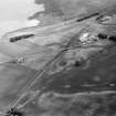
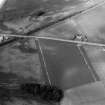
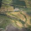
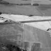
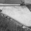
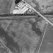
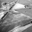
Accessibility

Font Size

100% 150% 200%

Background Colour

Default Contrast
Close Reset

Gilrivie

Souterrain(S) (Prehistoric)(Possible), Unenclosed Settlement (Prehistoric)(Possible)

Site Name Gilrivie

Classification Souterrain(S) (Prehistoric)(Possible), Unenclosed Settlement (Prehistoric)(Possible)

Canmore ID 161749

Site Number NO65NE 85

NGR NO 6865 5957

NGR Description CENTRED NO 6865 5957

Datum OSGB36 - NGR

Permalink http://canmore.org.uk/site/161749

Ordnance Survey licence number AC0000807262. All rights reserved.
Canmore Disclaimer. © Bluesky International Limited 2025. Public Sector Viewing Terms

Toggle Aerial | View on large map

Digital Images

Oblique aerial view centred on the cropmarks at Gilrivie, looking ENE.
Oblique aerial view centred on the cropmarks at Gilrivie, looking ENE.Oblique aerial view centred on the cropmarks of the Roman temporary camp, linear features, pits and rig at Dun, looking to the NW.Oblique aerial view centred on the cropmarks at Gilrivie, looking S.Oblique aerial view centred on the cropmarks at Gilrivie, looking NNE.Gilrivie, oblique aerial view, taken from the NNE, centred on the cropmarks of a possible unenclosed settlement, souterrains, pits, a pit-alignment and linear cropmarks.Gilrivie, oblique aerial view, taken from the ENE, centred on the cropmarks of a possible unenclosed settlement, souterrains, pits, a pit-alignment and linear cropmarks.Oblique aerial view centred on the cropmarks of the Roman Temporary Camp, linear features, enclosure, pits and rig at Gilrivie with the farmstead adjacent, looking to the WNW.Gilrivie, oblique aerial view, taken from the SE, centred on the cropmarks of a possible unenclosed settlement, souterrains, pits, a pit-alignment and linear cropmarks.Oblique aerial view centred on the cropmarks of the Roman Temporary Camp, unenclosed settlement, linear features, pits and rig at Gilrivie, looking to the SW.Oblique aerial view centred on the cropmarks of the Roman Temporary Camp, ring ditches, enclosure, lienar features, pits and rig at Dun and Gilrivie, looking to the NNW.Oblique aerial view of cropmarks of the Roman camp, linear features, enclosures, settlement and rig, looking NNW.Oblique aerial view centred on the cropmarks of an unenclosed settlement, linear features, souterrains and pits at Gilrivie, looking to the N.Oblique aerial view centred on the cropmarks of an unenclosed settlement, linear features, souterrains and pits at Gilrivie, looking to the NNW.Oblique aerial view centred on the cropmarks of the Roman Temporary Camp, linear features, enclosure, pits and rig at Gilrivie with the farmstead adjacent, looking to the NW.Gilrivie, oblique aerial view, taken from the SW, centred on the cropmarks of a possible unenclosed settlement, souterrains, pits, a pit-alignment and linear cropmarks. An enclosure and linear cropmarks  are visible in the top left-hand corner of the photograph.

Administrative Areas

  • Council Angus
  • Parish Dun
  • Former Region Tayside
  • Former District Angus
  • Former County Angus

Archaeology Notes

NO65NE 85 6865 5957

Information to follow.

RCAHMS (KJ) 2 May 2000.

References

MyCanmore Image Contributions


Contribute an Image

MyCanmore Text Contributions