Dundee, Stannergate
Coastal Battery (Second World War)
Site Name Dundee, Stannergate
Classification Coastal Battery (Second World War)
Canmore ID 161641
Site Number NO43SW 162
NGR NO 4338 3088
Datum OSGB36 - NGR
Permalink http://canmore.org.uk/site/161641
- Council Dundee, City Of
- Parish Dundee (Dundee, City Of)
- Former Region Tayside
- Former District City Of Dundee
- Former County Angus
NO43SW 162 4338 3088
A coastal battery was situated on the shore side of the W end of Broughty Ferry Road. Nothing survives of this battery which had mounted two 6-inch Mk XI/PV guns in June 1940. The site was put into care and maintainance in April 1945 and had been removed by October 1945.
J Guy 2000; NMRS MS 810/9
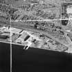
This battery, with its associated observation post and trench system, is visible on RAF aerial photographs (106G/Scot/UK 1: 6303-6302) taken on 10 April 1946. The communication trenches were filled in by March 1954 (RAF aerial photographs 58/RAF/1366 F22: 0016-0015) and the remainder of the site had been removed by February 1957 (RAF aerial photographs 58/RAF/2098 F22: 0017-0016).
Information from RCAHMS (KM) 9 November 2000.
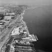
The battery is also visible on a WW II RAF oblique aerial photograph, (No.1 CAM, AF 686, flown 8 May 1943), which shows the canopied two gun-emplacements, battery observation post, one searchlight emplacement and other associated buildings.
Informatio from RCAHMS (DE), February 2002
Project (1 January 2005)
Pillbox Study Group comprised a list of Second World War sites, drawn together from various documentary sources and field work.
The project is informal and recording is mostly crowd sourced by submissions to the Pillbox Study Group Forum and Facebook Group as well as a number of other online groups and websites. The aim is to continue the work of the original Defence of Britain survey run by the CBA and record the locations and status of 20th century military and civil defence sites. Site visits are often undertaken group members to confirm the status of known sites and record new ones.


