Accessibility

Font Size

100% 150% 200%

Background Colour

Default Contrast
Close Reset

Angus Nurseries

Pit(S) (Period Unknown), Rig And Furrow (Medieval) - (Post Medieval), Ring Ditch (Period Unknown)

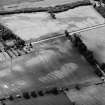
Site Name Angus Nurseries

Classification Pit(S) (Period Unknown), Rig And Furrow (Medieval) - (Post Medieval), Ring Ditch (Period Unknown)

Alternative Name(s) House Of Dun Policies

Canmore ID 160749

Site Number NO65NE 78

NGR NO 6728 5938

NGR Description Centred on NO 6742 5947

Datum OSGB36 - NGR

Permalink http://canmore.org.uk/site/160749

Ordnance Survey licence number AC0000807262. All rights reserved.
Canmore Disclaimer. © Bluesky International Limited 2025. Public Sector Viewing Terms

Toggle Aerial | View on large map

Digital Images

Oblique aerial view of the cropmarks of the rig, taken from the NW.
Oblique aerial view of the cropmarks of the rig, taken from the NW.Oblique aerial view of the cropmarks of the unenclosed settlement, pits and rig, looking WNW.Oblique aerial view of the cropmarks of the rig, taken from the NNE.Oblique aerial view of the cropmarks of the rig, taken from the NNW.Oblique aerial view of the cropmarks of the rig, taken from the NNW.Oblique aerial view of the cropmarks of the rig, taken from the WSW.Oblique aerial view of the cropmarks of the ring ditches and rig at West Broomley and Angus Nurseries, looking to the S.

Administrative Areas

  • Council Angus
  • Parish Dun
  • Former Region Tayside
  • Former District Angus
  • Former County Angus

References

MyCanmore Image Contributions


Contribute an Image

MyCanmore Text Contributions