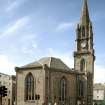
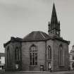
Perth, St Paul's Square, St Paul's Church
Church (19th Century)
Site Name Perth, St Paul's Square, St Paul's Church
Classification Church (19th Century)
Alternative Name(s) High Street; South Methven Street
Canmore ID 159607
Site Number NO12SW 549
NGR NO 11532 23622
Datum OSGB36 - NGR
Permalink http://canmore.org.uk/site/159607
- Council Perth And Kinross
- Parish Perth
- Former Region Tayside
- Former District Perth And Kinross
- Former County Perthshire
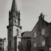
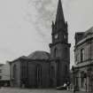
Architect: John Paterson 1799 completed 1807. Plans first prepared for new church 6 Jan 1794. March 5 1799 estimates for a castellated church. The Committee formerly app. to examine a report for building new church & spire agreable to plan by Mr Paterson. Mr McEwan, mason. Architect in charge of work.
NMRS REFERENCE
Perth T.C. Minutes (City Chambers) March 5th 1799 estimate for a new church
Standing Building Recording (12 January 2018 - 16 February 2018)
NO 11532 23622 An enhanced historic building survey was
undertaken, January 2018, on the Category B listed St Paul’s
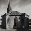
Church. The building was constructed in 1805 and was the
first church in Perth to be built after the Reformation. The
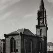
church was octagonal in plan and had a clock tower on its
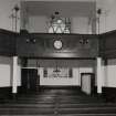
N side facing the High Street. The interior of the church
was in a serious state of dereliction and had been neglected
since it closed in 1986. The ground floor was well lit by tall
clearstorey windows that ascended to the wall head of the
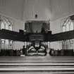
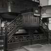
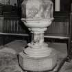
gallery. The pulpit and font were located on the N side of
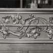
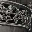
the church. The pulpit was dilapidated, but its rear ornate
balustrade still survived; it was of exceptional craftsmanship
with an interlaced wrought iron grape vine motif.
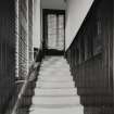
The gallery was accessed by three staircases each lit by a
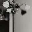
clearstorey window. The staircases were also lit by electric
lights, but these are now missing. The gallery was supported
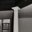
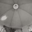
by a series of wooden and cast-iron pillars. The ceiling was in
a poor condition and large sections had collapsed, exposing
its lath and plaster. The church organ had been removed but
its wooden frame was still extant.
The church tower was accessed by a passage off the gallery.
A small room was present on the first stage. The second stage
contained a wooden weight chamber that ascended to the
clock mechanism floor. From here a ladder allowed access
to the belfry. This housed a single bell within a bell-frame.
Archive: NRHE (intended). Report: PKHT
Funder: Perth and Kinross Council
Mike Cressey – CFA Archaeology Ltd
(Source: DES, Volume 19)
OASIS ID: cfaarcha1-309151
Watching Brief (4 March 2019 - 21 May 2021)
NO 11533 23621 A watching brief was carried out during the alteration of St Paul’s Church from a building into an open shelter/space on St Paul’s Square, Perth. The interior of the church was reduced and service trenches were excavated within the interior and around the exterior of the building to a maximum depth of 0.6m. Interior and exterior deposits largely comprised levelling deposits over made ground. The work took place from 4 March–1 May 2021.
The foundation courses of the church walls were exposed to the exterior along with ceramic drains. Architectural elements including floor joist scarcement ledges abutting the interior walls, a stone pillar base, and stair bases within the E, W and S transepts were identified within the interior.
A 7m length of culvert was also uncovered within the interior, orientated NNE–SSW, with a rough arched covering of mortar- bonded rubble. The culvert possibly relates to the lade that ran N/S through the site as depicted on Rutherford’s 1774 Town Plan. The 1774 map shows the lade as an open watercourse, running along the western side of what became South Methven Street, which then passed under the High Street to the north. Increased development in the 19th century meant the lade was filled in and built upon as is seen on the 1832 Great Reform Act Town Plan, and it may be at this time that the watercourse was culverted.
Archive: NRHE (intended)
Funder: Perth and Kinross Council
Oliver Rusk – CFA Archaeology Ltd
(Source: DES Vol 22)
OASIS ID: cfaarcha1-424263 (O Rusk) 2021.


