
Following the launch of trove.scot in February 2025 we are now planning the retiral of some of our webservices. Canmore will be switched off on 24th June 2025. Information about the closure can be found on the HES website: Retiral of HES web services | Historic Environment Scotland
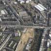
Edinburgh, Brunswick Road, Post Office Sorting Depot


Post Office (19th Century) - (20th Century)
Site Name Edinburgh, Brunswick Road, Post Office Sorting Depot
Classification Post Office (19th Century) - (20th Century)
Canmore ID 159242
Site Number NT27SE 4320
NGR NT 2660 7478
Datum OSGB36 - NGR
Permalink http://canmore.org.uk/site/159242
![Archaeological excavation, Section shot of [001] at E set girder, Post Office Sorting Depot, Brunswick Road, Edinburgh](http://i.rcahms.gov.uk/canmore/l/DP00339338.jpg)
![Archaeological excavation, Shot of [001] stone stets closer, Post Office Sorting Depot, Brunswick Road, Edinburgh](http://i.rcahms.gov.uk/canmore/l/DP00339339.jpg)
![Archaeological excavation, Sot of entire section showing [001] and upper deposits, Post Office Sorting Depot, Brunswick Road, Edinburgh](http://i.rcahms.gov.uk/canmore/l/DP00339353.jpg)


![Archaeological excavation, SSE facing section of [001] and upper layers, Post Office Sorting Depot, Brunswick Road, Edinburgh](http://i.rcahms.gov.uk/canmore/l/DP00339350.jpg)


![Archaeological excavation, SSE facing section of [001] and upper layers, Post Office Sorting Depot, Brunswick Road, Edinburgh](http://i.rcahms.gov.uk/canmore/l/DP00339349.jpg)

![Archaeological excavation, General shot of trench [004], Post Office Sorting Depot, Brunswick Road, Edinburgh](http://i.rcahms.gov.uk/canmore/l/DP00339359.jpg)


![Archaeological excavation, Shot of [006] concrete underlay, Post Office Sorting Depot, Brunswick Road, Edinburgh](http://i.rcahms.gov.uk/canmore/l/DP00339342.jpg)
![Archaeological excavation, Shot of [007] curved wall to SE, Post Office Sorting Depot, Brunswick Road, Edinburgh](http://i.rcahms.gov.uk/canmore/l/DP00339343.jpg)

![Archaeological excavation, SSE facing section of [001] and upper layers, Post Office Sorting Depot, Brunswick Road, Edinburgh](http://i.rcahms.gov.uk/canmore/l/DP00339351.jpg)
![Archaeological excavation, Section shot [001] at central, Post Office Sorting Depot, Brunswick Road, Edinburgh](http://i.rcahms.gov.uk/canmore/l/DP00339365.jpg)
![Archaeological excavation, Section shot of [001] at W set girder, Post Office Sorting Depot, Brunswick Road, Edinburgh](http://i.rcahms.gov.uk/canmore/l/DP00339366.jpg)


![Archaeological excavation, Shot of [001] stone stets, Post Office Sorting Depot, Brunswick Road, Edinburgh](http://i.rcahms.gov.uk/canmore/l/DP00339363.jpg)


![Archaeological excavation, General shot of trench [001], Post Office Sorting Depot, Brunswick Road, Edinburgh](http://i.rcahms.gov.uk/canmore/l/DP00339358.jpg)
![Archaeological excavation, Section shot of [001] at SW edge, Post Office Sorting Depot, Brunswick Road, Edinburgh](http://i.rcahms.gov.uk/canmore/l/DP00339364.jpg)
![Archaeological excavation, Shot of [003] cobbled path, Post Office Sorting Depot, Brunswick Road, Edinburgh](http://i.rcahms.gov.uk/canmore/l/DP00339340.jpg)
![Archaeological excavation, Shot of [005] paved area, Post Office Sorting Depot, Brunswick Road, Edinburgh](http://i.rcahms.gov.uk/canmore/l/DP00339341.jpg)

![Archaeological excavation, Shot of [001] stone stets, Post Office Sorting Depot, Brunswick Road, Edinburgh](http://i.rcahms.gov.uk/canmore/l/DP00339362.jpg)


![Archaeological excavation, SSE facing section of [001] and upper layers, Post Office Sorting Depot, Brunswick Road, Edinburgh](http://i.rcahms.gov.uk/canmore/l/DP00339352.jpg)
![Archaeological excavation, Section shot of [001] at E set girder, Post Office Sorting Depot, Brunswick Road, Edinburgh](http://i.rcahms.gov.uk/canmore/s/DP00339338.jpg)
![Archaeological excavation, Shot of [001] stone stets closer, Post Office Sorting Depot, Brunswick Road, Edinburgh](http://i.rcahms.gov.uk/canmore/s/DP00339339.jpg)
![Archaeological excavation, Sot of entire section showing [001] and upper deposits, Post Office Sorting Depot, Brunswick Road, Edinburgh](http://i.rcahms.gov.uk/canmore/s/DP00339353.jpg)


![Archaeological excavation, SSE facing section of [001] and upper layers, Post Office Sorting Depot, Brunswick Road, Edinburgh](http://i.rcahms.gov.uk/canmore/s/DP00339350.jpg)


![Archaeological excavation, SSE facing section of [001] and upper layers, Post Office Sorting Depot, Brunswick Road, Edinburgh](http://i.rcahms.gov.uk/canmore/s/DP00339349.jpg)

![Archaeological excavation, General shot of trench [004], Post Office Sorting Depot, Brunswick Road, Edinburgh](http://i.rcahms.gov.uk/canmore/s/DP00339359.jpg)


![Archaeological excavation, Shot of [006] concrete underlay, Post Office Sorting Depot, Brunswick Road, Edinburgh](http://i.rcahms.gov.uk/canmore/s/DP00339342.jpg)
![Archaeological excavation, Shot of [007] curved wall to SE, Post Office Sorting Depot, Brunswick Road, Edinburgh](http://i.rcahms.gov.uk/canmore/s/DP00339343.jpg)

![Archaeological excavation, SSE facing section of [001] and upper layers, Post Office Sorting Depot, Brunswick Road, Edinburgh](http://i.rcahms.gov.uk/canmore/s/DP00339351.jpg)
![Archaeological excavation, Section shot [001] at central, Post Office Sorting Depot, Brunswick Road, Edinburgh](http://i.rcahms.gov.uk/canmore/s/DP00339365.jpg)
![Archaeological excavation, Section shot of [001] at W set girder, Post Office Sorting Depot, Brunswick Road, Edinburgh](http://i.rcahms.gov.uk/canmore/s/DP00339366.jpg)


![Archaeological excavation, Shot of [001] stone stets, Post Office Sorting Depot, Brunswick Road, Edinburgh](http://i.rcahms.gov.uk/canmore/s/DP00339363.jpg)


![Archaeological excavation, General shot of trench [001], Post Office Sorting Depot, Brunswick Road, Edinburgh](http://i.rcahms.gov.uk/canmore/s/DP00339358.jpg)
![Archaeological excavation, Section shot of [001] at SW edge, Post Office Sorting Depot, Brunswick Road, Edinburgh](http://i.rcahms.gov.uk/canmore/s/DP00339364.jpg)
![Archaeological excavation, Shot of [003] cobbled path, Post Office Sorting Depot, Brunswick Road, Edinburgh](http://i.rcahms.gov.uk/canmore/s/DP00339340.jpg)
![Archaeological excavation, Shot of [005] paved area, Post Office Sorting Depot, Brunswick Road, Edinburgh](http://i.rcahms.gov.uk/canmore/s/DP00339341.jpg)

![Archaeological excavation, Shot of [001] stone stets, Post Office Sorting Depot, Brunswick Road, Edinburgh](http://i.rcahms.gov.uk/canmore/s/DP00339362.jpg)

![Archaeological excavation, SSE facing section of [001] and upper layers, Post Office Sorting Depot, Brunswick Road, Edinburgh](http://i.rcahms.gov.uk/canmore/s/DP00339352.jpg)
- Council Edinburgh, City Of
- Parish Edinburgh (Edinburgh, City Of)
- Former Region Lothian
- Former District City Of Edinburgh
- Former County Midlothian
ARCHITECT: Sir Basil Spence, Glover and Ferguson, 1984
Archaeological Evaluation (10 December 2012 - 12 December 2012)
This report presents the results of an archaeological evaluation undertaken in respect of a proposed development at Brunswick Road, Edinburgh (NGR: NT 266 747). The development area measures 1.625 ha in total of which the overwhelming majority is covered in reinforced concrete. Evaluation trenches were targeted over farm and rail buildings visible on the1st Ordnance Survey map of 1853 and the 2nd Edition Ordnance survey map of 1897. The evaluation revealed that the majority of the site had undergone significant truncation with no in situ original deposits remaining. Archaeological remains in the form of stone flooring were recorded underlying the raised concrete foundation platform associated with the latest building known to occupy the site. This flooring is associated with a rail shed visible on 2nd Edition Ordnance survey map of 1897. Upright supports for racking were also observed. These were also probably associated with the rail shed.
AOC Archaeology 2012 (R. Engl) OASIS ID: aocarcha1-139545
Excavation (2 March 2015 - 20 March 2015)
An archaeological excavation undertaken in respect of a proposed development at 10 Brunswick Road, Edinburgh. The development area measures 1.625ha in total of which the overwhelming majority is covered in reinforced concrete. The excavation focused on the location of the previous railway building in the south of the site. A previous evaluation in 2012 revealed stone setts underlying the raised concrete foundation platform associated with the pre-existing railway building. The excavation revealed that the majority of the site had undergone significant truncation with no in situ original deposits remaining, although stone setts were recorded underlying the raised concrete foundation platform associated with the latest building known to occupy the site. The setts are associated with a rail shed visible on the Ordnance survey map of 1894. Evidence of modern landscaping was also revealed in the south-west corner of the trench. This consisted of a paved area and curved wall which most likely related to latest modern construction.
Information from AOC Archaeology Group

