
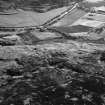
Burn Of Dalforth, Glen Esk


Building (Period Unassigned)
Site Name Burn Of Dalforth, Glen Esk
Classification Building (Period Unassigned)
Canmore ID 158328
Site Number NO57NE 12
NGR NO 5735 7745
Datum OSGB36 - NGR
Permalink http://canmore.org.uk/site/158328


- Council Angus
- Parish Edzell
- Former Region Tayside
- Former District Angus
- Former County Angus
Note
A single unroofed building is depicted on the 1st edition of the OS 6-inch map (Forfarshire 1865, sheet xiii) and on the current edition of the OS 1:10000 map (1975).
Information from RCAHMS (AKK) 30 June 1999.

