
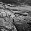
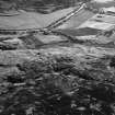
Burn Of Dalforth, Glen Esk


Township (Period Unassigned)
Site Name Burn Of Dalforth, Glen Esk
Classification Township (Period Unassigned)
Alternative Name(s) Dalforth
Canmore ID 158322
Site Number NO57NE 6
NGR NO 5720 7740
NGR Description Centred NO 5720 7740
Datum OSGB36 - NGR
Permalink http://canmore.org.uk/site/158322


- Council Angus
- Parish Edzell
- Former Region Tayside
- Former District Angus
- Former County Angus
Note
A township, comprising fourteen roofed, two unroofed buildings and eight enclosures is depicted on the 1st edition of the OS 6-inch map (Forfarshire 1865, sheet xiii). Six unroofed buildings and four enclosures are shown on the current edition of the OS 1:10000 map (1975).
Information from RCAHMS (AKK) 30 June 1999.

